-
Hello, please take a minute to check out our awesome content, contributed by the wonderful members of our community. We hope you'll add your own thoughts and opinions by making a free account!
You are using an out of date browser. It may not display this or other websites correctly.
You should upgrade or use an alternative browser.
You should upgrade or use an alternative browser.
Wintry 1/20 - 1/23 Winter Storm
- Thread starter packfan98
- Start date
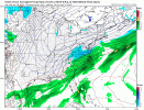
Lots of freezing rain along the TX and LA Gulf coasts on this run of the NAM.
Timing i think was the thing we had a little more confidence in out of everything, i feel like the NAM just threw a wrench into that also with delaying everything. Wild stuff with this one folks.
Showmeyourtds
Member
NAM tried to go boom boom across NGA at 84.
But its the long-range NAM, right?
But its the long-range NAM, right?
dsaur
Member
Chris, have you been down there for one of these big sleet/zr dumps across n central Ga? I've seen some mighty fine sleet storms, and a few really bad zr ones....but a big sleet dump can be very impressive on county roads for sleddingNAM said hold/put my beer on the porch in your ice storm Chris...hahahahah
Showmeyourtds
Member
'Twas merely an attempt at sarcasm, but yes, the next frame would've been interesting.You are exactly right it is the long-range NAM, in fact, can't get any longer range then the very last frame
lj0109
Member
CAE issues their first AFD since 3AM this morning:
Area Forecast Discussion
National Weather Service Columbia SC
335 PM EST Tue Jan 18 2022
.SYNOPSIS...
High pressure and a dry airmass will remain over the region
through Wednesday, producing more typical January weather. A
cold front moves into the area Thursday bringing a good chance
of rain. Friday into the weekend look very unsettled with a mix
of wintry weather expected through Saturday. Conditions improve
Sunday into the first part of next week.
.SHORT TERM /WEDNESDAY THROUGH THURSDAY NIGHT/...
Wednesday looks to be the primary transition day as the surface
high pressure center will slowly shift offshore. Southwest
surface and 850mb flow will ramp up throughout the day as the
high exits and central CONUS shortwave approaches allowing
modest moisture into the area with dew points climbing into the
upper 30`s and low 40`s. Cloud cover is expected to persist
throughout the day given the overrunning and moisture return at
low-mid levels. High temperatures will finally jump above
average for the first time in several days, generally in the low
60`s across the area. Southwest flow will continue ahead of the
front associated with the shortwave off to the west into
Wednesday night. There is good consensus across guidance on the
overall timing of the front, entering the forecast area from the
northwest around 12z Thursday and progressively sliding
southeast through the area by 18z. Overall precip totals will be
fairly low given the mountain interaction and general lack of
synoptic lift. The arctic airmass begins filling in behind this
front and this is where things start to get more uncertain. The
front is expected to slow and stall as a weak area of low
pressure develops along the Gulf coast and northern Florida.
Guidance is somewhat consistent is showing PoPs continuing into
late Thursday as the front stalls but the interaction with the
diving cold air is the primary uncertainty. Regardless of model
solution, the surface layer air should remain too warm for any
frozen precip until early Friday morning. Some wintry PoPs begin
across our extreme northern counties between 06z and 12z
Friday.
.LONG TERM /FRIDAY THROUGH TUESDAY/...
While a somewhat clearer picture has developed in the last few
model suites, there is still relatively high uncertainty in the
Friday-weekend system will play out. The mid-upper level flow is
inherently chaotic and unstable for run to run consistency with
numerous shortwaves embedded across the general southwest flow
across the CONUS. So this type of uncertainty is annoyingly
expected given the pattern. Each global operational model and
its corresponding ensemble are depicting somewhat unique
solutions on how both the upper level pattern will develop over
the northeast and southwest CONUS, and how the low pressure
center will develop along the stalling cold front. Friday
appears to be coming into clearer focus, albeit slowly, with
NAM, ECMWF, and GFS all developing a broad shield of overrunning
over top the southward rushing arctic airmass as strong south-
southwest flow ramps up. Associated ensembles are still quite
scattered in timing and intensity of this precip, but at least
there is a decent signal compared to 24 hours ago. Obviously
this interaction between a thin cold layer, sharp mid level
trough, strong upper level jet, and weakly developing low
pressure is tricky and guidance likely not get a good handle on
it for another day or so. So current thinking on Friday wintry
precip is increasing slightly in confidence but intensity
remains a big question mark as does spatial extent. All wintry
precip types are possible at this time across the fa,
particularly sleet and freezing rain. We should start to see
better agreement in the next suite or two over the specifics of
the Friday event.
More uncertainty develops for how the shortwave over the
southwest CONUS and western Gulf will track east and then
interact with stalled front. The GFS and associated ensembles
are more aggressive with pushing the shortwave east and spinning
up the stalled front in the Gulf. This then swings another
batch of wintry precip into the fa Saturday and would
dramatically increase impacts. The EC and Canadian ensembles and
operational are much more suppressed with this second
shortwave, so impacts would be minimal or none. Again with the
complexity of the 500 mb pattern, this will be inherently
unstable run to run so not expecting consistency for another run
or two.
In general, there is a large spread of possible outcomes with
this event ranging from mild inconvenience to highly impactful
winter storm across the Midlands and CSRA.
Cold temps fill in behind this regardless of what plays out and
the long term is expected to remain well below average.
that would be amazing. I would like to see that. Most ice ever was like in 04 I think it was. over .60" of ZRChris, have you been down there for one of these big sleet/zr dumps across n central Ga? I've seen some mighty fine sleet storms, and a few really bad zr ones....but a big sleet dump can be very impressive on county roads for sleddingI'd like to see a few inches of sleet, or more from north of me down to past Perry. That's kind of typical when it runs thru here like this one has been wanting to do for days.
Ron Burgundy
Member
iGRXY
Member
N/S on the ICON is faster and still positively tilted so it may try something with the 2nd wave.
Jrips2710
Member
Area Forecast Discussion
National Weather Service Peachtree City GA
317 PM EST Tue Jan 18 2022
...Afternoon Area Forecast Discussion...
.LONG TERM /Thursday through Tuesday/...
The extended forecast remains rather complex with significant
uncertainty regarding eventual outcome. The potential remains for
some degree of wintry precipitation across portions of the area
heading into the weekend. At the onset of the forecast period
Thursday, a cold front will bisect the area with rain along said
front. A reinvigorated cold airmass will filter into the area behind
the front as a strong surface high pushes into northern New England
and Quebec.
Uncertainty then increases markedly behind this front as the
evolution of upper features will decide how any winter precipitation
threat unfolds. While cold air will be in place behind the stalled
front to our southeast, timing, precipitation type, and areal extent
all remain in flux. Significant spread between different models and
between individual model remains remains. While earlier ECMWF
solutions had been more bullish on wintry precipitation potential
based on stronger followup system, the latest deterministic solution
presents a drier solution with precipitation scouring out more
quickly late Friday into Saturday morning behind a more amplified
upper wave. However, a number of ensemble members still favor wintry
precipitation potential. The GFS and NAM continue to favor more
potential for a freezing rain event for portions of the area, though
timing discrepancies remain. The NAM is more aggressive with a
freezing rain potential beginning Friday evening while the GFS
brings a late wave of precipitation across central Georgia on
Saturday with a southwesterly upper wave.
All of this to say, will maintain a broad brush forecast from Friday
into Saturday indicating a potential for freezing rain across a good
portion of north and central Georgia with some snow ptype more
likely across far north Georgia. These details will be refined over
the next couple of forecast cycles as model data hopefully comes
into better agreement. Beyond this initial Friday/Saturday time
frame, a quieter but cool interlude looks to persist into at least
Tuesday or so.
accu35
Member
Little quicker it looks compared to NAM but Precip Field a good bit further NW then previous runs of the ICON
D
Deleted member 609
Guest
That NAM run stings bad. It has me at 6” inches at the end of the run. If I can just have the thermals I’ll take a risk on the precip.
- Joined
- Jan 23, 2021
- Messages
- 4,602
- Reaction score
- 15,197
- Location
- Lebanon Township, Durham County NC
I had six hours of heavy snow this euro run in the teens on Friday. I think we have potential for the best ratios that I’ve seen since the 1/23/03 snowstorm which featured absurdly high ratios.
I think I need to sit down.
I think I need to sit down.
D
Deleted member 609
Guest
dsaur
Member
It'll teeter totter back and forth, dulling the nastiness of the zr, if you are lucky. Since the low looks like it will be weak, you should get good cold in down there, but it's always tricky. But from watching the maps for days now, I'm guessing mostly sleet, then snow here, and I hope for you too. El K down in Perry needs a good sleet too. And if the cold isn't very enthusiastic, well, we are way over due for a bad zr apoxyclips. But this just looks like one of my sleet paradises, lol....let Atl have the snow, I'll take the sleet! I worry about Larry in Sav though. I hope he doesn't live in a forest like I do.that would be amazing. I would like to see that. Most ice ever was like in 04 I think it was. over .60" of ZR
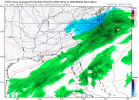
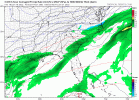
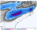
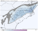
18z RDPS


Cary_Snow95
Member
iGRXY
Member
RGEN looks like the NAM with close to a phase and more precip with the 2nd wave.
The RGEM looks like a big phase on the 18z run which is was aggressive at 12z but even more so this run. Northern stream has more energy than earlier runs, it’s phasing the southern wave into that piece. The original northern stream energy kinda misses. Odd unpredictable setup.
Sent from my iPhone using Tapatalk
Sent from my iPhone using Tapatalk
iGRXY
Member
NBAcentel
Member
Surface temperatures at the end of the RDPS...oh the potential


iGRXY
Member
RGEM ratios would be ridiculous with temps at the surface in the mid 20's and 850's and 925's roughly -3 to -5C
One thing about the NAM, never trust it nor dismiss it. If you do either it will end in heartbreak or you looking stupid.
Last edited:
SnowNiner
Member
18z RDPS

Now is that so hard? Why can't the rest of the models do that? Lol. I'm wondering if that was a phase or no?
Whoever in SC/SNC sets up above the snowline where this thing starts to deepen and tug east is going to get a nice snowstorm
Blue_Ridge_Escarpment
Member
RGEM heading toward climo
And still snowing obviously.
iGRXY
Member
Short range trending with more digging of the energy which has been the trend in the short range this year. Much more expansive precip shield as well.
- Joined
- Jan 23, 2021
- Messages
- 4,602
- Reaction score
- 15,197
- Location
- Lebanon Township, Durham County NC
Humidity maps would imply another 4-6 hours of snow for the triad, triangle and NE NC.And still snowing obviously.
RDPS did what @wow asked the NAM to do on his drawingNow is that so hard? Why can't the rest of the models do that? Lol. I'm wondering if that was a phase or no?


