• Hello, please take a minute to check out our awesome content, contributed by the wonderful members of our community. We hope you'll add your own thoughts and opinions by making a free account!

Wintry 1/20 - 1/23 Winter Storm

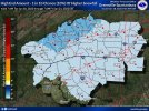
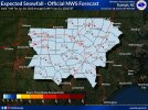
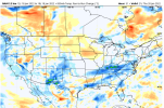
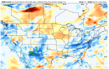
I’m not showing this for accumulation, way to early to think about that. but I’m showing this because the blend of many models, basically shows that our range looks good right now across the area with many solutions averaged out FB61E148-F4B3-4375-86E1-DBDE0DF01AA6.png
 
I like the set-up. We have an arctic high in a good place, not racing off east of us. This gives us a constant supply of cold air. Also, we have an arctic front south of us. It might not work out but its far better than the storm we just experienced.

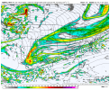
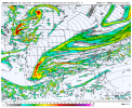
gfs_mslp_pcpn_frzn_us_14.png
 
Kind of funny, the CMC pulls off this move back to back. At least we have a central and eastern trough with chances, and aren't talking SE ridges, MJO Phase 5, and bathtub sloshing ?‍♂️

crTFoX9.gif
Good grief you'd have to think one or the other hits big with the tough axis generally not off shore here. I just skimmed the gfs and we have about 6 waves that could be considered somewhat legit through 300hrs. This is just about the anti December pattern
 
I’m not showing this for accumulation, way to early to think about that. but I’m showing this because the blend of many models, basically shows that our range looks good right now across the area with many solutions averaged out View attachment 107293
I think in this case with a strong arctic high to out NW there is a good chance for a small SE trend unlike last time when the high was racing east off the coast.
 
Good grief you'd have to think one or the other hits big with the tough axis generally not off shore here. I just skimmed the gfs and we have about 6 waves that could be considered somewhat legit through 300hrs. This is just about the anti December pattern
Gonna be the anti of this in feb then in March we’re gonna deal with this again lol
 
I’m not showing this for accumulation, way to early to think about that. but I’m showing this because the blend of many models, basically shows that our range looks good right now across the area with many solutions averaged out View attachment 107293
I’m right in the middle of that purple in Virginia… trying not to get sucked in because of the inevitable model swings but it’s really hard
 
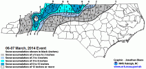
Looking at these models this morning, I can’t help but be reminded of how the models were handling the February 2014 systems even inside 96 hours. All they seemed to latch onto with just about certainty then was a strong cold push with plenty of cold dry air getting in place, but there was so much uncertainty over the different pieces of energy. Like then, I really think we won’t get a good picture going until these waves get sampled on shore and things simply go from there
 
I like the set-up. We have an arctic high in a good place, not racing off east of us. This gives us a constant supply of cold air. Also, we have an arctic front south of us. It might not work out but its far better than the storm we just experienced.

gfs_mslp_pcpn_frzn_us_14.png
Most of our best snowstorms have that high dropping through the Midwest like that. Would like to see it in the 1045ish range, but with the front that will have moved through, cold air should be in place.
 
I have NO IDEA what's going to happen this weekend, but somebody is going to be happy. Could 1 wave hit, could it be 2? Anyone's guess at this point. This actually reminds me of Jan 2000 with an arctic front and a lot of energy flying around. The models were keying in on one wave and it was another that snuck in and leading to the Carolina crusher.
 
I think this should be pointed out. At 10am there was significant fear of an amped nw system due to a stronger WAR. Then at 1130am that switched to a fear of suppression with an elongated southern stream. All this goes to tell us Is we still haven’t locked onto the correct piece of energy. Maybe tomorrow we will see models converge on a specific piece since we will be about 72-84 hours from onset. But right now we are seeing whole sell changes. Yesterdays 12z euro had nothing, then 0z was amped. Long ways to go. 12z euro is on deck. Giddy up. Just my two cents
 
Yeah, I meant that seeing the GFS/ICON/UKMET set up the main axis of snow along the outer banks is good news for those areas. It is somewhat concerning though to see the Canadian, Euro, and the ensembles setting up the snow over Central NC and Southeast Va though. Doesn’t leave much margin for error.

I will take a blend of those two camps, there will be less nw trend this time as there won't be one consolidated storm....I hope anyways....I am rather zen about this one, it's gonna be a good hit for central coastal plains NC , I like where I am sitting.
 
Back
Top