-
Hello, please take a minute to check out our awesome content, contributed by the wonderful members of our community. We hope you'll add your own thoughts and opinions by making a free account!
You are using an out of date browser. It may not display this or other websites correctly.
You should upgrade or use an alternative browser.
You should upgrade or use an alternative browser.
Wintry 1/20 - 1/23 Winter Storm
- Thread starter packfan98
- Start date
iGRXY
Member
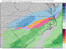
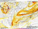
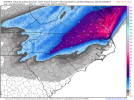
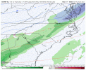
Definitely a colder press through 75.
The front is pushing better this run as well.
Snowflowxxl
Member
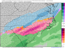
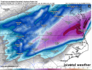
It’s suppressed compared to 0z
Sharp gradient on euro starting to slowly get the eastward correction. Not gonna be widespread to the mtns here we go seeing it fold to GFS again and again
L
Logan Is An Idiot 02
Guest
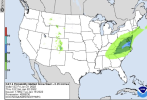
Official WPC…now starting to hone in on the Virginia potential! View attachment 107851
30-50% chance for CLT is still quite a solid chance bird
Sent from my iPhone using Tapatalk
iGRXY
Member
If you're on the 85 corridor you gotta love where this is currently. There will be more moisture on the NW side than depicted and we are getting more cold air funneling further SE for snow.
much drier as well? especially over GA this run.....or am I missing something
Showmeyourtds
Member
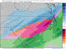
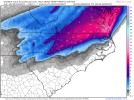
Looks much drier @84 for Atlanta & points north. Carolinas looks like they may do alright. Interesting from the Euro.
iGRXY
Member
Yes and if you hadn’t zoomed in, you would have seen that they probabilities were also raised back west towards the mountains as well. No body is questioning that NE NC and SE VA have a decent shot at seeing the highest totals, but there is plenty of support for significant totals all the way to the mountains.Official WPC…now starting to hone in on the Virginia potential! View attachment 107851
Snowflowxxl
Member
It can keep this look until hour 54 and I’ll be fine with it. Still plenty of time to get this better here.
packfan98
Moderator
Snownut
Member
I could see this being a 1-3" Snow for NW upstate.
Sent from my SM-A526U using Tapatalk
Sent from my SM-A526U using Tapatalk
Jrips2710
Member
Not a good trend for Atlanta today if you're wanting to see Atlanta get more than an inch or so. We'd need to have some earlier phasing but it seems as if we are trending away from that. Might be a Carolina special
late bloomer....certainly possible.
Cadi40
Member
If the Thursday night precipitation proves to be correct then we may start to see watches being issued this evening if I’m not mistaken.
neelsamb
Member
Yeah not good for us further west. Looks like models are agreeing a bit more at 12z but just not much precip back this way. This is OK I think given we’re still 72-96 hours and still time for a NW tick so GA can cash inmuch drier as well? especially over GA this run.....or am I missing something
That or more expansive back to the northwest than currently depicted.Seems like models are converging on something but generally at least a small NW trend is to be expected. I feel like the gfs is headed towards more phasing every run
Sent from my iPhone using Tapatalk
Yeah I’m leaning late bloomer here. Worth watching though
Cary_Snow95
Member
Pretty solid trends for central nc today. It does seem to be favoring the classic central nc to se VA jackpot
iGRXY
Member
a jog to the NW is going to be expected as we get closer. Nothing is really holding it back from not going back NW some. Couple that with FGEN driven precip and global model bias of not picking up on it is making this threat look really nice for places that aren't in those 6"+ areas right now.Seems like models are converging on something but generally at least a small NW trend is to be expected. I feel like the gfs is headed towards more phasing every run
Sent from my iPhone using Tapatalk
depends on what that now could be trailering energy or the southern energy does. I would lean late bloomer, but I also think we have a better shot than normal back west.
Snownut
Member
I could see places toward the NE side of upstate like Spartanburg, Rock Hill getting higher totals than say Oconeea jog to the NW is going to be expected as we get closer. Nothing is really holding it back from not going back NW some. Couple that with FGEN driven precip and global model bias of not picking up on it is making this threat look really nice for places that aren't in those 6"+ areas right now.
Sent from my SM-A526U using Tapatalk
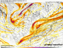
Great look from those....EURO is starting to drag that southern energy and kind of dampen it out. If that happens....late bloomer or bust if not,......we have some other shots west.
NBAcentel
Member
Ron Burgundy
Member
I’m still on board. These are the kind of systems that often end up being big producers for our area at the 11th hour. ?Not a good trend for Atlanta today if you're wanting to see Atlanta get more than an inch or so. We'd need to have some earlier phasing but it seems as if we are trending away from that. Might be a Carolina special
Iceagewhereartthou
Member
For us I hope you're correct but I'm not feeling very optimistic on this one. This looks like too late a bloomer and there have been many storms in the past where the Upstate (especially western) and NEGA just don't get in on it while eastern areas get a big dog. We need an earlier phase without a big amplification. We need a bigger gulf tap earlier. I will be interested to see what the HRRR shows as we get closer but this one may not be for us.If you're on the 85 corridor you gotta love where this is currently. There will be more moisture on the NW side than depicted and we are getting more cold air funneling further SE for snow.

