Cary_Snow95
Member
Gonna be shocked if euro isn’t less amped
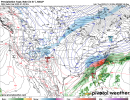
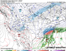
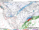
Perfect illustration. Over running always performs on the NW side of these systems and generally you see it along the 85 corridor.Pretty easy to see why I’m favoring a precip sheild further NW then modeled, this setup is driven by 850mb/700mb WAA and FGEN which is responsible for overrunning in the first place, imo even with the artic front itself, there’s already insentropic upglide, globals don’t handle this well at all, mesoscale models do View attachment 107811View attachment 107812View attachment 107813View attachment 107814
This has been one of the more tricky set ups I’ve seen in a while. Don’t envy the Mets on this one. Could be a big storm for the coast or verify 200 miles NW. both are equally likely imo
Most of these are a lot further NW
A third of them look similar to the Canadian. So at this point, I would say a miss (at least for central NC) is a real possibility.@90 even better.
View attachment 107820
I'm waiting to see if the EURO shows this again for a 4th straight runThe models sure seem to be shifting east wrt my area of the world. The million dollar question is how much will these models trend NW (and they very well may not) and unless we see some more amplification, this could be another swing and maybe not a compete miss but a foul ball. Pedestrian 1" type SN.
What say you N GA posters? How comfortable are you with the trends of the past 12 hours or so?


A certain poster who's no longer here would point out that 2 thirds show a good hit. I will take this look any day.A third of them look similar to the Canadian. So at this point, I would say a miss (at least for central NC) is a real possibility.
There’s many notorious examples of global NWP also whiffing on overrunning while mesoscale models caught on. December 2017, February 2014 are big ones, this list goes on
Not too worried. Thermals look good for us even with n/w trend in mind. Energy needs to phase earlier but it seems like all winter the models push storms back and slow them down by 12-18 hours. As said above Precipitation shield is almost always under modeled. I’m not worried, just watch and wait!The models sure seem to be shifting east wrt my area of the world. The million dollar question is how much will these models trend NW (and they very well may not) and unless we see some more amplification, this could be another swing and maybe not a compete miss but a foul ball. Pedestrian 1" type SN.
What say you N GA posters? How comfortable are you with the trends of the past 12 hours or so?
Wouldn’t this be like the Dec 2017 over running event, but with a colder airmass in place? I’m above my pay grade here so please let me know if I’m not seeing the differences.Yeah I don't even know what to think about this for the Atlanta area. I've been struggling to understand this set up....I mean I know it's a wave of low pressure causing overrunning on the edge of the cold air mass, but I'm still struggling with understanding how we can maximize potential snow/sleet in the metro area. Even if it trends northwest, not even sure it'll be cold enough for snow here. It's mainly why I've been quiet and just reading the posts and analyzing the models.
Depends on where you are. Brier Creek looks really really good and so does around Falls Lake.Looks like Wake Co will be in the narrow transition zone on the NAM with ZR IP SN mix.
Sent from my iPhone using Tapatalk
Thought I read it a few days ago but not sure if made it into the 12z suitedidnt we get solid sampling this morning? or is that not until tonight's 00z runs?
