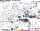
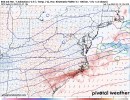
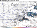
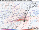
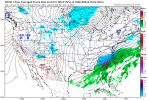
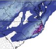
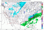
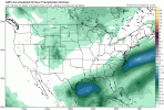
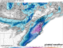
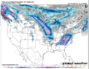
I bet DT will be honking for Virginia. Since y’all posted his info do you care to show his thinking once he issues it later today? I bet he does 1-2 feet for north-eastern NC into Virginia. I could see that happening like the euro showed.
-
Hello, please take a minute to check out our awesome content, contributed by the wonderful members of our community. We hope you'll add your own thoughts and opinions by making a free account!
You are using an out of date browser. It may not display this or other websites correctly.
You should upgrade or use an alternative browser.
You should upgrade or use an alternative browser.
Wintry 1/20 - 1/23 Winter Storm
- Thread starter packfan98
- Start date
See this dance too many times. I think areas along and N of 85 are sitting pretty.Those of us on the Northern edges where precip doesn't look robust. Trust and believe there will be so either way we are looking great as of right now.
This could help with that, noAnd I feel confident the GFS was underdone on QPF.

Would feel much better if it were colder. Then if the precip doesn’t happen we are stuck with a nasty cold rainy day.I'll take this 96 hours out ....
Sent from my iPhone using Tapatalk
Snownut
Member
But are you talking about upstate sc north of 85 or you talking Nc?See this dance too many times. I think areas along and N of 85 are sitting pretty.
Sent from my SM-A526U using Tapatalk
Hypsometric
Member
Absolutely. This plus just the general inabilty for coarser global models to accurately predict the northwestern shield of these type of events makes me wonder just how much it could be underdone.This could help with that, no

Flotown
Member
Com
Come on northwest bout 100 miles ease!!! Seriously though i20 in bama and Georgia look good to meWould feel much better if it were colder. Then if the precip doesn’t happen we are stuck with a nasty cold rainy day.
SC and NC precip will fill in by go time not Everytime but if I was a betting man lolBut are you talking about upstate sc north of 85 or you talking Nc?
Sent from my SM-A526U using Tapatalk
King euro about to be dethroned yet again. It’s prob gonna show 12-18” near Virginia Beach tho and I’m interested to see how much for Raleigh can they do 3-6”…maybe more?!
packfan98
Moderator
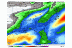
GEFS Looks to have improved from previous runs for NC and SC as a whole. Mean precip looks to have shifted further NW too.


Heelyes
Member
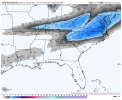
I realize some areas are missing out on this map but every state on this board has some snow showing, that seems like it's pretty close to board wide. Whamby if necessary.GEFS Looks to have improved from previous runs for NC and SC as a whole. Mean precip looks to have shifted further NW too.


Drscottsmith
Member
Does confidence increase with a particular model when events occur so close together (e.g. The ____ did so well with the 1/15-16 event that we should pay most attention to it's output for the 1/22 event)?
Cary_Snow95
Member
snowlover91
Member
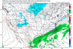
CMC is pretty suppressed.


Much better press over the NE though.CMC is pretty suppressed.
snowlover91
Member
Much better press over the NE though.
Yeah but it won't matter if there is no QPF to work with. CMC a bit of an outlier but goes to show this isn't a guaranteed storm like Euro/GFS show, things can still shift bad here if the timing isn't right.
canadian east.


NBAcentel
Member
Basically we should want mix of what Icon model has(less suppressed) and what the CMC has(better cold press and allowing the 850s to be futher SE)?Much better press over the NE though.
Downeastnc
Member
This why I like the flatter solutions, high ratio snows........

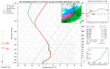
This is most likely well underdone as well...the trends are exactly what I hoped they would be down the stretch back to a less amped more traditional overrunning setup...again I totally expect someone between you and me to get 6-12" out of this....just need to trend to keep up, there will be some mixing to start I think but by Friday night its gonna be all snow and Sat gonna be glorious...
I mean I dont hate it....
accu35
Member
Anyone have Ptype panels of thr 12 gefs? CD is stuck.
Hypsometric
Member
Avalanche
Member
TWC going with climo saying NW NC foothills and mountains see some snow and Raleigh on east rain.
L
Logan Is An Idiot 02
Guest
Yeah I’m thinking the CMC ensembles will not agree with it either
Sent from my iPhone using Tapatalk
Yeah, this setup isn't climo. Definitely much colder and RDU will at least see sleet if they can get the precip.TWC going with climo saying NW NC foothills and mountains see some snow and Raleigh on east rain.
Due to staffing issues they had me and @BIG FROSTY getting 12-18” at hr 0 with the last storm. Ended up 2-6”. Complete joke no model even showed that.TWC going with climo saying NW NC foothills and mountains see some snow and Raleigh on east rain.
snowlover91
Member
Snowflowxxl
Member
UKMET is much more south vs last night
Blue_Ridge_Escarpment
Member
Sounds like last storm and the bias the UK has at this lead.UKMET is much more south vs last night
Snowflowxxl
Member
Snowflowxxl
Member
The UK met last week at 90 hours was close to spot on. It’s biases show more in 120-144 rangeSounds like last storm and the bias the UK has at this lead.
Avalanche
Member
Eerily similar to Birdman's forecast.
Cary_Snow95
Member
NBAcentel
Member
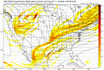
Pretty easy to see why I’m favoring a precip sheild further NW then modeled, this setup is driven by 850mb/700mb WAA and FGEN which is responsible for overrunning in the first place, imo even with the artic front itself, there’s already insentropic upglide, globals don’t handle this well at all, mesoscale models do 