iGRXY
Member
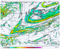
The thing is even though there was less phasing on the Euro, the GFS is still trending more NW with the low and the precip and that is gaining support on the GEFS. More than likely we’re probably headed towards a blend of the Euro/GFS/CMC where there is still plenty of moisture back here to the west from overrunning to put down a decent snow with temperatures in the 20s, but the heaviest QPF is east of Hwy 1 where things are aided by the phase. The big question whether or the WAR plays nice and stays backed off to keep the warm nose at bay more

View attachment 107763
This is is so close


That's got the look of classic SE winter storm! A lot of folks get in on this one.Cool depiction along the Gulf Coast on the NAM

Been a minute since we've seen both Carolinas covered in winter weather! This looks very ukie like to me.NAM coming in similar at the surface ptypes to @bouncycorn 's custom model. ZR alllll the way to the coast.
Got to have the phase or a much deeper cold push.Hope this isn’t a whamby post but what is needed for areas west into AL to get back into the game with this? Or is it too late for any major changes like that?
Yeah an earlier phase and this thing is further west but probably not gonna do it fast enough for usGot to have the phase or a much deeper cold push.
It does need to phase just a little bit earlier but it took a massive step towards the EURO with more phasing.We're in a somewhat okay look with the NAM. I think that if it can phase faster, then the wave can move east more quickly with lower heights.
Hey, How do I access this?
What's causing the front not to push south ?Yes, NAM doesn't really give a good push for the front....That is why I have been saying all along that we need to make sure the front has a good push south. **1st**
People sometimes confuse the accumulated precipitation output with comparing what is being seen on radar as well I think. A lot of times what is being shown on radar isn’t reaching the ground, and/or not heavy enough to reach the .10 inch threshold to show accumulation on the output. comparing simulated reflectivity with the real time radar would be closer to reality. That’s not to say the precip shield doesn’t verify farther north because it usually does. Just not to the extent that it sometimes seemsFinally someone with some prestige said it. The term "nw trend" is so over used but rarely explained. More times than not it's only the precip field has expanded nw not the Low itself, although that does happen. Robert did a real good job explaining this back in the day when he hung out in these lowly forums before going big time. Thanks Burrel!
Yes, it usually is. I live in the normal warm bubble. In this depiction, the wedge is building in stronger and faster than usual. That warm spot would fill in the next frame surely all else being equal.usually that warm nose is a little further east isnt it ?

The 500mb flow at that point is not going to allow for much more of a push southward.What's causing the front not to push south ?
Sheesh we were at 2 inches of sleet here in Raleigh .. before the big hit .. this could be an absolute mess
Because it has mixing. Miller A would create the assumption it is all snow.Where is Webb getting a Miller B from? Isn’t this just a hung up front with a low that develops and ride up the coast?
TW
yall have a better push from the wedge.T
Do you think this could effect CAE? Could this cause Us to just see rain?
Yeah, the NAM is Miller A. You can still get a lot of mixed precip types in a Miller A with CAD, depending on the setup. Miller B is a surface low tracking into N Bama / E TN (or NW of there), then reforming along the coast. Miller A / Miller B is very surface low track centricWhere is Webb getting a Miller B from? Isn’t this just a hung up front with a low that develops and ride up the coast?
TW
