bingcrosbyb
Member
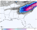
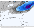
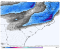
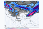
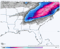
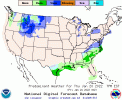
BMX AFD. To phase or not to phase, that is the question. Major impact differences to north/central AL. Low confidence in solutions right now.
Thursday night through Friday night:
Models generally remain in their camps regarding the Friday
shortwave, with the GEFS and European ensembles generally
following their respective deterministic models. It continues to
boil down to whether the shortwave is phased or unphased, which
determines if mid-level flow is southwesterly or west-
southwesterly, with implications for where moist isentropic lift
occurs and whether this is over the cold dome at the surface, and
whether an 850mb low forms over far southeast AL/southwest GA.
Will note that the GFS has some mid-level moisture and
frontogenesis/omega a bit to the northwest of where it has QPF,
and it is sometimes a bias of the model to not be far enough to
the north with QPF in these over-running situations. But the
overall confidence remains low. Expect mainly dry conditions
Thursday evening, with temperatures falling well below freezing
across the northwest half of the area. In the southeast counties,
cloudcover and a wind shift from northwest to northeast bringing
in a slightly less cold air mass in advance of the wedge will keep
temperatures a bit milder. General model consensus at this time
between midnight Thursday night and 6 AM Friday has the surface
freezing line setting up somewhere near approximately a
Dallas/Lowndes county up through Randolph/Chambers County. While
the highest precipitation chances are southeast of this line,
indicating rain, there is a chance there could be an overlap for a
stripe of freezing rain along the northwest side of the
precipitation shield with some wet bulb effects possibly coming
into play. Temperatures would then rise above freezing Friday
morning, but if precipitation is falling generally over the
northeast quadrant of Central Alabama by Friday afternoon and
Friday evening thermal profiles would support a wintry mix in this
area. This remains a conditional threat, but overall I think
there`s too much moisture close to too much cold air to not
mention a low confidence threat in the HWO.

