• Hello, please take a minute to check out our awesome content, contributed by the wonderful members of our community. We hope you'll add your own thoughts and opinions by making a free account!

Wintry 1/20 - 1/23 Winter Storm

RAH Discussion (euro leading the pack, they're going with a GFS/ECMWF/GEFS blend):

.LONG TERM /THURSDAY THROUGH MONDAY/...
As of 345 AM Tuesday...

The well-advertised arctic cold front has continued to trend slower,
with the location of the front early Thursday morning forecast to be
located northeast to southwest over the Appalachians and stretching
southwest into southern Texas, with a roughly 1046mb arctic high
over the upper Midwest. Likely rain is forecast ahead of the front
with good these-e advection and moisture transport from the
southwest and a shortwave perturbation tracking through that is
currently located over southern California. Amounts should generally
be under a half inch. Highs were lowered a few degrees from the
earlier forecast to the low to middle 40s in the north and lower to
middle 50s in the south, owing to extensive clouds and light rain.
The front roughly passes through from north to south in the late
afternoon to early evening, with low-level thicknesses dropping to
around 1270-1300m and overnight lows turning quite cold in the upper
teens in the north to the middle 20s in the south. As front sags
south through the overnight, it should favor a changeover from rain
to snow, possibly a mix of sleet/ice as evident in forecast
soundings, as anafrontal isentropic upglide overrides the arctic
front. At the same time, precipitation will slowly taper off through
the overnight as the energy at mid-levels shifts out of the area.
Projected snow amounts are currently under an inch, though it is
worth noting that considerable uncertainty exists in these amounts
(including potential ptypes) and the forecast is likely to change,

so stay tuned for further updates.

Fri-Mon
: The 00Z suite of deterministic and ensemble data has come
into better agreement
on the overall pattern during this period,
though the finer details still need to be ironed out. The 00Z GFS,
which appeared an outlier relative to the GEFS/ECMWF
ensemble/Canadian, has trended wetter toward the 00Z ECMWF/Canadian

and GEFS. A mid-level trough over the Midwest on Friday, as well as
a secondary shortwave over southern Texas and northern Mexico will
track east into the Carolinas and Mid-Atlantic region by Saturday.
There continues to remain differences in the models on these two mid-
level shortwaves and whether or not they can phase to influence the
downstream pattern and a resultant surface low tracking off the

coast Friday night and Saturday. Regardless, the GFS/ECMWF show
evidence that the polar jet and subtropical jet may phase Fri-Sat,
putting central NC in the favored right entrance region, favorable
for precipitation and winter weather. There remains a lot of
questions, especially since the trend has been for the 850 mb low to
be further inland, which would potentially favor a wintry mix of
rain/snow/ice. Confidence in these details are low at the moment,
but suffice to say that it appears winter precipitation is likely in
the Fri-Sat period, so be sure to stay tuned as the details are
likely to change. The current forecast is largely a blend of the
GFS/ECMWF/GEFS. Temperatures during this time will be in the
20s/30s, some 15-25 degrees below normal, owing to the arctic air in
place. By Saturday night, the guidance indicates a 1030mb high
pressure settling in from the west, favoring a dry period for the
rest of the extended. The main story for the late weekend will be
temperatures remaining some 10-20 degrees below normal.

&&

So at least they believe something winter weather is coming now... My grid forecast for snow has also jumped from 40% to 70% for Friday night.
 
We need a colder trend!!!!

Morehead sounding serious alarm bells

Thursday night through Friday night...A high impact winter
weather event appears to be unfolding this period, with a signal
for potential significant icing for parts of ENC. The
aforementioned sfc cold front will stall off of the Southeastern
Seaboard this period. A wave of low pres develops along this
boundary Thur night. 18/00Z global models indicating a frontal
inversion developing over ENC Thu night and into Fri, and with
most guidance indicating 850 mb temps above freezing, limiting
the chances for snow (GFS is colder aloft and indicating some
snow, though a known bias of the GFS is cold thermal profiles
aloft). With sfc temps at or below freezing, the threat for a
prolonged period of ice/sleet will come into play, as upper flow
will be nearly parallel to the frontal boundary. ECMWF/CMC
continue to be especially concerning, indicating significant
freezing rain totals across much of the Coastal Plain counties.
GFS is now catching on to this scenario as well for the swrn
counties as it has trended further north with the warm nose with
this latest cycle.

Relied heavily on raw model T`s for temp forecast, as MOS
guidance is much too warm with sfc T`s in strong frontal
inversion/CAD events. Most of the FA along and west of a
Jacksonville to Plymouth line will not get above freezing on
Friday, and far wrn counties will remain in the 20s. This does
not bode well for ice accretion, which would be efficient and
significant with these temperatures.
 
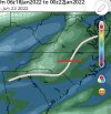
prateptype_cat.us_se.png
 
000
FXUS62 KCAE 180848
AFDCAE

Area Forecast Discussion
National Weather Service Columbia SC
348 AM EST Tue Jan 18 2022

.LONG TERM /THURSDAY NIGHT THROUGH MONDAY/...
Much uncertainty still remains in the long term period. The
surface front will push off to the south Thursday night into
Friday before briefly stalling out. An area of low pressure is
then expected to develop along this front near the northeastern
Gulf, then track off to the northeast Friday into Saturday. The
All of the Ensembles (GEFS/ECMWF/Canadian) still show much
uncertainty in regards to moisture return and temperatures. This
uncertainty leads to a low confidence forecast at this time in
regards to precip and precip type across the region. The overall
pattern does support cold weather and wintry precip though.

The wintry precip is expected to begin early Friday morning as
the colder air moves in from the north. Surface temperatures
will be fall near freezing across the Northern and central
Midlands Friday morning before rising a few degrees during the
day. This should limit the freezing rain potential some through
the day Friday. Bigger threat begins Friday evening and into
Saturday morning as temperatures fall back below freezing. Models
soundings continue to show a good amount of warm advection
above the surface cold air intrusion. The northward extend to
this warm nose will ultimately determine where the transition
from freezing rain to snow will occur overnight Friday into
Saturday. For now at least, expecting a good mix of wintry
precip Friday night into Saturday, with the potential for some
significant impacts depending on the amount of freezing rain and
snow that eventually may accumulate. The timing, type, and
amounts of the wintry precip will continue to be adjusted the
next few days.
 
Extended Forecast Discussion
NWS Weather Prediction Center College Park MD
222 AM EST Tue Jan 18 2022

Valid 12Z Fri Jan 21 2022 - 12Z Tue Jan 25 2022

...Guidance/Predictability Assessment and Weather
Highlights/Threats...

Guidance remains in decent agreement with the large scale mean
flow over the lower 48 highlighted by an upper ridge off/along the
West Coast and upper troughing over the central and eastern U.S..
However, the models have recently been horrendous with run to run
continuity with embedded shortwaves that dig through the mean
upper trough position. In particular, forecast spread remains a
significant timing and amplitude issue with a main shortwave over
the east-central to eastern states Fri/Sat that produces major
placement differences with a potentially impactful coastal low
genesis in the western Atlantic. The 00 UTC ECMWF/UKMET trended
deeper and less progressive with the inland shortwave and
subsequent coastal system. The 00 UTC GEFS also trended in that
direction. The 00 UTC GFS was slightly less progressive and
northward shifted. The 00 UTC Canadian seems in line with its 12
UTC run. It does seem noteable that the 00 UTC model trends now
seem more favorable for significant system develpment. However, it
has been an annoying recent trend for 00 UTC guidance to trend
slower vs 12 UTC guidance, possibly due to diurnal initialization
data sensitivity. Hopefully, model solutions will continue to
converge on a more common solution.

Accordingly and in anticipation, the earlier released WPC product
suite was primarily derived from the most amplified ensemble mean
solution, the ECMWF ensemble mean. Manual adjustments were further
applied to increase shortwave amplitude smoothed out by the mean
and to maintain max WPC product continuity.

There is potential for heavy snow, sleet, and freezing rain
particularly from the southern Appalachians and
Carolinas/Mid-Atlantic into Fri, potentially into the Northeast by
Sat. The pattern will also be favorable for lake effect snow given
cold air in place. Into early next week, guidance agrees to hold
an amplified mean upper trough over the cooled east-central U.S.,
ableit with variations with embedded shortwaves set to dig and
reinforced the feature underneath a deep low centered just east of
the Hudson Bay.
 
From GSP

ONG TERM /SATURDAY THROUGH MONDAY/...
As of 230 AM EST Tuesday: An active extended is in store as
models come into better agreement about a potent system entering
the eastern CONUS over the weekend. Deterministic guidance is
struggling to handle the system consistently, with the last 2 runs
of the ECMWF finally converging on a strong cyclone affecting
the Carolinas, even as latest run of the GFS begins to diverge
fromt his solution. The CMC has consistently depicted a solution
in line with the latest ECMWF. Such a solution would result in
cyclogenesis along a stalled frontal boundary south and east of
the forecast area, in turn producing a cyclone that shifts east
too quickly to appreciably warm 850mb temps. So, precipitation
develops atop bitterly cold low-level air, resulting in an all-snow
solution throughout Friday night and much of Saturday.

About 75% of GEFS members now depict some amount of wintry precip
occurring with this system, indicating the latest dry solution from
the deterministic run is an outlier; nonetheless, there remains
significant uncertainty with the timing and intensity of this
system, as well as what, if any, accumulations could be expected
should another winter system actually materialize.

In any case, the upper pattern becomes much less perturbed behind
this system, and cold, dry air builds in at the surface. A weak
reinforcing cold front should arrive Monday evening, but looks
too dry to warrant any PoPs.
 
How well did the Korean perform lately, or are we just testing the waters with it?
 
Not sold on the snow with the cold front, sure that will be a cold chasing moisture and those rarely work, however, absolutely love the changes with our energy and location of slp at this lead time. Anyone saying it's too far south/east/suppressed well you have the shortest memory in the existence of all mankind.
I might be eating those cold chasing moisture rarely work words lol
 
No change from me at the moment I’m still leaning on the GFS over the euro and a combination of some of the dry solutions. Below and east of the pink line however needs to watch out for winter weather chances with greater moisture returns. This will still teeter (red line) west or east but if anything I believe it ticks east occasionally in the days ahead! My max zone is still north east NC and south east Virgina. We wait and see how much showers can make it west torwards Charlotte. *Not a final forecast or depiction of any amounts for anyone. Please do not get upset at me. 275F4659-2C49-46BE-AB5B-40F30AF5B31D.jpeg
 
No change from me at the moment I’m still leaning on the GFS over the euro and a combination of some of the dry solutions. Below and east of the pink line however needs to watch out for winter weather chances with greater moisture returns. This will still teeter (red line) west or east but if anything I believe it ticks east occasionally in the days ahead! My max zone is still north east NC and south east Virgina. We wait and see how much showers can make it west torwards Charlotte. View attachment 107715
Still big NW shift, whether you think it did or not.

Sent from my SM-A526U using Tapatalk
 
This is a private model right? Extremely experimental made by like two dudes? I can't remember
It's me and my colleague's model. It's still experimental but it's 2 years old now & has gone through extensive testing. It has performed exceptionally the past 6 months.

I posted the last run earlier on pg 59 I believe. It had a nice ice storm for south carolina/ga last run.
 
Pretty easy to see where this is going, already .35 QPF in Charlotte View attachment 107718
Yep NW Trend is evident, just how far NW it goes is still a guess. There gonna be a lot more people in the game for snow time this one is done. Even NE Ga gonna see some snow

Sent from my SM-A526U using Tapatalk
 
Back
Top