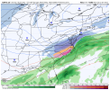
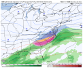
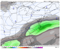
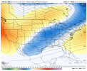
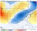
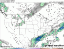
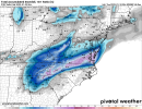
Well you nailed the last storm so you’ll probably be right again ?oh and I’m not calling for a dusting in Charlotte by the way I think it would be less than that.i was just looking at 0z output and it def doesn’t change anything from me
-
Hello, please take a minute to check out our awesome content, contributed by the wonderful members of our community. We hope you'll add your own thoughts and opinions by making a free account!
You are using an out of date browser. It may not display this or other websites correctly.
You should upgrade or use an alternative browser.
You should upgrade or use an alternative browser.
Wintry 1/20 - 1/23 Winter Storm
- Thread starter packfan98
- Start date
John1122
Member
It was bad. I was barely on the Western edge of getting anything on the UK, I ended up on the Eastern edge of heavy snow here in Tennessee. It basically was a good 200 miles too far S/E Sunday.
The ukmet did awful with the last system.
NBAcentel
Member
NBAcentel
Member
NBAcentel
Member
Somehow the CMCE was worse
It’s still possible sure man I just putting my own take on what zones are in the greatest impact area. I know it’s too far out to determine the cutoff line I just want readers to know not everyone is gonna score with this one and I’m leaning to most (Greensboro Charlotte and points west) not getting much or any qpf.
What in the world UKMET!
On the bright side, we’re not seeing too much of a nod to the Euro.Somehow the CMCE was worse
I’m not worried about the moisture at all, it will come. But if we can get our temps right, we would be sitting so much better.That is beautiful at this stage.
Get the cold, then worry about the moisture.
Snownut
Member
Just sit back and watch the NW Trend. It happens almost always with these southern systems like this.It’s still possible sure man I just putting my own take on what zones are in the greatest impact area. I know it’s too far out to determine the cutoff line I just want readers to know not everyone is gonna score with this one and I’m leaning to most (Greensboro Charlotte and points west) not getting much or any qpf.
Sent from my SM-A526U using Tapatalk
Chattownsnow
Member
accu35
Member
Very nice
Totally different system man not all are the same. Far from our last system. This one is not coming from the Dakotas or transferring. It’s ejecting ENE and will spill qpf in a more conservative fashion with how the precip shield evolves you can see it clearly on the 0z guidance.Just sit back and watch the NW Trend. It happens almost always with these southern systems like this.
Sent from my SM-A526U using Tapatalk
NBAcentel
Member
As we’ve seen this year, everything has became ampedTotally different system man not all are the same. Far from our last system. This one is not coming from the Dakotas or transferring. It’s ejecting ENE and will spill qpf in a more conservative fashion with how the precip shield evolves you can see it clearly on the 0z guidance.
Things are prone to being more NW from the ridging nosing in off the coast
The energy is trending back to a partial phase on modeling
Way more support for this to be a bit west, then stay ots or be further east, I mean the nam already starts our winter storm in 75 hours. I could be wrong tho
Last edited:
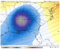
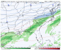
Unfortunately, just about all of the 0.75-1.00” wintry qpf SAV-CHS and nearby areas is ZR. This is based on 850’s mainly +5 to +6 hours 90-114 and 925’s just above freezing. So, what looks like a beautiful heavy snowfall on the clown is really devastating ice. 2M temps plunge to the low 30s and then upper 20s due to a very strong wedge along with very windy conditions meaning windchills near 20. In this area, that would be the worst ZR since 1922. I wouldn’t want any part of this. Hopefully UK is off of its rocker though there have been certain runs of various models with something similar over the last few days, which is unnerving. Fortunately, it is an outlier and NW shifts meaning warmer are common.
@Stormsfury fyi
Last edited:
Pilotwx
Member
Definitely seeing a NW trend, Euro possible phase like what I see here.
NW Trend doesn’t necessarily have to mean warmer if the phase occurs earlier, like ukmet showsUnfortunately, just about all of the 0.75-1.00” wintry qpf SAV-CHS and nearby areas is ZR. This is based on 850’s mainly +5 to +6 hours 90-114 and 925’s just above freezing. So, what looks like a beautiful heavy snowfall on the clown is really devastating ice. 2M temps plunge to the low 30s and then upper 20s due to a very strong wedge along with very windy conditions. In this area, that would be the worst ZR since 1922. I wouldn’t want any part of this. Hopefully UK is off of its rocker though there have been certain runs of various models with something similar over the last few days, which is unnerving. Fortunately, it is an outlier and NW shifts meaning warner are common.
@Stormsfury fyi
accu35
Member
0z Euro is under way
NW Trend doesn’t necessarily have to mean warmer if the phase occurs earlier, like ukmet shows
I’d much rather there be a SE trend of the surface low track to cool the 850s/925s so I could get mainly sleet or snow. Anything but this as this is about the worst case scenario.
h5 of this euro run looks a lot like UKMET thus far (thru hour 36)
Euro has much less of a WAR than 18z through hr 66.
accu35
Member
1043 h
Looks like it has slowed the southern wave more through 72hrs.
accu35
Member
Looks south
Precip filing in


Low is southwest at hr 87.
GeorgiaGirl
Member
Hour 96 has a low pressure right off the Georgia coast on the crude maps.
Just a bit behind, allowing cool air to push in. This will be a nice run.
Gonna be a more phased run though at 90hrs.

Looking nice!
Raging sleet storm with several hours of freezing rain also for Central NC per the soundings on Pivotal Weather. Ugh, what a mess. I really hope the UKMET is correct.
Last edited:
Snownut
Member
Well there ya go, NW all the way
Sent from my SM-A526U using Tapatalk
Sent from my SM-A526U using Tapatalk
accu35
Member
Low in the gulf is a bit NW this run
Snowflowxxl
Member
I’ll take it. Hoping temps can trend slightly cooler
Monster of a trend for us in AL and west GA!

