-
Hello, please take a minute to check out our awesome content, contributed by the wonderful members of our community. We hope you'll add your own thoughts and opinions by making a free account!
You are using an out of date browser. It may not display this or other websites correctly.
You should upgrade or use an alternative browser.
You should upgrade or use an alternative browser.
Wintry 1/20 - 1/23 Winter Storm
- Thread starter packfan98
- Start date
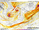
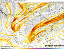
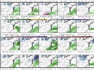
There was some close biters but they’ve mainly converged into the first wave taking the show2nd wave 0Z GEFS member SLPs: there are some interesting members well offshore. Anyone have the precip for these members?
View attachment 107653
Snowflowxxl
Member
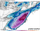
Omfg the UKMET is the a thing of beauty I’m deceased
WOOF WOOF HONK HONK
WOOF WOOF HONK HONK
Dewpoint Dan
Member
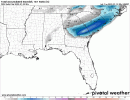
A general 2-4" for Atlanta area. Not bad.Holy $hit the UKMET!!!!!!!
Snownut
Member
That cold is a lock, this will be Snow for many from upstate sc, through E NC. Not sure if NE Ga gets in on this one. They could depends on the NW pull.
Sent from my SM-A526U using Tapatalk
Sent from my SM-A526U using Tapatalk
How things go right … the 00z ukmet
Just the usual reminder to all, this is not just snow on the pivotal UK clown. Regardless, wow!
brendan123
Member
wow
Member
ukmet is a classic phase and buries the deep south. Looks like all snow west of 95.
Also a reminder for whoever stayed snow .. these were 10:1 ratios .. ratios would be much higher for whoever stays snowJust the usual reminder to all, this is not just snow on the pivotal UK clown. Regardless, wow!
That's a Carolina crusher sirukmet is a classic phase and buries the deep south
Especially in the midlands!!Just the usual reminder to all, this is not just snow on the pivotal UK clown. Regardless, wow!
bingcrosbyb
Member
Overall good trends from 00z suite
That’s all snow. It’s like the Euro from a few days ago.The UK doesn't differentiate from sn/ip/zr on it's precip maps or does it?
UK/EC inside day 5 is a very tough hand to beat.
The ukmet did awful with the last system.UK/EC inside day 5 is a very tough hand to beat.
Lol the UK matched my thoughts on s/e Virginia and north/east nc. Patterns supports the moisture being weighted and sliding east north east. Don’t think it will be that widespread tho.i would think maybe a dusting of moisture closer to Charlotte and it’s too far out to see the cutoff near Raleigh but I think they are in game certainly
The ukmet did awful with the last system.
It was too far southeast, this should be a warning shot
Sent from my iPhone using Tapatalk
Translation: a lot of ZR and IP Macon to Augusta to Columbia to Fayetteville and points east to the coast on the 0Z UK since the 850 line is still then well inland. That’s a lot of it over a big area!
Lol the UK matched my thoughts on s/e Virginia and north/east nc. Patterns supports the moisture being weighted and sliding east north east. Don’t think it will be that widespread tho.i would think maybe a dusting of moisture closer to Charlotte and it’s too far out to see the cutoff near Raleigh but I think they are in game certainly
I totally disagree with this
Sent from my iPhone using Tapatalk
The ukmet did awful with the last system.
Hopefully we were not looking at 10:1 and more at the larger synoptic picture modeled.
I will say though... this upcoming system is much more upper air: synoptic-oriented which UKMET is great at. Last system was largely dominated by mesoscale interaction between hp and lp.The ukmet did awful with the last system.
NBAcentel
Member
Went from ots to a small sliver on ENC to now a dusting in CLT lolLol the UK matched my thoughts on s/e Virginia and north/east nc. Patterns supports the moisture being weighted and sliding east north east. Don’t think it will be that widespread tho.i would think maybe a dusting of moisture closer to Charlotte and it’s too far out to see the cutoff near Raleigh but I think they are in game certainly
Snowflowxxl
Member
The UKMET at this range with the last system was really SE, so we will have to wait and see
Beat me to it. Betting a lot that this system won’t be like the UK in terms of covering all of NC. Saving that solution for the UK dumpster model file again!The ukmet did awful with the last system.
The euro should be telling on which way we should be prioritizing our thoughts trend wise
Really feeling like (totally not a wishcast) this will shift NW/phase earlier and give North Georgia a really nice event.
You just had your storm man. But In all honesty this is really ripe pattern for s/e Virginia and north eastern NC to even get that freak blizzard if it would bomb out.i know Raleigh wants in and deserves it I hope it trends in their favor not ours.Went from ots to a small sliver on ENC to now a dusting in CLT lol
I thought the UKMET was lock in step with most up to like 24-36 hours before main event but yeah then was garbageThe ukmet did awful with the last system.
Yeah, other models have spoken now including the NAM tonight. It's the euro's call (or raise) coming upThe euro should be telling on which way we should be prioritizing our thoughts trend wise
Hypsometric
Member
Snownut
Member
Yep I've been saying this same thing for awhile now. We've seen it time and time again when these things start showing the coast in the Game, time and time again they will shift NW usually taking the lower south out of the game. I think Midlands will get and ice storm but that Snow line will be further NWReally feeling like (totally not a wishcast) this will shift NW/phase earlier and give North Georgia a really nice event.
Sent from my SM-A526U using Tapatalk
oh and I’m not calling for a dusting in Charlotte by the way I think it would be less than that.i was just looking at 0z output and it def doesn’t change anything from me
bingcrosbyb
Member
That is beautiful at this stage.
farleydawg792
Member
UK is top end, upper portion of guidance envelope at this still early stage. Streams starting to interact IVO Ark-La-Tex is a good thing within reason, too much play and thermals will respond. Very fine line like always living 1-2C above 925mb this time of year.


