Models always suck at depicting ZR. They had me at .8 in, and I stayed sleet the entire event.I don't work for FFC, but I may or may not have stayed in a Holiday Inn Express last night.
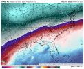
The FRZ RN depiction on pivotal almost maxed out the color scale with some amounts approaching 2 inches. Does that even seem like a realistic outcome down that way?
-
Hello, please take a minute to check out our awesome content, contributed by the wonderful members of our community. We hope you'll add your own thoughts and opinions by making a free account!
You are using an out of date browser. It may not display this or other websites correctly.
You should upgrade or use an alternative browser.
You should upgrade or use an alternative browser.
Wintry 1/20 - 1/23 Winter Storm
- Thread starter packfan98
- Start date
jay.p
Member
Possible Late-Week Winter Weather
https://www.weather.com/storms/winter/video/possible-late-week-winter-weather?pl=pl-latest-forecasts
Sent from my iPhone using Tapatalk
https://www.weather.com/storms/winter/video/possible-late-week-winter-weather?pl=pl-latest-forecasts
Sent from my iPhone using Tapatalk
iGRXY
Member
If mixed precip is being modeled the only way to know if you’re likely getting sleet or ZR is to check the soundings for each panel. Models always show sleet as ZR and spit out ridiculous outputs. If you go look at the soundings, most of the time the warm nose is not very big or is not very deep. Couple that with CAD is under modeled and the lower level cold is always colder than modeled. Really the best place to get ZR is the closer you get to the coast where if it is cold enough for wintery precip it’s usually at the surface as they’re closer to the LP. That’s why if I see ZR getting spit out along and east of I95 I pay more attention to that.
- Joined
- Jan 23, 2021
- Messages
- 4,602
- Reaction score
- 15,197
- Location
- Lebanon Township, Durham County NC
The icon was the only model not showing significant freezing rain(you do get freezing rain on extracted data).Models always suck at depicting ZR. They had me at .8 in, and I stayed sleet the entire event.
I can imagine having that much FZRA, that would be terrible. I’m guessing it would be something else as well.I don't work for FFC, but I may or may not have stayed in a Holiday Inn Express last night.
The FRZ RN depiction on pivotal almost maxed out the color scale with some amounts approaching 2 inches. Does that even seem like a realistic outcome down that way?
brendan123
Member
Wakefield sounding less and less conservative. Keep in mind, tomorrow evening, at least SE Virginia will be within the 48 hr Winter Storm Watch window if winter precip starts falling Thursday evening associated with the front...
"Arctic high pressure will be centered over southeast Canada and
northern New England/NY Friday. Cold air will be moving into the
region following the passage of the cold front on Thursday. The
cold front will likely stall along the Carolina coast Friday and
into Saturday. This will set up the potential for a low
pressure system to track just southeast of the area this
weekend, and keep in chances for light snow near the front
Thursday night into Friday across far southeast VA and inland
areas of northeast NC. Precip could change over to all snow as
far southeast as the northern Outer Banks Thursday night into
Friday morning. There is high confidence that very cold air will
be in place Friday ahead of this potential winter storm. Low
temperatures Friday morning will be in the teens inland and 20s
along the coast. Cold air will still be moving into the area
during the day on Friday with a north wind. High temperatures on
Friday are expected to be in the mid and upper 20s inland and
around 30F along the coast. Cold air combined with the northerly
wind could result in wind chill starting in the single digits
Friday morning and only rising to the teen Friday afternoon.
Low pressure begins to form over the northeast Gulf of Mexico
Friday. Southwest flow aloft will bring moisture north, well
ahead of the center of low pressure. Snow could over spread the
area late Friday through Saturday. There is low confidence in
how much moisture comes back north into the region as the low
pressure moves up the coast, but there is high confidence that
the cold air will be in place. So if precip fall, it will likely
be mostly snow, with some mixing near the VA/NC coasts. This
storm has the potential to be a high impact event. ECMWF
probabilities show a 50-60% chance of at least 3" of snow
accumulation for all of our forecast area Friday night into
Saturday morning. ECMWF probs show also show 30-40%
probabilities of at least 6" of snow accumulation for Hampton
Roads, with less than 30% probability for the remainder of the
area. This snow will be falling into sfc temperatures that are
in the low to mid 20s. The ECMWF is the most aggressive with
showing widespread heavy snow accumulations across the area. GFS
show less of a threat with most of the precip along the NC
coast and across Hampton Roads. While the Canadian is in
between. However, the latest runs of the GFS have trended the
system northwest, coming in closer with the ECMWF."
wow
Member
Southern s/w still progressing east 18z ECMWF ...
2nd wave surface low mean on 18Z GEFS is further south weaker vs 12Z GEFS:
View attachment 107469View attachment 107470
View attachment 107471
Will this, assuming it doesn’t disappear/weaken more in later runs, come back NW later?
In the meantime, does anyone have the 18Z GEFS member precip panels for this second wave, alone? (Especially hours 120-150 or so)
Bump, anyone have the 18Z GEFS member wintry precip panels for hours 120+? (Second shortwave) Thanks.
You mentioned something that is another thing about these crazy differences on the models. The field offices in GA, the Carolinas, and VA have to start deciding during the overnight shift tomorrow night about issuing Winter Storm Watches.Wakefield sounding less and less conservative. Keep in mind, tomorrow evening, at least SE Virginia will be within the 48 hr Winter Storm Watch window if winter precip starts falling Thursday evening associated with the front...
"Arctic high pressure will be centered over southeast Canada and
northern New England/NY Friday. Cold air will be moving into the
region following the passage of the cold front on Thursday. The
cold front will likely stall along the Carolina coast Friday and
into Saturday. This will set up the potential for a low
pressure system to track just southeast of the area this
weekend, and keep in chances for light snow near the front
Thursday night into Friday across far southeast VA and inland
areas of northeast NC. Precip could change over to all snow as
far southeast as the northern Outer Banks Thursday night into
Friday morning. There is high confidence that very cold air will
be in place Friday ahead of this potential winter storm. Low
temperatures Friday morning will be in the teens inland and 20s
along the coast. Cold air will still be moving into the area
during the day on Friday with a north wind. High temperatures on
Friday are expected to be in the mid and upper 20s inland and
around 30F along the coast. Cold air combined with the northerly
wind could result in wind chill starting in the single digits
Friday morning and only rising to the teen Friday afternoon.
Low pressure begins to form over the northeast Gulf of Mexico
Friday. Southwest flow aloft will bring moisture north, well
ahead of the center of low pressure. Snow could over spread the
area late Friday through Saturday. There is low confidence in
how much moisture comes back north into the region as the low
pressure moves up the coast, but there is high confidence that
the cold air will be in place. So if precip fall, it will likely
be mostly snow, with some mixing near the VA/NC coasts. This
storm has the potential to be a high impact event. ECMWF
probabilities show a 50-60% chance of at least 3" of snow
accumulation for all of our forecast area Friday night into
Saturday morning. ECMWF probs show also show 30-40%
probabilities of at least 6" of snow accumulation for Hampton
Roads, with less than 30% probability for the remainder of the
area. This snow will be falling into sfc temperatures that are
in the low to mid 20s. The ECMWF is the most aggressive with
showing widespread heavy snow accumulations across the area. GFS
show less of a threat with most of the precip along the NC
coast and across Hampton Roads. While the Canadian is in
between. However, the latest runs of the GFS have trended the
system northwest, coming in closer with the ECMWF."
iGRXY
Member
Euro looks better to me. SW in the southwest is further east
iGRXY
Member
Northern stream is definitely slower this run
brendan123
Member
They could wait until even 24 hours out to issue watches, but with the chance of this being a big hit for some areas, they may get pushback from people who said there wasn't ample warning if they did that. And 24 hours out, you'd normally expect warnings and advisories to start getting issued instead of watchesYou mentioned something that is another thing about these crazy differences on the models. The field offices in GA, the Carolinas, and VA have to start deciding during the overnight shift tomorrow night about issuing Winter Storm Watches.
NBAcentel
Member
Lol it’s a good thing we’re not 150 hours out because that western Atlantic ridge trend on all modeling has been cringeworthy
NBAcentel
Member
wow
Member
seems overall a bit slower with all features
Better sampling in the next couple of cycles will probably fix that. Hopefully, we'll get some clarity very soon on the nature of the system...big wound up Miller A, MillerBcrap, or overraining.The euro and gfs are night and day at hr 78 with the northern energy. Wow
Sent from my iPhone using Tapatalk
Atlantic ridge still trending . Extrapolating that run should be another wound up phaser for sure.
If the gfs scored the coup on this storm it’s the new king. I’ve never seen the euro miss it this bad this close.
Sent from my iPhone using Tapatalk
If the gfs scored the coup on this storm it’s the new king. I’ve never seen the euro miss it this bad this close.
Sent from my iPhone using Tapatalk
packfan98
Moderator
Much warmer run on the 18z euro too.
NBAcentel
Member
850s only support snow in the mountains and maybe some northern counties this run
- Joined
- Jan 23, 2021
- Messages
- 4,602
- Reaction score
- 15,197
- Location
- Lebanon Township, Durham County NC
2” of snow here this run.850s only support snow in the mountains and maybe some northern counties this run
NBAcentel
Member
Snownut
Member
When you say that, what areas are you speaking of?A ice storm isn’t gonna be escaped with a 1042 high pressure parked to our North feeding in a very cold/dry airmass View attachment 107486
Sent from my SM-A526U using Tapatalk
Also going to depend on how fast that it can get into that position and feed the cold.A ice storm isn’t gonna be escaped with a 1042 high pressure parked to our North feeding in a very cold/dry airmass View attachment 107486
L
Logan Is An Idiot 02
Guest
A ice storm isn’t gonna be escaped with a 1042 high pressure parked to our North feeding in a very cold/dry airmass View attachment 107486
I’m sorry but how exactly is that an ice storm? Literally looks like a perfect set up to me
Sent from my iPhone using Tapatalk
- Joined
- Jan 23, 2021
- Messages
- 4,602
- Reaction score
- 15,197
- Location
- Lebanon Township, Durham County NC
Just my opinion as I look at this run:
I think it would’ve been a massive snow to sleet storm between 85 and 40 with damaging ice east of say 95 to almost the immediate coastline in NC with freezing rain roughly south of a line from Anderson to Lancaster in SC down to a line from Aiken to Manning-ish.
I think it would’ve been a massive snow to sleet storm between 85 and 40 with damaging ice east of say 95 to almost the immediate coastline in NC with freezing rain roughly south of a line from Anderson to Lancaster in SC down to a line from Aiken to Manning-ish.
NBAcentel
Member
I’m sorry but how exactly is that an ice storm? Literally looks like a perfect set up to me
Sent from my iPhone using Tapatalk
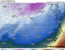
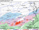
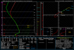
It’s not, to much western Atlantic ridging is nosing in a warm nose aloft, maybe we can get it to back off, but most of the time, it gets stronger until go time, soundings around us seem more supportive of IP tho on the euro
Snowflowxxl
Member
This is why you want it in Cuba and beat down until hour 48. 96 hours is wayyyy to much time and as you can see we now have an amped up beast that will leave 85% of GA rain for the majority. Idk how people still worry about storms being suppressed after years of this stuff.
NBAcentel
Member
- Joined
- Jan 23, 2021
- Messages
- 4,602
- Reaction score
- 15,197
- Location
- Lebanon Township, Durham County NC
It feels like a potentially colder version of last weekend.WAR brings warm air into the mid-levels despite low-level cold.
View attachment 107488View attachment 107492
View attachment 107493
Snowflowxxl
Member
We went from precip in the mid 20s to 38 degree rain in a matter of 36 hours. Don’t ever tell me again that there’s not enough time for something to trend poorly.
Just out of curiosity… where the 850s are 1-2c, can those not be cooled just enough with enough forcing and lift?WAR brings warm air into the mid-levels despite low-level cold.
View attachment 107488View attachment 107492
View attachment 107493
Showmeyourtds
Member
Is it warmer due to the lack of cold push or due to the change in the strength of the LP?We went from precip in the mid 20s to 38 degree rain in a matter of 36 hours. Don’t ever tell me again that there’s not enough time for something to trend poorly.
Jessy89
Member
To be honest way euro temps are trending. A rain event for a lot of people can’t be ruled out. The ridge can’t be underestimated
Sent from my iPhone using Tapatalk
Sent from my iPhone using Tapatalk
NBAcentel
Member
Trust me those 20s were coming for you that wedge boundary was flying south on the euroWe went from precip in the mid 20s to 38 degree rain in a matter of 36 hours. Don’t ever tell me again that there’s not enough time for something to trend poorly.
The upper shortwave hasn't made it close enough by hour 90. There would be a changeover after this frame on this run.We went from precip in the mid 20s to 38 degree rain in a matter of 36 hours. Don’t ever tell me again that there’s not enough time for something to trend poorly.

