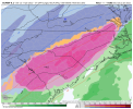
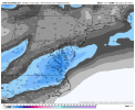
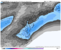
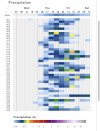
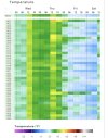
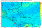
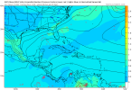
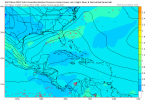
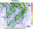
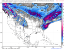
The Canadian did a really good job at modeling the warm nose.How did the Canadian perform for this past system? Right now it seems like the middle ground for the Euro and GFS for the late-week system, but I don't know if its solution really holds any value.
-
Hello, please take a minute to check out our awesome content, contributed by the wonderful members of our community. We hope you'll add your own thoughts and opinions by making a free account!
You are using an out of date browser. It may not display this or other websites correctly.
You should upgrade or use an alternative browser.
You should upgrade or use an alternative browser.
Wintry 1/20 - 1/23 Winter Storm
- Thread starter packfan98
- Start date
This might be the start of something, and I mean with that strung out southern stream ---- View attachment 107440
Yes, but the northern stream seems to be lifting north by the western Atlantic ridge.
Sent from my iPhone using Tapatalk
Stephenb888
Member
No matter how the models play out, is the best we can expect from this is a small event? Or is there potential for a big event? Big snow?
NBAcentel
Member
Everything is on the table.No matter how the models play out, is the best we can expect from this is a small event? Or is there potential for a big event? Big snow?
- Joined
- Jan 23, 2021
- Messages
- 4,602
- Reaction score
- 15,197
- Location
- Lebanon Township, Durham County NC
People don’t want to hear it but it did pretty good last event, especially at the surfaceThe ICON looks like February 2015 but colder at the surface.
View attachment 107421
View attachment 107422
Definitely potential for a big.. or even huge event.No matter how the models play out, is the best we can expect from this is a small event? Or is there potential for a big event? Big snow?
No matter how the models play out, is the best we can expect from this is a small event? Or is there potential for a big event? Big snow?
What?
Sent from my iPhone using Tapatalk
NBAcentel
Member
However the GEFS has way less QPF and has more suppressed look at the sfc
I will never take the American model seriously with how it preformed in the last event but I guess we can’t turn a complete blind eye to what it’s showingHowever the GEFS has way less QPF and has more suppressed look at the sfc
Snownut
Member
No but I will be really surprised if it's not on board with EURO tomorrowI will never take the American model seriously with how it preformed in the last event but I guess we can’t turn a complete blind eye to what it’s showing
Sent from my SM-A526U using Tapatalk
NBAcentel
Member
brendan123
Member
View attachment 107465
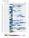
This is the ICON-ensemble for Atlanta. Lots of members showing precip during the day Friday. Not sure on ptype but gives temps in the 30s.
Check this out.. if you go to the weather.us site and put in your location it will bring up a forecast menu that will let you select all kinds of different stuff... forecast XL will break down the model output and type of weather PER model that you select
Hard to explain but it's pretty awesome of a site when drilled down that deep into it
Yeah they have a lot of nice tools. Seems like a lot is missing too though like icon ensemble display maps, GEFS map capabilities, etc.Check this out.. if you go to the weather.us site and put in your location it will bring up a forecast menu that will let you select all kinds of different stuff... forecast XL will break down the model output and type of weather PER model that you select
Hard to explain but it's pretty awesome of a site when drilled down that deep into it
Last edited:
accu35
Member
Anyone have the CMC? TT doesn’t have it
Well….. wow if that is right! Anyone from FFC post in here? Just curious. PM me please
With the wide spread in these models, one thing is for sure… local mets and the staffs at the NWS Field Offices in the Carolinas are gonna earn their pay this week. This is gonna be a deal where they are just gonna have to rely heavily on upstream observations to get a feel of the end result
NBAcentel
Member
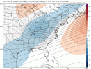
What does it shows?12z > 18z CMC run to run change View attachment 107473
CMC is holding the energy back less.What does it shows?
Looks like it brings that Southern energy in a little more (better for a storm)What does it shows?
Can someone explain what a meso high is and if it's more conducive to form where there is a higher snow pack? Also, can this allow more IP vs. ZR if it forms? The Euro puts a high in VA which would be the location I would expect to see such a feature.
View attachment 107461
Bump
Following
Sent from my iPhone using Tapatalk
NBAcentel
Member
GFS is gonna fold I can smell it from a mile away, I’m almost convinced the Carolinas/lower MA/other parts of the SE is gonna see a winter storm
iGRXY
Member
I still say this trends to an 85 special for snow and I20 for ice.GFS is gonna fold I can smell it from a mile away, I’m almost convinced the Carolinas/lower MA/other parts of the SE is gonna see a winter storm
Snownut
Member
I agree those southern sliders like that almost Always trends to thatI still say this trends to an 85 special for snow and I20 for ice.
Sent from my SM-A526U using Tapatalk
SnowNiner
Member
All the foreign models show big events…KMA was a big hit. GFS going to fold soon…?
View attachment 107474
GFS is gonna fold I can smell it from a mile away, I’m almost convinced the Carolinas/lower MA/other parts of the SE is gonna see a winter storm
Well, this is Merica. Im going with the Ford F150 of weather models. lol. I'm going to go againt the grain here. GFS was the first to see amplification of the yesterday's storm, and the gfs ensembles really don't see much of anything yet. And the phase and timing of the Euro is very hard for me to believe. I'm going to lean toward a cold whiff until the gefs beefs up.
It always folds. Lose count of the times its by itself against rest of world. Last storms Western KY runs day 3-5 range prime example.GFS is gonna fold I can smell it from a mile away, I’m almost convinced the Carolinas/lower MA/other parts of the SE is gonna see a winter storm
BHS1975
Member
It always folds. Lose count of the times its by itself against rest of world. Last storms Western KY runs day 3-5 range prime example.
Yeap Euro still king.
Sent from my iPhone using Tapatalk
BHS1975
Member
Well, this is Merica. Im going with the Ford F150 of weather models. lol. I'm going to go againt the grain here. GFS was the first to see amplification of the yesterday's storm, and the gfs ensembles really don't see much of anything yet. And the phase and timing of the Euro is very hard for me to believe. I'm going to lean toward a cold whiff until the gefs beefs up.
More like the Ford Fiesta.
Sent from my iPhone using Tapatalk
Showmeyourtds
Member
I don't work for FFC, but I may or may not have stayed in a Holiday Inn Express last night.Well….. wow if that is right! Anyone from FFC post in here? Just curious. PM me please
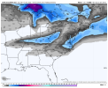
The FRZ RN depiction on pivotal almost maxed out the color scale with some amounts approaching 2 inches. Does that even seem like a realistic outcome down that way?
Bruh, were you here like 5 days ago? lolIt always folds. Lose count of the times its by itself against rest of world. Last storms Western KY runs day 3-5 range prime example.

