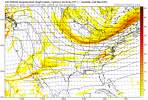
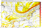
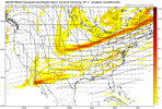
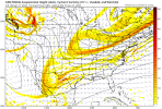
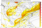
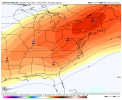
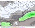
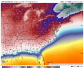
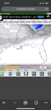
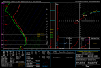
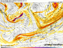
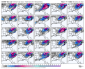
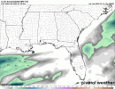
Not the front but any wave that forms along that arctic front after it passes, timing still debatable at the moment.So Thursday front could be the one? Seems that way
-
Hello, please take a minute to check out our awesome content, contributed by the wonderful members of our community. We hope you'll add your own thoughts and opinions by making a free account!
You are using an out of date browser. It may not display this or other websites correctly.
You should upgrade or use an alternative browser.
You should upgrade or use an alternative browser.
Wintry 1/20 - 1/23 Winter Storm
- Thread starter packfan98
- Start date
accu35
Member
So it’s not from the tail end of that Thursday front? Trying to understandNo, what happens after that front on Thursday is from something else.
brendan123
Member
This just shows how we can potentially really score when we have real cold air to work with... pretty sure the last time the cold air/moisture lined up as well as this appears to be doing was January 2018
GeorgiaGirl
Member
So it’s not from the tail end of that Thursday front? Trying to understand

The piece to the west is the energy of interest and precip develops from it as it interacts with the northern piece of energy.
OMG y'all..... already arguing semantics in here. It's an arctic front that passes and wave(s) of low pressure try to form and move along it. They all play a role, it's mostly the wave that forms on the front that generates the potential winter storm
Bet there will be a few big dogs ? on the ensembles for the Raleigh area
Yep and you're right about the fropa not likely to deliver any snow. That will just be some cold rain but not much of that I suspect.OMG y'all..... already arguing semantics in here. It's an arctic front that passes and wave(s) of low pressure try to form and move along it. They all play a role, it's mostly the wave that forms on the front that generates the potential winter storm
Off of the Env Canada Website maps, it looks like the CMC is definitely not holding the wave back.
Edit: I'm looking at yesterday's 00z.
Edit: I'm looking at yesterday's 00z.
10-4 lol that wasn't really directed at you, just trying to keep that argument from snowballing and derailing the thread. Things can spiral out of control so fast hahaYep and you're right about the fropa not likely to deliver any snow. That will just be some cold rain but not much of that I suspect.
accu35
Member
accu35
Member
Hypsometric
Member
accu35
Member
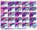
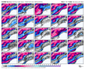
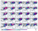
Some big members on the 0z
snowlover91
Member

@accu35 to clear things up; there are multiple pieces of energy and the evolution of each is hard to pinpoint. There are some lighter events, then some bigger ones, especially when two pieces are phasing together.
What we are looking at to happen first is a strong cold front.. (Arctic) to push through and lay down some cold to allow the other pieces of energy to be able to ride along it and generate precipitation that gets thrown into the cold air; and we are also looking at a bigger deal a little down the road.
So the Arctic front itself, likely won't produce much of anything Wintry. It's what is going to ride along it, after it passes, that is.
accu35
Member
Thank you very much.@accu35 to clear things up; there are multiple pieces of energy and the evolution of each is hard to pinpoint. There are some lighter events, then some bigger ones, especially when two pieces are phasing together.
What we are looking at to happen first is a strong cold front.. (Arctic) to push through and lay down some cold to allow the other pieces of energy to be able to ride along it and generate precipitation that gets thrown into the cold air; and we are also looking at a bigger deal a little down the road.
So the Arctic front itself, likely won't produce much of anything Wintry. It's what is going to ride along it, after it passes, that is.
NBAcentel
Member
Some big hits on the GEFS .. sheesh
accu35
Member
Brad knows it’s cooking. GFS and CMC on board, let’s get the EURO tonight as we get inside 100hrs.
mydoortotheworld
Member
God this reminds me so much of 1/28/14 for ATL. Days in advance it looked like mostly a central GA storm, and within 2 days we had a legit threat on our hands. Not to mention the cold that will be setting the stage for this
Hypsometric
Member
UKMET is a nice coastal hit.
UKMET:


Giddy up!


Cary_Snow95
Member
These are substantial trends at hour 102
Snowflowxxl
Member
UKMET was way too far south with our system for this past weekend at this range fwiw
Better than a cold rain,but yeah this somewhat sucks. I would pefer pure snow,espically since our areas haven't had a snow event since 2014.
- Joined
- Jan 23, 2021
- Messages
- 4,602
- Reaction score
- 15,197
- Location
- Lebanon Township, Durham County NC
Canadian probably would’ve had a snow footprint like 1/2002
They are all gonna trend to member 36 on the gefs. Its turning out to be our year, why not.
Still too early for those west trends to occur. Models around this timeframe still have a eastern bias. Watch the Mountains/upstate SC/Central/Northern VA jackpot with this storm,while we are dealing with freezing rain/sleet as we get closer to go time.Giddy up!


