• Hello, please take a minute to check out our awesome content, contributed by the wonderful members of our community. We hope you'll add your own thoughts and opinions by making a free account!

Wintry 1/20 - 1/23 Winter Storm

Still moderate differences between GFS/Euro...normally I would say Euro is probably more right but it's really sucked lately. This is just over 2 days away.

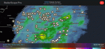
View attachment 108219

Blend it and watch central and eastern NC get the best storm they have had in a decade....RDU to Goldsboro then over to Rocky Mount down to Wilson and hopefully Greenville and NE from there look like the best chance at seeing a legit 8-12" type event....I flirt with the 0C 850 line but with good rates I will take a 60/40 Sn/IP mix at the height of the storm....average around 1.4" QPF with decent ratios 10:1-15:1 this is going to nail someone....probably somewhere like Ahoskie down the Edenton gonna jackpot.
 
Last edited:
I think these icing amounts are way overdone along and east of US 17. Surface temps at the time will be 30-34 which is not great for ice accrual. Additionally, with a Miller A setup, we expect to see a much narrower corridor of ice. And going by our most recent history with the storm last week, the ice was way over modeled and more plain rain or sleet fell instead.
 
Nice to see a met that actually lives in my CWA.....I have been in Greenville all my life ( 50 yrs ) so I have been down this road many times.....its the old need some phasing to get the QPF up but you play with that 850 warm nose though I am willing to mix pingers during the height of the storm to get 1.5" QPF as mostly snow. This starting to remind me a bit of Dec 2000 where the same general thing happened I mean I am not that scared of 0C at 850 if we had good rates....anyway post more :)
Right its tough but what we need to get a good snow, especially down here at the coast, is a low track well offshore which screws over everyone else on this board. There is much more leeway with the low track for the Greenville area and I think yall have a good shot of getting a pretty good snow out of this.
 
Right its tough but what we need to get a good snow, especially down here at the coast, is a low track well offshore which screws over everyone else on this board. There is much more leeway with the low track for the Greenville area and I think yall have a good shot of getting a pretty good snow out of this.

Yeah the ice potential some of these models are spitting out even all the way to the coast is alarming really....I mean you got to believe these 1.3-1.5" ZR totals are wrong cause I have never seen anything even close to that around here actually pan out but even half of that is gonna raise hell on power lines and limbs, heck entire trees.....
 
These charts never tell the whole story. Who cares what it got right over Kazakhstan. It's been an abomination with this system and should be ashamed of itself. King my bleep per brick
But that is not how science works dude. Anecdotal evidence does not outweigh statistics. Not trying to be a smart ass, I’m just saying.
 
But that is not how science works dude.
Yeah I getcha but it's how application works. If it whiffs on every winter storm, then it what difference does it make it it has an accuracy rating of 99.9, especially if another model seems to be doing better in that particular scenario? Currently, the Euro is 0-2 (assuming the current system doesn't amp way up).

Edit: And I hear what you're saying. I give it a hard time, but I do believe there are situations when it is a better tool than others. It used to be the gold standard with winter storms. It's not like that anymore, for whatever reason.

I'm a firm believer that as global model resolution increases, any early forecast errors across the globe, can compound and totally botch forecasts, especially on the mesoscale level. When we look at verification scores, we are only seeing a small slice of the pie. Overall, the Euro is better at h500 than other globals lately, it doesn't mean it's any good when it comes down to details in a specific region. It just does well with the heights, in this example, across the globe versus the others.

Don't get me wrong, h500 is one of the most important elements.. but again.. any errors with higher resolution seem to compound and cause big swings in it's forecasts of sensible weather and this is not limited to any specific model.
 
Intresting ... Light precip, but training over the same area with sub freezing temps will lead to some accumulations Aka for example January 2014. Birmingham snowmageddon. Very interested. A precip shield/train is still plausible for Alabama. Screenshot_20220119-071252-775.pngScreenshot_20220119-071139-843.png
 
Yeah the ice potential some of these models are spitting out even all the way to the coast is alarming really....I mean you got to believe these 1.3-1.5" ZR totals are wrong cause I have never seen anything even close to that around here actually pan out but even half of that is gonna raise hell on power lines and limbs, heck entire trees.....
Yeah it's looking quite ugly for NE South Carolina and SE North Carolina. The hope is that more sleet gets mixed in for those areas to prevent a catastrophic ice storm from happenning(kind of what happened this past weekend for Central/western Pidmont areas of North Carolina or what happened for the Central and northern Midlands of South Carolina back in 2014). We need to watch the trends over the next 24 hours to see if more sleet gets involed.
 
6z NAM Bufkit data for RDU:

----------------------------------------------+----++-----+-------------++--------------++-------------++-----------+---+---
220121/1900Z 61 02009KT 26.0F 0:1| 0.0|| 0.00|| 0.00|| 0.000 0:1| 0.0|| 0.00|| 0.00|| 0.00 0| 0| 0
220121/2000Z 62 02009KT 25.4F 0:1| 0.0|| 0.00|| 0.00|| 0.000 0:1| 0.0|| 0.00|| 0.00|| 0.00 0| 0| 0
220121/2100Z 63 01009KT 24.7F SNOW 11:1| 0.1|| 0.00|| 0.00|| 0.009 11:1| 0.1|| 0.00|| 0.00|| 0.01 100| 0| 0
220121/2200Z 64 02009KT 24.7F SNOW 11:1| 0.1|| 0.00|| 0.00|| 0.013 11:1| 0.2|| 0.00|| 0.00|| 0.02 100| 0| 0
220121/2300Z 65 02009KT 24.5F SNOW 9:1| 0.2|| 0.00|| 0.00|| 0.018 10:1| 0.4|| 0.00|| 0.00|| 0.04 100| 0| 0
220122/0000Z 66 02009KT 24.2F SNOW 14:1| 0.3|| 0.00|| 0.00|| 0.024 12:1| 0.7|| 0.00|| 0.00|| 0.06 100| 0| 0
----------------------------------------------+----++-----+-------------++--------------++-------------++-----------+---+---
220122/0100Z 67 03008KT 23.8F SNOW 12:1| 0.3|| 0.00|| 0.00|| 0.028 12:1| 1.1|| 0.00|| 0.00|| 0.09 100| 0| 0
220122/0200Z 68 03009KT 23.6F SNOW 15:1| 0.3|| 0.00|| 0.00|| 0.022 13:1| 1.4|| 0.00|| 0.00|| 0.11 100| 0| 0
220122/0300Z 69 01009KT 23.4F SNOW 13:1| 0.2|| 0.00|| 0.00|| 0.018 13:1| 1.7|| 0.00|| 0.00|| 0.13 100| 0| 0
220122/0400Z 70 01010KT 23.1F SNOW 12:1| 0.4|| 0.00|| 0.00|| 0.038 12:1| 2.1|| 0.00|| 0.00|| 0.17 100| 0| 0
220122/0500Z 71 01010KT 22.5F SNOW 12:1| 0.5|| 0.00|| 0.00|| 0.041 12:1| 2.6|| 0.00|| 0.00|| 0.21 100| 0| 0
220122/0600Z 72 01011KT 22.0F SNOW 11:1| 0.6|| 0.00|| 0.00|| 0.055 12:1| 3.2|| 0.00|| 0.00|| 0.27 100| 0| 0
----------------------------------------------+----++-----+-------------++--------------++-------------++-----------+---+---
220122/0700Z 73 01010KT 21.8F SNOW 10:1| 0.8|| 0.00|| 0.00|| 0.074 12:1| 3.9|| 0.00|| 0.00|| 0.34 100| 0| 0
220122/0800Z 74 01009KT 21.6F SNOW 13:1| 1.2|| 0.00|| 0.00|| 0.091 12:1| 5.1|| 0.00|| 0.00|| 0.43 100| 0| 0
220122/0900Z 75 01010KT 21.3F SNOW 14:1| 1.4|| 0.00|| 0.00|| 0.098 12:1| 6.5|| 0.00|| 0.00|| 0.53 100| 0| 0
220122/1000Z 76 01010KT 21.3F SNOW 18:1| 1.2|| 0.00|| 0.00|| 0.065 13:1| 7.8|| 0.00|| 0.00|| 0.59 100| 0| 0
220122/1100Z 77 01009KT 21.1F SNOW 15:1| 0.8|| 0.00|| 0.00|| 0.055 13:1| 8.6|| 0.00|| 0.00|| 0.65 100| 0| 0
220122/1200Z 78 01009KT 21.1F SNOW 13:1| 0.5|| 0.00|| 0.00|| 0.038 13:1| 9.1|| 0.00|| 0.00|| 0.69 100| 0| 0
----------------------------------------------+----++-----+-------------++--------------++-------------++-----------+---+---
220122/1300Z 79 01009KT 21.3F SNOW 17:1| 0.4|| 0.00|| 0.00|| 0.023 13:1| 9.5|| 0.00|| 0.00|| 0.71 100| 0| 0
220122/1400Z 80 01009KT 22.4F SNOW 8:1| 0.0|| 0.00|| 0.00|| 0.005 13:1| 9.5|| 0.00|| 0.00|| 0.71 100| 0| 0
220122/1500Z 81 01009KT 23.8F 0:1| 0.0|| 0.00|| 0.00|| 0.000 13:1| 9.5|| 0.00|| 0.00|| 0.71 0| 0| 0
220122/1600Z 82 01008KT 27.6F 0:1| 0.0|| 0.00|| 0.00|| 0.000 13:1| 9.5|| 0.00|| 0.00|| 0.71 0| 0| 0
220122/1700Z 83 36008KT 30.1F 0:1| 0.0|| 0.00|| 0.00|| 0.000 13:1| 9.5|| 0.00|| 0.00|| 0.71 0| 0| 0
220122/1800Z 84 36007KT 31.4F 0:1| 0.0|| 0.00|| 0.00|| 0.000 13:1| 9.5|| 0.00|| 0.00|| 0.71 0| 0| 0
==========================================================================================================================
 
Yeah I getcha but it's how application works. If it whiffs on every winter storm, then it what difference does it make it it has an accuracy rating of 99.9, especially if another model seems to be doing better in that particular scenario? Currently, the Euro is 0-2 (assuming the current system doesn't amp way up).

Edit: And I hear what you're saying. I give it a hard time, but I do believe there are situations when it is a better tool than others. It used to be the gold standard with winter storms. It's not like that anymore, for whatever reason.
Euro nailed my location for this past weekend's system when the GFS was out in left field. We should wait to see what verifies this weekend before deciding which model got it right.
 
The northern stream digging more is just such a fantastic trend. I think that if you're scratching your head about this (hey, I thought a stronger, more amplified shortwave would be warmer!" it's completely understandable because that's how most of our events work. Last weeks system was a pretty good example of this- we're pretty used to amplification of our shortwaves causing more warm air advection and the system to achieve negative tilt sooner. However, the location matters- last week's amplification trend took place around arklatex- so yeah, it makes sense as that trough got stronger, the ridging ahead would also get stronger.

For this system, as the northern stream gets stronger, it's digging much further south, and generally depressing heights for the wholesale region because of how much more it is digging. I think that's why snow totals have actually ticked SE over the last cycle. Sure, as this feature gets stronger, the processes like WAA get stronger as well. The southward shift is doing a good enough job to shunt these forces southward a well. The northern stream shortwave as it turns out did detach from a much colder longwave trough, so it makes sense that as it digs southward, that chilly arctic air hangs on a little longer.

(BTW, in case anyone is wondering why an account with like 20 posts over 4 years is now writing a dissertation on phasing, I've lurked here for a while. I originally got on here to troll a friend of mind who now happens to be banned. But I still stay on because I enjoy the expert GIF makers on here and the pay graphics that get posted. I'm typically more active on American under the name "ILMRoss")
 
Back
Top