• Hello, please take a minute to check out our awesome content, contributed by the wonderful members of our community. We hope you'll add your own thoughts and opinions by making a free account!

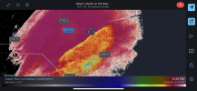
Wintry 1/20 - 1/23 Winter Storm

6236f56c0ecb52129c8cc59791727707.jpg


Sent from my iPhone using Tapatalk
 
I don't normally post much but this is shaping up to be a significant event for eastern NC

For those of us on the immediate coast, we are right on the edge of a significant icing event. Right now it looks like our temps will be 31-33 for most of the event which would limit icing. Of course if the track of the low shifts farther offshore, we could get some colder air at the surface which would increase our risk of damaging freezing rain. I don't really see a scenario where we can get the low to shift far enough offshore to give us significant snow accumulations, but I cant rule out an inch as the event ends Sat morning.

Along the US 17 corridor from Jacksonville up through New Bern, Washington, and into northeastern NC I think sleet will be the main p-type but also mix with freezing rain at times and snow possible early Sat morning. Best guess for accumulations in this area is 1-3 inches of snow/sleet and around 0.1 inches ice.

Farther inland from Kinston to Greenville back to I-95, we have the best chance of accumulating snow but even here I think sleet will mix in at times. If the warm nose is not as strong as modeled, I could see 6 inches somewhere in this region but more likely to see 2-4 inches of accumulations.

While I think models have come into pretty fair agreement on the current scenario, there is still potential for some changes in the coming days. Who knows, maybe the UKMET will lead the way and we can all have a bunch of snow here in eastern NC, but its just as likely that we will see a northwest shift at this point. It will be fascinating to see how this all plays out.
 
Thanks. The sleet maps were totally wrong on the last system for me. I had 2.5" of sleet and very little freezing rain. I hope that's the case for those in the SE regions this time as well. I'll be interested in seeing what the next couple of Nam runs say. They were the most aggressive with the sleet depictions yesterday.
 
I don't normally post much but this is shaping up to be a significant event for eastern NC

For those of us on the immediate coast, we are right on the edge of a significant icing event. Right now it looks like our temps will be 31-33 for most of the event which would limit icing. Of course if the track of the low shifts farther offshore, we could get some colder air at the surface which would increase our risk of damaging freezing rain. I don't really see a scenario where we can get the low to shift far enough offshore to give us significant snow accumulations, but I cant rule out an inch as the event ends Sat morning.

Along the US 17 corridor from Jacksonville up through New Bern, Washington, and into northeastern NC I think sleet will be the main p-type but also mix with freezing rain at times and snow possible early Sat morning. Best guess for accumulations in this area is 1-3 inches of snow/sleet and around 0.1 inches ice.

Farther inland from Kinston to Greenville back to I-95, we have the best chance of accumulating snow but even here I think sleet will mix in at times. If the warm nose is not as strong as modeled, I could see 6 inches somewhere in this region but more likely to see 2-4 inches of accumulations.

While I think models have come into pretty fair agreement on the current scenario, there is still potential for some changes in the coming days. Who knows, maybe the UKMET will lead the way and we can all have a bunch of snow here in eastern NC, but its just as likely that we will see a northwest shift at this point. It will be fascinating to see how this all plays out.

Nice to see a met that actually lives in my CWA.....I have been in Greenville all my life ( 50 yrs ) so I have been down this road many times.....its the old need some phasing to get the QPF up but you play with that 850 warm nose though I am willing to mix pingers during the height of the storm to get 1.5" QPF as mostly snow. This starting to remind me a bit of Dec 2000 where the same general thing happened I mean I am not that scared of 0C at 850 if we had good rates....anyway post more :)
 
Back
Top