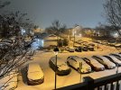
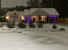
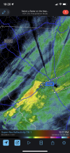
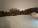
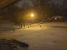
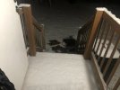
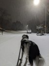
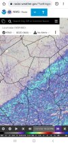
Are the flakes any biggerdayummmmm it’s pouring here, the radar is really cranking now. Accums really piling up now.
-
Hello, please take a minute to check out our awesome content, contributed by the wonderful members of our community. We hope you'll add your own thoughts and opinions by making a free account!
You are using an out of date browser. It may not display this or other websites correctly.
You should upgrade or use an alternative browser.
You should upgrade or use an alternative browser.
Wintry 1/20 - 1/23 Winter Storm
- Thread starter packfan98
- Start date
Just got back from my extensive Jeb Walk. Gotta be closing in on an inch at this point, I’d estimate. Or at least close to it.
Maybe so, but its not like these are big cities. Weird for sure.Really… I’m like wtf is going on? Is it some type of heat island effect or something? Sheesh!
Sent from my iPhone using Tapatalk
Cary_Snow95
Member
I think 3” is pretty easily reached in Cary given current radar. At 1” now. Solid 4-5 hours left
PDubRDU
Member
1.5” now, .5”/hr rates and still ripping!!
When was the last time you saw this much snow?
whatalife
Moderator
Over 1" now. Getting obliterated with large, destructive tiny flakes. What a night!
Past an inch in grassy areas
Heelyes
Member
Almost a inch and pouring, 4wd low in effect
Sctvman
Member
Swansea seems to be the cutoff so far from snow to the sleet/freezing rain mix heading south from Columbia. Everywhere north of Swansea is in the snow.
NBAcentel
Member
Really hoping we get in on the bigger flake action
OGlaze forming on the trees..
Enjoy! that looks like fun, you guys deserve a good snow. From the radar it looks like the heaviest bands are south, just above the transition zone, likely where there is the best lift.Come to papa!View attachment 109480
Seems like it might be picking up more now. Hard to judge visibility at night, though. Tempted to fire up the WRX and do some snow driving but that’s probably a bad idea lol.
L
Logan Is An Idiot 02
Guest
Just passed an inch here in southeast Mooresville
Sent from my iPhone using Tapatalk
Sent from my iPhone using Tapatalk
Don’t bigger flakes often mean lesser ratios? Or is my understanding mistaken?Really hoping we get in on the bigger flake action
that band is gonna be glory!Come to papa!View attachment 109480
Yeah it's about the same here. Small flakes but very dense. Hopefully, it will intensity for a while.It really is. Honestly, it’s very similar to January 2003… it’ll be interesting to see what the ratios will be. I just went out with my son and even the flakes are still strong, it’s a legitimately heavy snow right… visibility is probably .25 miles. Anything that is in the trees blows out when a little breeze picks up… closing in on 1” right now and the radar and obs looks really good to my west and southwest.
SimeonNC
Member
Snow rates are really picking up here, damn lol.
Jlaw0097
Member
Radar really lighting up west of Raleigh
We are easily at or just pass the 1 inch mark. All blades of grass that had reappered from the melt almost fully covered again. Stuff is not going to waste, freezing outside in the wind. Flakes are as numerous and biggest theyve been all night last 5 mins or so. Moderate snow
D
Deleted member 609
Guest
Wooo inch now. Roads covered.
LickWx
Member
So , seems like Charlotte places to the west may overperform while here probably is right around forecast . Easy 4-5 inches here by morning perhaps here.
ok PDU, unless you're a Pirate like me the purple is overdoing it.View attachment 109477
Puking Domino Sugar. 22 degrees.
GarnerNC
Member
The GFS is looking pretty good right now, too. Had a wide swath of snow across the Piedmont that seems to be lining up well with reality right now. The RGEM, of course, as well.So , seems like Charlotte places to the west may overperform while here probably is right around forecast . Easy 4-5 inches here by morning perhaps here.
Cary_Snow95
Member
Really nice band setting up near asheboro
Any chance Jacksonville sees a final band of snow accumulating to wrap things up tomorrow morning? Its been just sleet and freezing rain here so far.
EastNC
Member
PDubRDU
Member
I’m gay, so I have an excuse . ?ok PDU, unless you're a Pirate like me the purple is overdoing it.
24.1/20 Light snow still falling in Lewisville (west of Winston). It looks like we're approaching 1/2" of accumulation and it might end soon based on radar. Congrats to those to the east seeing bigger flakes and totals. ?
And fun was had by all; happy sledding tomorrow!
And fun was had by all; happy sledding tomorrow!
Just got back taking dog out. Have no idea how much--maybe almost 1''. But the stuff is just blowing around everywhere. I disturbed the grass with footprints, but with this type of snow, I know I won't see those prints in the morning.
You know some dogs love snow? Well, my beagle/dachsund mix hates it, so I let her back in after a minute. She's a good dog in all other respects, but she's a drama queen when it comes to cold weather. She can't stand it. I walked around outside taking it all in for a few minutes while she stared at me through the door wondering what on earth had gotten into me.
Nice pics ya'll--I'll try to take some in the morning.
Sctvman
Member
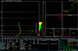
Wow not much room to spare with the warm noseView attachment 109487
Sounding from our balloon launch

