D
-
Hello, please take a minute to check out our awesome content, contributed by the wonderful members of our community. We hope you'll add your own thoughts and opinions by making a free account!
You are using an out of date browser. It may not display this or other websites correctly.
You should upgrade or use an alternative browser.
You should upgrade or use an alternative browser.
Wintry 1/20 - 1/23 Winter Storm
- Thread starter packfan98
- Start date
Cary_Snow95
Member
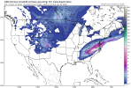
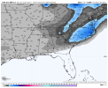
Cmc depicts moderate snow across nc with temps in the low 20s
Ok, nobody change a thing for the next144 hours.
Thx,
Mgmt
Well, for the Canadian anyway.Ok, nobody change a thing for the next144 hours.
Thx,
Mgmt
accu35
Member
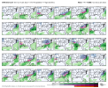
Some really good Gefs members on Friday/Saturday storm
Do they appear colder overall?Some really good Gefs members on Friday/Saturday storm
- Joined
- Jan 5, 2017
- Messages
- 3,774
- Reaction score
- 5,985
I don't like being in the bullseye at 144 hours. It will likely trend north.Ok, nobody change a thing for the next144 hours.
Thx,
Mgmt
ukie a whiff
Also since the snow map doesn’t show it, the 12Z CMC has for the GA/SC coasts close to 1” liquid equivalent of a mix of ZR and IP (likely mainly ZR that transitions to mainly IP as the 850s drop) to maybe some snow near the end. That would be the worst here in 100 years almost to the exact day amazingly enough. The fact that various models/runs/ensemble members keep showing this sort of thing is a legit concern for me as a power outage from that would be very difficult to handle considering the cold during and after and having a bro to take care of. I wonder if I should consider buying a generator just in case before any potential later mad rush. I could always return it quickly it if I end up not needing it.
I’ll hope for either the common northwest trend that would make it liquid or a rare slightly southeast trend that would make it mainly sleet and snow.
Huge nod to the GFS with holding the wave in the SW.ukie a whiff
Cary_Snow95
Member
If it holds back in 72 hours it’s game over for wave 1
pcbjr
Member
Larry,Also since the snow map doesn’t show it, the 12Z CMC has for the GA/SC coasts close to 1” liquid equivalent of a mix of ZR and IP (likely mainly ZR that transitions to mainly IP as the 850s drop) to maybe some snow near the end. That would be the worst here in 100 years almost to the exact day amazingly enough. The fact that various models/runs/ensemble members keep showing this sort of thing is a legit concern for me as a power outage from that would be very difficult to handle considering the cold during and after and having a bro to take care of. I wonder if I should consider buying a generator just in case before any potential later mad rush. I could always return it quickly it if I end up not needing it.
I’ll hope for either the common northwest trend that would make it liquid or a rare slightly southeast trend that would make it mainly sleet and snow.
In all sincerity, it's a week out and you as well as anyone know how models are at that range; it seems like a waste of time to go buy something now; give it 3 days and see how things are looking; you know NWS wouldn't alert the public until 60 hours out ... and that's when the mad dish to Home Depot will start ... giving you ample time ... just my 2¢ worth ... Phil
All models, especially GFS, have biases of holding back energy too long
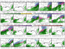
16/20 of the members on the CMCE develop a storm with wave #1.
Larry,
In all sincerity, it's a week out and you as well as anyone know how models are at that range; it seems like a waste of time to go buy something now; give it 3 days and see how things are looking; you know NWS wouldn't alert the public until 60 hours out ... and that's when the mad dish to Home Depot will start ... giving you ample time ... just my 2¢ worth ... Phil
Phil,
Thanks for your response. It actually is potentially as little as 5 days out per this and some other model runs, but I get your point about how inaccurate models often are. Maybe I’ll just call around today just to get an idea of what might be available and see if there’s a lot in stock.
By the way, 3 members (10%) of 12Z GEFS have wintry in your area and that’s just from the first wave!
Last edited:
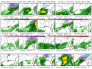
Do later frames of the 12Z GEFS show some wintry members for the SE from the 2nd wave?
GeorgiaGirl
Member
Do later frames of the 12Z GEFS show some wintry members for the SE from the 2nd wave?
I'm not going to try to pick through to see, but it did feel like to me while I was observing the GEFS that it either had the first system or the second system.
Sort of makes me feel that this will end up being a Sunday system if it happens.
ETA: 6 out of 20 had the second system.
I would say it's good to have a generator, You would definitely use it during hurricanes...Also since the snow map doesn’t show it, the 12Z CMC has for the GA/SC coasts close to 1” liquid equivalent of a mix of ZR and IP (likely mainly ZR that transitions to mainly IP as the 850s drop) to maybe some snow near the end. That would be the worst here in 100 years almost to the exact day amazingly enough. The fact that various models/runs/ensemble members keep showing this sort of thing is a legit concern for me as a power outage from that would be very difficult to handle considering the cold during and after and having a bro to take care of. I wonder if I should consider buying a generator just in case before any potential later mad rush. I could always return it quickly it if I end up not needing it.
I’ll hope for either the common northwest trend that would make it liquid or a rare slightly southeast trend that would make it mainly sleet and snow.
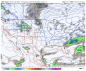
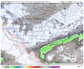
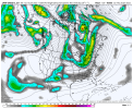
The 12z Euro looks about the same as the past two runs. The opposite of the GFS/ICON.
Edit: Actually a worse trend, but still not as bad as the GFS.
Edit: Actually a worse trend, but still not as bad as the GFS.
Much worse this run.The 12z Euro looks about the same as the past two runs. The opposite of the GFS/ICON.
Edit: Actually a worse trend, but still not as bad as the GFS.
accu35
Member
So either way there’s a storm potential sometime this weekend. My Friday forecast shows snow/rain mix
Cary_Snow95
Member
Yeah euro still moves it out but trended towards hanging it back more. Not ideal. GFS has been on fire lately and it looks to score again
accu35
Member
Wait I’m on hour 102, how are y’all ahead?
GeorgiaGirl
Member
Euro seems as if it's going to try to bury the energy in the SW?
Maybe I shouldn't have talked...perhaps that was the right solution.
Maybe I shouldn't have talked...perhaps that was the right solution.
Cary_Snow95
Member
That's where the problem occurs. Energy is digging into the southwestWait I’m on hour 102, how are y’all ahead?
Blue_Ridge_Escarpment
Member
Looks like euro likes the 2nd piece of energy better.
Cary_Snow95
Member
Man what a terrible trend that completely screws that storm. GFS folded at 18z yesterday only to bring it back 6 hours later. Sometimes the models troll us so well
I think swing and miss for Thur/FRI.....but more energy coming down the plains...lets see if it digs all of this out. 1040mb High up north so thats good.
In first with "Euro bias hangs energy back in the SW".
Cary_Snow95
Member
But the trend that screws the whole run is only 78/84 hours outShould have noted…Op euro probably a blessing. Last thing we want is some big bomb at day 5-6.
Cary_Snow95
Member

