• Hello, please take a minute to check out our awesome content, contributed by the wonderful members of our community. We hope you'll add your own thoughts and opinions by making a free account!

Wintry 1/20 - 1/23 Winter Storm

To be fair, North Carolina doesn't have a large enough sample size of modeled storms like this to judge.
I'm just going off of memory, so yeah it's anecdotal.

Can you recall a storm that ended up producing major totals over most of SC and NC that you followed that ended up as modeled 7-10 days before the event? I can't. Maybe the Christmas storm? But I'm not sure that counts. And it certainly went away for a while.
I swear I want to say 2004 and also maybe 2010.
 
I'm just going off of memory, so yeah it's anecdotal.

Can you recall a storm that ended up producing major totals over most of SC and NC that you followed that ended up as modeled 7-10 days before the event? I can't. Maybe the Christmas storm? But I'm not sure that counts. And it certainly went away for a while.
December 2018 comes to mind as that stayed consistent very far out. However, I know a lot of people didn't get as much as they wanted with it.
 
To be fair, North Carolina doesn't have a large enough sample size of modeled storms like this to judge.
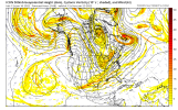
The unique component is the arctic front draped off the SE Coast as the wave dives down. We are normally fighting and clawing to find cold air, but the cold air is in place as long as the wave doesn't cut. The one it reminds me of the most from a success standpoint is the Dec 1989 storm. Same thing, positive tilt wave dives down to the SE and just barely has the room to get the storm going along the coast. The GFS just sharpened up the wave more in this case compared to that one
 
I swear I want to say 2004 and also maybe 2010.
There was a storm in late January of I think 2010 that all guidance picked up in around D5 and never let go of. But it wasn’t as significant as this one is being modeled to be.
 
I believe yall are in good shape guys unless something outrageous happens. Perhaps a little more west with trough but other than that, looks good
 
I'm just going off of memory, so yeah it's anecdotal.

Can you recall a storm that ended up producing major totals over most of SC and NC that you followed that ended up as modeled 7-10 days before the event? I can't. Maybe the Christmas storm? But I'm not sure that counts. And it certainly went away for a while.
Feb 2014 was like that I think?
 
The unique component is the arctic front draped off the SE Coast as the wave dives down. We are normally fighting and clawing to find cold air, but the cold air is in place as long as the wave doesn't cut. The one it reminds me of the most from a success standpoint is the Dec 1989 storm. Same thing, positive tilt wave dives down to the SE and just barely has the room to get the storm going along the coast. The GFS just sharpened up the wave more in this case compared to that one
That's a good point about the arctic front coming through. I remember several times throughout the 80s where the front came through and a wave developed along it and produced snow. I wasn't paying attention to synoptics then.

Now we often see fronts clear the area in the medium range and overrunning, but as we close in, the front doesn't quite make it through and we get rain or slop. No SER in play this time, so maybe it will actually push through the area. That's the entire ballgame here. The height field in the east HAS to be as suppressed as the models are indicating now. Otherwise, it will be the same old same old.
 
I can't recall a time where we saw this vigorous a system modeled with this track/evolution and these widespread snowfall amounts that ever worked out. It almost always runs inland by D0. Maybe the December 2000 storm is an exception...only it went the other way, which was because of a missed phase. The fact that the GFS went from nada to it's current solution is a red flag.

The patten is supportive of wintry weather, however, and I'm glad we have something to track. What I'd like to see is the models lose it to the east for a few days and then inevitably come back.

Yeah I mean its pretty much a crap shoot, though I would rather have all the models more or less agree and be in the bullseye in this range than have 3 different camps with 2 screwing us and one crushing us. Bottom line is we are due eastern NC has not had a area wide big dog in 10 yrs and we average a footer every 10 yrs or so. This pattern is gonna produce for us, a couple of times I bet.

There will be some scary runs but I think we have a good chance of reeling this one in.
 
Back
Top