• Hello, please take a minute to check out our awesome content, contributed by the wonderful members of our community. We hope you'll add your own thoughts and opinions by making a free account!

Wintry 1/20 - 1/23 Winter Storm

Here's a view of how the GFS and Euro are producing a similar end result, but going about it a bit differently. GFS is farther north with the wave track, but less amplified (best seen by looking at the diff in the height lines thru NC/VA). Both work for the Raleigh to Elizabeth City corridor...but what you don't want in those areas is the GFS track with the Euro amplitude (it would be warmer). Bottom line, if the wave is more amped or has more phasing, it needs to be farther south, and ideally, farther SE.

FbUDO9y.gif
 
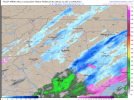
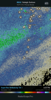
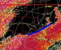
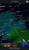
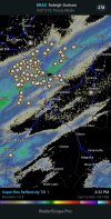
Rap starting to come in range with the Arctic front itself View attachment 108052
This Arctic front to me is a bit of a wild card in all this. Obviously cold air moving in during the precip is not typically a recipe that works here east of the mountains. This however is a deal where the cold push is coming in straight from the N and NNE.
 
This Arctic front to me is a bit of a wild card in all this. Obviously cold air moving in during the precip is not typically a recipe that works here east of the mountains. This however is a deal where the cold push is coming in straight from the N and NNE.
It definitely isn’t cold air struggling to get over the hills. Usually these fronts, when they come from this direction, can come through fast.
 
It definitely isn’t cold air struggling to get over the hills. Usually these fronts, when they come from this direction, can come through fast.
Yes I seem to remember sometime around 2014 or 2015, one of these coming in this direction and much of NC experienced a 25 degree temperature drop in a matter of a couple hours during the day. Temperatures fell from the mid to upper 50 to low to mid 30s.
 
Are there any other models that phased the streams other than the rgem? The nam looked close and better than any others I can think of. Just trying to figure out my last vestiges hope.
Those were it pretty much. But it's time to pay more attention to them than the globals at this point. If they start leaning toward the globals here shortly its going to be a short night for me. If they hold their ground I may stay up and see if the globals respond.
 
The 18z Nam and 18z RDPS where both very similar imo and also more west than the Globals at 18z. See if this happens agan tonight at 0z. The globals shear or are a little to stringy with the energy at h5
 
Yes I seem to remember sometime around 2014 or 2015, one of these coming in this direction and much of NC experienced a 25 degree temperature drop in a matter of a couple hours during the day. Temperatures fell from the mid to upper 50 to low to mid 30s.
I think that was 2015. The wind gusts during the front knocked out power
 
Back
Top