Wouldn't be surprised , with these DB's, to start seeing some light snow in this area in the next hour. 
The EURO came in low compared to the rest of the latest global and high resolution model runs I've seen this afternoon Hopefully King EURO isn't sniffing another last minute trend in the wrong direction for snow lovers. I told my stepdaughter when she called from Willow Springs last night to expect between two to three inches of snow in her location. It might be a bit conservative but I think it is a pretty safe bet. My family knows I'm a weather weenie and I get plenty of calls when something dramatic is in the air weather wise.View attachment 109187Final euro run before go time

Not his problem maybeView attachment 109203
DT really upped his totals this morning after completely giving up last night, still am confused as to why he’s saying ice won’t be a significant problem along the coast
Really confused by that being the high end potential? 2” in Durham, 3” in Raleigh? Really, as the high end??
There have already been plenty of reports of snow in NC. Don't really think it's going to be that big of an issue.Going to take a lot of moisture to saturate the column over much of NC....very dry aloft.


It's too bad we don't have a stronger system here, the temp profile is fantastic. Heck, even a repeat of the .22 I got last night would yeild 2-3 inches. You might be in a slightly better spot than I am but this one just isn't ours. Gonna be fun for the Midland to Triangle folks though; CAE definitely due.Are we gonna be in for a nice surprise? Or just some flurries.
Mostly virga around the Triangle although small line setting up just southeast that could eventually fall to the ground


Already filling in at 2pm.Column moistening up now quickly seen from tilt one here we go View attachment 109232

Curious if some of that in the S Piedmont/Sandhills might start hitting the ground. Looks somewhat robust there on radar. Will help to moisten the column in any case, which is good.Column moistening up now quickly seen from tilt one here we go View attachment 109232

Curious if some of that in the S Piedmont/Sandhills might start hitting the ground. Looks somewhat robust there on radar. Will help to moisten the column in any case, which is good.

Let the games begin
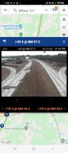
View attachment 109241
Snow report in southwest raleigh, not sure I buy it. Nothing here
Is this earlier than what was predicted? If so that might be a good sign of extra accums.officially snowing in rocky mount!!