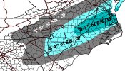
Winter storm warning has been expanded.
-
Hello, please take a minute to check out our awesome content, contributed by the wonderful members of our community. We hope you'll add your own thoughts and opinions by making a free account!
You are using an out of date browser. It may not display this or other websites correctly.
You should upgrade or use an alternative browser.
You should upgrade or use an alternative browser.
Wintry 1/20 - 1/23 Winter Storm
- Thread starter packfan98
- Start date
From NWS Raleigh
.NEAR TERM /THROUGH TONIGHT/...
As of 1135 AM Friday...
Update: After evaluation of new guidance, have expanded the winter storm warning westward, with the warning now running roughly along and southeast of a Rockingham-Raleigh-Roanoke Rapids line. New high res guidance is suggestive of a band of heavier snow potential across the Sandhills into the central/NE Coastal Plain and far SE Piedmont, with the focus still on 7p-3a time frame. -GIH
No advisory for Davidson and Guilford is interesting.Winter storm warning has been expanded.
NBAcentel
Member
D
Deleted member 609
Guest
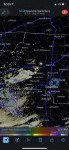
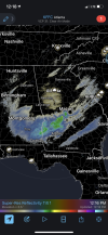
What time you think the precip starts in Charlotte area. 5?Here we goView attachment 109159
iGRXY
Member
HRRR continuing to initialize too dry down along the gulf coast and in the gulf.
This is showing up way sooner than any models I saw. With these temperatures, it’s not going to take much to start seeing some problems… very suprised that GSP hasn’t backed that WWA westwardHere we goView attachment 109159
BHS1975
Member
Here we goView attachment 109159
How do you get the more sensative mode? Used to be pro mode on my iPhone.
Sent from my iPhone using Tapatalk
FamouslyHot
Member
We see this happen with almost every system where the front edge of precip arrives earlier than expected, but typically it doesn't make too much of a difference in final totals. However, with temps so cold I think we could see meaningful accumulations from this before the main event gets started!
But....as @Myfrotho704_ pointed out the leeside (or not?) is starting to pop streamers right now
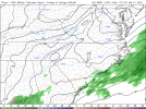
-- thoughts....he's also honkin' a bit?View attachment 109166
Ron Burgundy
Member
I don’t get this. I thought the whole purpose of that model is to ingest what’s actually happening into its next update?HRRR continuing to initialize too dry down along the gulf coast and in the gulf.
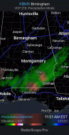
Radar returns deepening near Columbia,SC of all places who wants winter weather there
Sctvman
Member
NBAcentel
Member
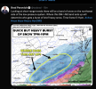
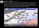
With as temps air and soil, as cold as they are I have to imagine that he's still downplaying accumulations a good bit. With that in-house model, it's pretty much snowing from 4-10. That's a solid 6 hours of what appears to be moderate and maybe some heavy snow. With ratios looking great, I'd imagine at least a good couple of inches for Charlotte. At least he is mentioning the dangers of the snow on the roads, so people aren't caught off guard.Yup...this is a honk from -- and the piedmontView attachment 109168
DirtyDeez77
Member
Im sorry, but what does this mean?Radar returns deepening near Columbia,SC of all places who wants winter weather there
BHS1975
Member
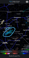
The hrrr already looks juiced and it’s still initializing to low with precip View attachment 109171View attachment 109172
How do you get the light precip to show up?
Sent from my iPhone using Tapatalk
NBAcentel
Member
Ron Burgundy
Member
Brad P upped snow amounts 1-2”Charlotte. Lol will he make us mind how many times has he changed his snow map? Just call for light accumulations imo!
From you to me...I'm guessing he goes with 1-3 CLT metro/Trace-1 Shelby west/ 2-4 Southeast CLT
Forevertothee
Member
GSP
NEAR TERM /THROUGH TONIGHT/...
As of 1045 AM EST: Upper divergence is ramping up, as indicated
by cooling cloud temps streaming into the area thanks to right
entrance region jet dynamics. This forcing is causing more snow
to fall and seed the low-level moisture across the NC mountains
(lots of reports of accumulating snow). So far, all the model
guidance seems to be struggling with this (consensus PoPs are less
than 15%). So it`s really challenging to assess how much this will
continue as we head thru the day. For now, think QPF will be very
light, and will handle with a Special Wx Statement (SPS). But an
advisory may be needed, if banding sets up (or the snow just stays
more persistent than expected). Outside the mountains, there`s
a deeper dry layer preventing the seeder-feeder mechanism at the
moment. However, both the NAM and GFS fcst soundings show overall
moistening profiles this aftn, and frontogenesis will ramp up toward
sunset, as a strong shortwave approaches from the west. The banding
will be parallel to the frontal zone (SW-NE orientation), but
the exact placement is still up for debate among the guidance. It
could very well set up over the southern and central NC mountains,
extending to the NW NC Piedmont. Then, things will shift SE, and the
best rates are still expected to be from Greenwood, SC to Cabarrus,
NC and points E. This is where our current Winter Wx Advisory is,
and that looks good. With the overall trends in the guidance since
the 00z runs trending a little higher QPF this evening further
west into the Piedmont, we may need to expand the advisory. But
there`s still not enough confidence, and will assess all the 12z
guidance and the latest radar/satellite trends before making a
decision. Will handle non-mountain snow/black ice concerns with
an SPS as well for now.
PDubRDU
Member
None of the extremely light dusting we got in North Hills last night has melted. Cold air is definitely in place! ?
D
Deleted member 609
Guest
This seems like a reasonable forecast at this point.
L
Logan Is An Idiot 02
Guest
Wouldn’t this be WWA level for clt?
Sent from my iPhone using Tapatalk
D
Deleted member 609
Guest
I'd be surprised if mecklenburg isn't added to wwa. We have one here in union.Wouldn’t this be WWA level for clt?
Sent from my iPhone using Tapatalk
My sense is that GSP is waiting to decide on WWA or straight to Winter Storm Warning. If we got 1-3 that would be just on the outside IIRC. Eastern portions of Meck may be closer to WSW.
Wouldn’t this be WWA level for clt?
Sent from my iPhone using Tapatalk
Cadi40
Member
By those standards Union County should be upgraded to a warning in GSP.
Steady @31F here..NE SC/Coastal NC temperatures are still pretty much steady. Crucial time imo will be late this afternoon to see if they resume dropping.
- Joined
- Jan 23, 2021
- Messages
- 4,602
- Reaction score
- 15,197
- Location
- Lebanon Township, Durham County NC
We went up to 26 and have now went back down to 25.
NBAcentel
Member
NCWeatherhound
Member
28 in central Harnett CO. That's as cold as we've been.

