-
Hello, please take a minute to check out our awesome content, contributed by the wonderful members of our community. We hope you'll add your own thoughts and opinions by making a free account!
You are using an out of date browser. It may not display this or other websites correctly.
You should upgrade or use an alternative browser.
You should upgrade or use an alternative browser.
Wintry 1/20 - 1/23 Winter Storm
- Thread starter packfan98
- Start date
That storm really was memorable .. people didn’t take it seriously and that snow stuck really quickly and also lasted much longer than initially thought .. now we’re just colder and don’t turn to sleetThe GOAT of NC winter storm photos
GFS not backing down
- Joined
- Jan 23, 2021
- Messages
- 4,602
- Reaction score
- 15,197
- Location
- Lebanon Township, Durham County NC
Some fascinating obs this morning:
-IP at Lakefront Airport in NOLA
-ZR in Mobile
Myrtle Beach to Charleston should be switching to freezing rain at any moment
-IP at Lakefront Airport in NOLA
-ZR in Mobile
Myrtle Beach to Charleston should be switching to freezing rain at any moment
You'd think it was the 80s again with such crazy shifts and expansions like that this close to an event.
But when s/w move across sparsely networked regions (*cough* Mexico mountains *cough *), this kinda gives validity to why so many winter events were "sneaky" suckers back in the day.
Temperatures running 1 to 2 degrees colder in the WWA around Charleston, Berkeley Counties at this time.
Most models have maintained the warmer trends of yesterday and I can’t find even one model now (ignoring the cold biased WRF) with more than a very tiny bit of ZR here in SAV. But as you said, the cold air in wedges is often underdone by most models. So, that remains the wild card. Will continue watching temperature trends to my NE. Plus your well inland area and 100 mile further NE area will probably end up 1-3 colder or so during precip than the coldest here while precip is falling. I see that temperature falls in NE SC/Coastal NC have either slowed or stopped for the time being with 32 in ILM, 33 in Florence, 34 in MYR, and 36 in CHS. Will they resume falling this afternoon, the crucial time imo?
jtgus
Member
What town?Been snowing in NW NC for 4 straight hours now. Never have had a radar echoe show up yet. Glad to to get your ground report Fountainguy97. This stuff will sneak up on folks. Temps in mid 20s, instantly covers the roads
LukeBarrette
im north of 90% of people on here so yeah
Meteorology Student
Member
2024 Supporter
2017-2023 Supporter
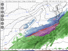
Doubt I get flakes all the way up here in Roanoke. But great look for y’allThat FV3 hi-res trend is pretty nuts..View attachment 109109
I'm not seeing any snow falling on the King St webcam for BooneWhat town?
snowlover91
Member
FFC may issue WWAs for E GA.
000
FXUS62 KFFC 211513
AFDFFC
Area Forecast Discussion
National Weather Service Peachtree City GA
1013 AM EST Fri Jan 21 2022
...Update for wintry impacts updates...
.UPDATE...
As we move into the morning, we are seeing patchy areas of
freezing drizzle affect portions of north, northwest, and west
central Georgia, including portions of the Atlanta metro, causing
slick spots on roadways, especially on brides and overpasses.
Please use caution when driving in these areas. Temperatures are
expected to improve through the morning, but with cold air
continuing to push in from the north and thick low-level cloud
cover, several areas of North Georgia are expected to remain near
or below freezing for the entirety of the day.
In east central and southeast portions of the forecast area,
some morning model runs have indicated and increasing chance for
mixed wintry precip with the potential to cause minor impacts
tonight into Saturday morning. Some of these areas may be upgraded
to a Winter Weather Advisory this afternoon depending on model
trends throughout the rest of the morning.
PLease see the Special Weather Statements for more details.
Thiem
 forecast.weather.gov
000
FXUS62 KFFC 211513
AFDFFC
Area Forecast Discussion
National Weather Service Peachtree City GA
1013 AM EST Fri Jan 21 2022
...Update for wintry impacts updates...
.UPDATE...
As we move into the morning, we are seeing patchy areas of
freezing drizzle affect portions of north, northwest, and west
central Georgia, including portions of the Atlanta metro, causing
slick spots on roadways, especially on brides and overpasses.
Please use caution when driving in these areas. Temperatures are
expected to improve through the morning, but with cold air
continuing to push in from the north and thick low-level cloud
cover, several areas of North Georgia are expected to remain near
or below freezing for the entirety of the day.
In east central and southeast portions of the forecast area,
some morning model runs have indicated and increasing chance for
mixed wintry precip with the potential to cause minor impacts
tonight into Saturday morning. Some of these areas may be upgraded
to a Winter Weather Advisory this afternoon depending on model
trends throughout the rest of the morning.
PLease see the Special Weather Statements for more details.
Thiem
National Weather Service
lexxnchloe
Member
Greg Postal said on TWC its possible to see a bit more snow that what they are forecasting which was around 3-4 inches around Raleigh
Greg Postal said on TWC its possible to see a bit more snow that what they are forecasting which was around 3-4 inches around Raleigh
Considering even the drier 12z GFS has CAE at 5.1 inches with ratios, I agree that this thing is surely going to do better up there; It just has to...
Stormsfury
Member
Temperatures running slightly colder than most guidance. When precip resumes again later, I could imagine we'd continue to see further falls in daytime temps. We saw the first level off in Charleston from 9am to 10am (first non fall ob's since 1pm yesterday. However, here at the Creek, with no precip falling now, temps have dropped down to 34 here. (Which is 2 to as much as 4 degrees colder than various model guidance from Yesterday).Most models have maintained the warmer trends of yesterday and I can’t find even one model now (ignoring the cold biased WRF) with more than a very tiny bit of ZR here in SAV. But as you said, the cold air in wedges is often underdone by most models. So, that remains the wild card. Will continue watching temperature trends to my NE. Plus your well inland area and 100 mile further NE area will probably end up 1-3 colder or so during precip than the coldest here while precip is falling. I see that temperature falls in NE SC/Coastal NC have either slowed or stopped for the time being with 32 in ILM, 33 in Florence, 34 in MYR, and 36 in CHS. Will they resume falling this afternoon, the crucial time imo?
Fountainguy97
Member
This is.... just bad. Moderate snow will be moving in by 7-8pm with temps in the upper 20s. A pretty careless tweet imo.People not taking this storm seriously at all. Hurricanes game is tonight that means a flood of traffic around 6 all through Raleigh .. light to moderate snow falling and if everyone makes it to the game then by the time they leave you have thousands of cars leaving in 23 degree moderate snow on top of 2 inches already fallen .. good grief could spell trouble if this game isn’t canceledView attachment 109117
Showmeyourtds
Member
Torching here now...up to 34.5
15z HRRR coming in


L
Logan Is An Idiot 02
Guest
15z HRRR coming in

It looks like it’s getting better and better each run
Sent from my iPhone using Tapatalk
Sctvman
Member
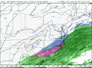
Trend on HRRR over last 5 runs for 8pm tonight


NBAcentel
Member
Pilotwx
Member
Sun out here in Surry county, tells me dry air will be hard to overcome in a lot of areas in the NW part of the storm
Where? In Wilkes not in the southern foothills I can tell u that.Snowing in foothills now. Jet streak is strengthening!
Dang, that heavy banding showing up more and more pronounced on the HRRR. Ruh roh. Maybe GFS is onto something that the NAM isn't seeing even at 3km.
BHS1975
Member
Dang, that heavy banding showing up more and more pronounced on the HRRR. Ruh roh. Maybe GFS is onto something that the NAM isn't seeing even at 3km.
Your right at the mix line.
Sent from my iPhone using Tapatalk
Jrips2710
Member
Trending NW still lol
Look at the Macon boys getting in on it! Hope it works out down there for some flakes
L
Logan Is An Idiot 02
Guest
Also Looks like the RAP has been improving each run FWIW
Sent from my iPhone using Tapatalk
Sent from my iPhone using Tapatalk
Stephenb888
Member
Lol what wack model is this.Ok, let's see, how does this go? Check please!
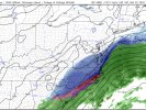
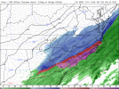
The HRRR certainly wants to put a lot moisture way back southwest now.Trending NW still lol View attachment 109134View attachment 109135
CAE just updated..
Area Forecast Discussion
National Weather Service Columbia SC
1128 AM EST Fri Jan 21 2022
.NEAR TERM /THROUGH TONIGHT/...
Recent model trends this morning have been consistently showing
a westward expansion of precipitation as it redevelops this
afternoon. Additionally, there is increasing concern about the
possibility of frontogenetic banding setting up from southwest
to northeast across the CWA. With a cold airmass in place,
model soundings have been suggesting more frozen precipitation
occurring further to the south and east than in the previous
forecast. With snowfall accumulations on the upswing, the
decision was made along with neighboring WFOs to upgrade the
Winter Weather Advisory to a Winter Storm Warning for
Chesterfield, Southern Lancaster, Kershaw and Lee Counties. For
these areas, around 2 inches of snowfall accumulation is
expected mainly from this evening and through the overnight
period. The Advisory was also expanded southward through much
of the CSRA counties, minus McCormick and Lincoln where lesser
impacts are expected.
Expect temperatures to fall this afternoon, with high
temperatures either having already occurred earlier today, or
are at their peak late this morning. There remains a chance for
some some light precipitation this morning and into the early
afternoon hours, mainly of the liquid variety. However, the best
chance for precipitation will be later in the day and evening,
when the ptype is more likely going to be a wintry mix and
capable of generating some hazardous conditions for the evening
commute period.
Ice accumulations expected between 0.1"-0.25" across the
eastern and southern Midlands, less than 0.1" elsewhere.
Snow/sleet accumulations will be highest over areas in the
Winter Storm Warning, with around 2" accumulation and isolated
higher amounts possible. Amounts then decrease to the south and
west, with around 1.5" through the Columbia metro and up to 1"
into the Augusta area through early Saturday morning.
Low temperatures tonight in the low to mid 20s, with warmest
values in the CSRA and coldest temperatures near the SC/NC
border.
Additional details with the afternoon package.
Your right at the mix line.
Sent from my iPhone using Tapatalk
He's on the mix line at the onset but not for the duration.
- Joined
- Jan 5, 2017
- Messages
- 3,773
- Reaction score
- 5,983
Sorry, I posted in the wrong thread. Still low 30's here with no precipitation falling.Lol what wack model is this.
Being right North of the mixing line is usually where there is stronger precipitation. I'm slightly away from CAE proper... but being right on that line can score big for people usually.. not just here but anywhere seeing that
- Joined
- Jan 23, 2021
- Messages
- 4,602
- Reaction score
- 15,197
- Location
- Lebanon Township, Durham County NC
HRRR keeps increasing QPF.
For the Raleigh weenies
packfan98
Moderator
Teach Lesley
Member
Flurries at my location just north of Hickory
Yeah, I wouldn't be surprised if RAH added Franklin, Wake, Johnston, and maybe even Harnett to the WSW in their afternoon package. I could also see them adding Davidson, Forsyth and Guilford to the WWA. We shall see.
NEAR TERM /THROUGH TONIGHT/...
As of 1135 AM Friday...
Update: After evaluation of new guidance, have expanded the winter
storm warning westward, with the warning now running roughly along
and southeast of a Rockingham-Raleigh-Roanoke Rapids line. New high
res guidance is suggestive of a band of heavier snow potential
across the Sandhills into the central/NE Coastal Plain and far SE
Piedmont, with the focus still on 7p-3a time frame. -GIH
Yeah… I was just about to post that GSP has updated their forecast grids… they now have 1-2” over the current WWA area and even now around 1” for CLT itself. They mentioned at 10:45 they were waiting for all 12z guidance to come in before making a call on expanding advisory westward, but they were perplexed by the light snow that is breaking out in the Lee of the mountains in areas that only had 15% POP. It’s interesting that for CLT metro 2” in 8 hours is. WSW criteria so I wonder if they might pull the trigger on a warning for Cabarrus, Union, and Chester counties… it looks as if most models has 2”+ for the majority of those counties now


