-
Hello, please take a minute to check out our awesome content, contributed by the wonderful members of our community. We hope you'll add your own thoughts and opinions by making a free account!
You are using an out of date browser. It may not display this or other websites correctly.
You should upgrade or use an alternative browser.
You should upgrade or use an alternative browser.
Wintry 1/20 - 1/23 Winter Storm
- Thread starter packfan98
- Start date
I'm gonna assume those warnings will extend into the adjacent counties (ie, Richland and Lexington).CAE just issued WWWs for 4 counties in SC. Chesterfield-Kershaw-Lee-Southern Lancaster
Looks like that coastal stuff is reaching as drizzle in a few spots
The scene is eerie outside. Blanked grey sky. White powder whipping around. Layer of crusty ice on everything. The table has been set here as we prepare for our first legit snowstorm in a while. Going to be a fun snow to watch get blown around since it’s so light and fluffy.
Stormsfury
Member
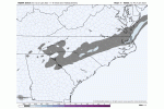
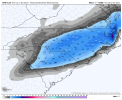
That FV3 hi-res trend is pretty nuts..View attachment 109109
You'd think it was the 80s again with such crazy shifts and expansions like that this close to an event.
But when s/w move across sparsely networked regions (*cough* Mexico mountains *cough *), this kinda gives validity to why so many winter events were "sneaky" suckers back in the day.
Temperatures running 1 to 2 degrees colder in the WWA around Charleston, Berkeley Counties at this time.
Before people complain about not being in a Winter storm warning, RAH's criteria up here is 3" in 12 hours or 4" in 24 hours. As of right now their forecast high end bust is just barely meeting the first criteria
- Joined
- Jan 23, 2021
- Messages
- 4,602
- Reaction score
- 15,197
- Location
- Lebanon Township, Durham County NC
NAM QPF now up to .25 for MBY which has increased for 3 consecutive runs.
I dont know I Think eventually they will raise totals right as the snow is breaking out probably .. this should be a warning IMO especially with how cold it will stay .. winter weather advisory isn’t going to keep a lot of people off the roadsBefore people complain about not being in a Winter storm warning, RAH's criteria up here is 3" in 12 hours or 4" in 24 hours. As of right now their forecast high end bust is just barely meeting the first criteria
- Joined
- Jan 23, 2021
- Messages
- 4,602
- Reaction score
- 15,197
- Location
- Lebanon Township, Durham County NC
UKMET, RGEM and GFS have led the way the last 24 hours so I see no reason to not take a blend of what they are showing.
It certainly wouldn’t be the first time they upgrade to a warning as the storm is underway. It’s happened many times before.I dont know I Think eventually they will raise totals right as the snow is breaking out probably .. this should be a warning IMO especially with how cold it will stay .. winter weather advisory isn’t going to keep a lot of people off the roads
A lot of people aren’t taking this system seriously now because it’s only under a WWA.
Anybody got one of them GFS snow ratio outputs?
Anybody got one of them GFS snow ratio outputs?
toss your klocation in there
At this point i think the horses have left the barn as far as public perception of impacts, the time to go WSwarnings was last night imo, raising it at like 3 would just be a change in semantics
Actually going off of this .. every most recent piece of model guidance has shows 3 inches or more here in Raleigh and the only ones I found that didn’t had 2 inches but using 10:1 ratios .. I believe this storm will be winter storm criteria when all is said and doneBefore people complain about not being in a Winter storm warning, RAH's criteria up here is 3" in 12 hours or 4" in 24 hours. As of right now their forecast high end bust is just barely meeting the first criteria
Oh yay. I just got a Special Weather Statement in Martin GA. Flurries or freezing drizzle possible in some areas thisafternoon. LOL
Dewpoint Dan
Member
Interesting that Charlotte isnt even under an advisory and the southern parts of the metro in SC are under a warning.
True I could see many complaints by the public on not being informed on a higher impact event event though travel impacts have always been a for sure with this system due to the temperaturesAt this point i think the horses have left the barn as far as public perception of impacts, the time to go WSwarnings was last night imo, raising it at like 3 would just be a change in semantics
RAH update, mentions the updates to warnings, if done, would be later
.NEAR TERM /THROUGH TONIGHT/...
As of 930 AM Friday...
Just minor changes this morning as we await a full suite of new 12z-
initialized guidance. Observational datasets confirm the near term
forecast trends. The latest surface analysis shows the frigid high
nosing strongly down through central NC with plenty of dry air
advection, including single-digit dewpoints just to our N. Skies are
just cloudy, with radar showing spotty elevated returns across the S
half, although most of this is likely not reaching the ground given
the somewhat dry subcloud layer noted on 12z soundings. Will
maintain low chance pops across the SE well into the afternoon,
before trending pops up with a NW expansion as we approach the
evening. Any changes to the advisory or warning will wait a few more
hours when further high res guidance can be fully considered. Expect
temps to hold firm or rise just a degree or two today, yielding
daytime highs of 27-34. Current brisk winds from the NNE and NE with
occasional gusts to around 20-25 mph will persist through the day as
the dense air pours in with a strong ageostrophic component, which
will keep wind chills in the upper teens to mid 20s for much of the
day. -GIH
D
Deleted member 609
Guest
- Joined
- Jan 23, 2021
- Messages
- 4,602
- Reaction score
- 15,197
- Location
- Lebanon Township, Durham County NC
I just averaged the RGEM, UKMET, GFS and NAM(all of which I find more in tune with reality and have led the way with the shift)
It left me with a QPF total of .30 and I expect a ratio of 15:1. That yields 4.5". I think totals will probably vary from 2" by far northern Durham County to maybe as much as 5-6" by the land that borders the airport.
It left me with a QPF total of .30 and I expect a ratio of 15:1. That yields 4.5". I think totals will probably vary from 2" by far northern Durham County to maybe as much as 5-6" by the land that borders the airport.
Thanks! I've got that saved for future use.
- Joined
- Jan 23, 2021
- Messages
- 4,602
- Reaction score
- 15,197
- Location
- Lebanon Township, Durham County NC
Chas Executive, which is about two miles as the bird flies from Folly Beach, seems to be reporting -IP.
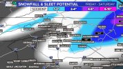
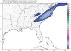
Regurgitated HRRR mapBrad ain't buying the higher totals
View attachment 109112
People not taking this storm seriously at all. Hurricanes game is tonight that means a flood of traffic around 6 all through Raleigh .. light to moderate snow falling and if everyone makes it to the game then by the time they leave you have thousands of cars leaving in 23 degree moderate snow on top of 2 inches already fallen .. good grief could spell trouble if this game isn’t canceled

I'm in Mount pleasant, The temp is 38°... Lower than what was forecasted. Temperatures dropped about 3° in the past couple of hours.Chas Executive, which is about two miles as the bird flies from Folly Beach, seems to be reporting -IP.
Now 37°... And I'm about 2 mi from the water.I'm in Mount pleasant, The temp is 38°... Lower than what was forecasted. Temperatures dropped about 3° in the past couple of hours.
Have the salt trucks been out at all? As @NickyBGuarantee has been saying, I think that people aren’t taking this storm seriously. With soil temperatures below freezing, snow is going to have no trouble sticking to the roads. Too many people are downplaying the threat.
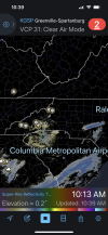
Not really watching the radar along the gulf our snow is coming from Boone NC where snow is falling in many areas now 
- Joined
- Jan 23, 2021
- Messages
- 4,602
- Reaction score
- 15,197
- Location
- Lebanon Township, Durham County NC
I can only speak for North Durham into campus but they definitely worked on them over night.Have the salt trucks been out at all? As @NickyBGuarantee has been saying, I think that people aren’t taking this storm seriously. With soil temperatures below freezing, snow is going to have no trouble sticking to the roads. Too many people are downplaying the threat.
D
Deleted member 609
Guest
Raleigh laterHave the salt trucks been out at all? As @NickyBGuarantee has been saying, I think that people aren’t taking this storm seriously. With soil temperatures below freezing, snow is going to have no trouble sticking to the roads. Too many people are downplaying the threat.
I’ve got a few flurries and the sun peeking through the clouds!
Sent from my iPhone using Tapatalk
Sent from my iPhone using Tapatalk
BelmontWX79
Member
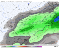
Intriguing to me the GFS has had higher totals further west than many of the CAM models. Jackpots areas just east of 85 in NC.
Snowing in foothills now. Jet streak is strengthening!
Sctvman
Member
Yup, Summerville already down to 34-35°
Sctvman
Member

