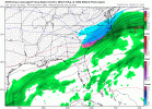
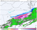
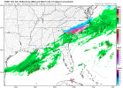
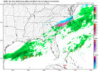
Official dusting here in Raleigh by the PNC arena snow is coming down well and it’s downright cold .. can’t believe we’re reeling this is in like this
-
Hello, please take a minute to check out our awesome content, contributed by the wonderful members of our community. We hope you'll add your own thoughts and opinions by making a free account!
You are using an out of date browser. It may not display this or other websites correctly.
You should upgrade or use an alternative browser.
You should upgrade or use an alternative browser.
Wintry 1/20 - 1/23 Winter Storm
- Thread starter packfan98
- Start date
Not gonna lie tonight has turned out better than I expected, .5 still light snow and the back edge has been very slow to progress east, with some back building at times. HRRR wasn't that far off actually. Hoping a good sign for tomorrow
Forevertothee
Member
I am in the county right above Newberry....based on the trends, I think Clinton could get 1.5 to 2 based on ratios?Chris Justice now saying the upstate could see an inch. Let’s me know we are on the cusp of higher totals
I'm wondering if NWS Raleigh will upgrade the Winter Weather Advisories to Winter Storm Warnings for Raleigh and points west considering the model trends that have taken place tonight by 6:00 AM tomorrow?
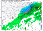
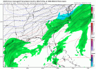
Oh okay. Can we coin a new term of getting WRF'd. I started to post this in the banter instead, but I mean it fits into the westward trend of the models tonight albeit the most extreme so far. ?
View attachment 109004
View attachment 109005
There’s no way that the WRF isn’t solidly cold biased. It is clearly colder than any other model. In addition, it was even colder in earlier runs, clear signs of cold bias. Also, it has much heavier qpf at least in my area vs all other models. I’m definitely tossing this lmao.
Models are slowly warming things here, which may be enough to keep out all ZR from here to the coast.
whatalife
Moderator
Christian T Murray
Member
snowing in wilson now
Looks like the 00z GGEM is probably going to follow the RGEM with a slight westward correction…out to hr 18.
HRW-ARW is a great modelOh okay. Can we coin a new term of getting WRF'd. I started to post this in the banter instead, but I mean it fits into the westward trend of the models tonight albeit the most extreme so far. ?
View attachment 109004
View attachment 109005
Oh I know, this is the same model that had us getting as low as 21 during last weekend's event.There’s no way that the WRF isn’t solidly cold biased. It is clearly colder than any other model. In addition, it was even colder in earlier runs, clear signs of cold bias. Also, it has much heavier qpf at least in my area vs all other models. I’m definitely tossing this lmao.
Models are slowly warming things here, which may be enough to keep out all ZR from here to the coast.
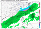
The Canadian so close to Atlanta...it ain't even funny!!View attachment 109014Canadian says let me join the party
HRW-ARW is a great model
I’m assuming you’re joking. It is ridiculously cold vs other models.
I wouldn’t be surprised either way, but I really think they should upgrade a lot more of their counties to warnings in their update tonight. The potential for warning criteria snowfall is now there for much of their CWA and even if the technical warning definition isn’t met, even 1-2” of snow will be high impact given how cold it is. The roads will be a mess, so it’s not like the public will be crying foul.I'm wondering if NWS Raleigh will upgrade the Winter Weather Advisories to Winter Storm Warnings for Raleigh and points west considering the model trends that have taken place tonight by 6:00 AM tomorrow?
The WRF was around 8 degrees too cold here for the last storm 24 hours out. I'd still be without power if were in the ballpark.Oh I know, this is the same model that had us getting as low as 21 during last weekend's event.
SimeonNC
Member
If these trends continue and verify then tomorrow is gonna be a crapshow for CLT, GSO, CAE, ect. Temps are gonna be below freezing for most of the day and if the snow arrives earlier than modeled like it usually does, a lot could go downhill when it comes to traffic.
Another view of how much the GFS has improved since a couple days ago


Another view of how much the GFS has improved since a couple days ago

If we could trend a little more it would be a state wide hit. Incredible
Sent from my iPhone using Tapatalk
I hope this is just the appetizer. Really fun little flizzard so far with sideways snow at times
That’s a huge shift west over 12z!10:1 ratios.... 00z ukmet
View attachment 109019
0Z CMC has nearly 0.50” of qpf here tomorrow night, but it just like other models has fortunately been slowly warming from run to run with the wetter conditions/western shifts of the main precip. At one point on older runs, Fri night was almost entirely looking to be at 32 or lower. Now it is looking to be a few degrees above 32 much of the night. Fingers crossed!
Edit for typo
Edit for typo
Last edited:
Ukie has been pretty Far East too, great to see it come west.10:1 ratios.... 00z ukmet
View attachment 109019
On Spectrum 14 news one of the meteorologists was saying that there is the possibility that snowfall ratios with this storm could be as high as 15 to 1. That would up these amounts significantly.10:1 ratios.... 00z ukmet
View attachment 109019
LovingGulfLows
Member
- Joined
- Jan 5, 2017
- Messages
- 1,499
- Reaction score
- 4,100
For my backyard, CMC has better lift in the mid levels(esp at 700mb height), but isn't as moist as the GFS. Still produces a little under an inch of snow here. If I could get GFS's moisture profile with CMC's UVV's in the mid levels, something could actually happen here tomorrow.
On Spectrum 14 news one of the meteorologists was saying that there is the possibility that snowfall ratios with this storm could be as high as 15 to 1. That would up these amounts significantly.
Yeah, our local guys in CAE are saying a "flurry" possibly a dusting. heh.
Stormsfury
Member
0Z CMC has nearly 0.50” of qpf here tomorrow night, but it just like other models has fortunately been slowly warming from run to run with the wetter conditions/western shifts of the main precip. At one point on older runs, last night was almost entirely looking to be at 32 or lower. Now it is looking to be a few degrees above 32 much of the night. Fingers crossed!
Per KCHS, they're going more towards the NAM thermal profiles on low level cold advection crashing SFC Temps a bit quicker than shown from other modeling (due to NAM performance of wedges better than most). Savannah probably escapes a lot of icing... probably up to .1" but if 00z and overnight trends continue, I really believe ice storm warnings may replace the current advisory in the Quad Counties in SC...
brendan123
Member
Wouldn't be surprised if blizzard criteria is met somewhere on the NC/VA coast, already gusting to 30-35 in some spots along the Chesapeake Bay and OBX
are warnings standard across most areas? I just read 25mph sustained meets criteria..Wouldn't be surprised if blizzard criteria is met somewhere on the NC/VA coast, already gusting to 30-35 in some spots along the Chesapeake Bay and OBX
Snowflowxxl
Member
Damn I just checked the models for the first time in 24 hours and see this has gotten kinda close here. I'm gonna drive to my families place on the SE metro if this continues.
brendan123
Member
I think that's the criteria and it could (and likely will) be met but the Wakefield NWS is pretty conservative and I doubt they'll issue oneare warnings standard across most areas? I just read 25mph sustained meets criteria..
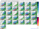
@snowlover91 has been posting these, but this is the 00z RDPS Ensemble members. Various solutions in here still....some with snow back into Atlanta


bnathanb1982
Member
I know it hasn't been as cold leading up to the event, however remember is 2014 it only took an inch of snow to shut down northern GA.For my backyard, CMC has better lift in the mid levels(esp at 700mb height), but isn't as moist as the GFS. Still produces a little under an inch of snow here. If I could get GFS's moisture profile with CMC's UVV's in the mid levels, something could actually happen here tomorrow.

