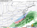
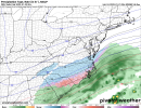
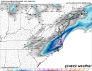
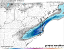
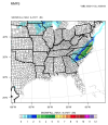
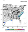
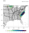
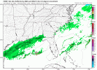
Lots of stuff still on the table… Thanks Grit@snowlover91 has been posting these, but this is the 00z RDPS Ensemble members. Various solutions in here still....some with snow back into Atlanta
-
Hello, please take a minute to check out our awesome content, contributed by the wonderful members of our community. We hope you'll add your own thoughts and opinions by making a free account!
You are using an out of date browser. It may not display this or other websites correctly.
You should upgrade or use an alternative browser.
You should upgrade or use an alternative browser.
Wintry 1/20 - 1/23 Winter Storm
- Thread starter packfan98
- Start date
Yeah but I think the difference here is that temps aren’t supposed to be below freezing until seemingly most moisture is gone. In 2014 we were in the upper 20s while snow was falling. That was like the perfect recipe for disaster. Not saying there can’t be issues tomorrow but things would have to really crank for their to be problems like that.I know it hasn't been as cold leading up to the event, however remember is 2014 it only took an inch of snow to shut down northern GA.
I remember one of the Atl NWS mets saying that there has only been 2 times when there was accumulating snow in Atlanta during the daytime with temperatures dropping into the mid-20's - both snowjams ('82 / '14)Yeah but I think the difference here is that temps aren’t supposed to be below freezing until seemingly most moisture is gone. In 2014 we were in the upper 20s while snow was falling. That was like the perfect recipe for disaster. Not saying there can’t be issues tomorrow but things would have to really crank for their to be problems like that.
Per KCHS, they're going more towards the NAM thermal profiles on low level cold advection crashing SFC Temps a bit quicker than shown from other modeling (due to NAM performance of wedges better than most). Savannah probably escapes a lot of icing... probably up to .1" but if 00z and overnight trends continue, I really believe ice storm warnings may replace the current advisory in the Quad Counties in SC...
Yeah, I guess it is a battle between the very slow warming trends of most models with the westward shift of precip vs most models not handing well the low level cold of strong wedges giving NAM and CMC/RGEM an advantage. Will be close, regardless.
We should get a better idea by looking to your north tomorrow morning at how fast temperatures are cooling as the wedge advances vs models.
I’ll also be closely watching CHS because in situations like this SAV will usually get within 1-2 of KCHS eventually albeit delayed.
The 3 hr visibility thing might be the hardest to meet. (falling/blowing sn) But I am just speculating. Good luck though. It's rare to even be in a position to consider if that kind of warning is a possibility.I think that's the criteria and it could (and likely will) be met but the Wakefield NWS is pretty conservative and I doubt they'll issue one
brendan123
Member
Southeastern Virginia's been pretty lucky with snowstorms recently (besides the past 3 years), we got back to back blizzard warnings after none for 40 years in 2017 and 2018, crazy to think even the possibility might be there again nowThe 3 hr visibility thing might be the hardest to meet. (falling/blowing sn) But I am just speculating. Good luck though. It's rare to even be in a position to consider if that kind of warning is a possibility.
It might be about to put down in Durham
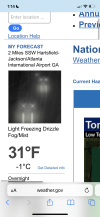
32 here right nowI remember one of the Atl NWS mets saying that there has only been 2 times when there was accumulating snow in Atlanta during the daytime with temperatures dropping into the mid-20's - both snowjams ('82 / '14)
Yep. Will never forget that day. If anyone is up for a stroll down memory lane. Starts to get interesting around page 8 haha
1/28-1/30 SE Winter Storm OBS
Okay gang I'm determined to join the party one way or another! Since it's looking more & more likely that I won't have obs to post I'm going to go ahead & start the obs thread. Barring a unforeseen collapse in modeling a large part of the deep south is getting winter weather. Good luck to...
I got a light dusting of snow on some elevated surfaces from the initial Arctic front, probably will go down as a T at RDU officially but it's a nice appetizer before the main event
Snowflowxxl
Member
1/28/14 is my favorite storm. It turned Atlanta into a damn zoo lol and over performed.
Stormsfury
Member
Yeah, I guess it is a battle between the very slow warming trends of most models with the westward shift of precip vs most models not handing well the low level cold of strong wedges giving NAM and CMC/RGEM an advantage. Will be close, regardless.
We should get a better idea by looking to your north tomorrow morning at how fast temperatures are cooling as the wedge advances vs models.
I’ll also be closely watching CHS because in situations like this SAV will usually get within 1-2 of KCHS eventually albeit delayed.
Indeed. The current winter weather advisory starts here at 1pm tomorrow until 3am Saturday morning. Temp is starting to fall at a faster rate plus it's starting to get breezy from N and NNE.
Hard to believe after I hit 73 today.
Hm some raw CAE output... like the higher than 10:1 rates showing up... 5.1 inches per gfs and 2.5 nam
00z GFS:
00z NAM:
00z GFS:
Code:
220122/0000Z  24  03008KT  28.7F  SNPL   10:1| 0.3|| 0.02|| 0.00|| 0.031   10:1|  0.3|| 0.02|| 0.00|| 0.03   71| 29|  0
----------------------------------------------+----++-----+-------------++--------------++-------------++-----------+---+---
220122/0100Z  25  03007KT  28.1F  SNOW   15:1| 0.9|| 0.00|| 0.00|| 0.061   14:1|  1.3|| 0.02|| 0.00|| 0.09  100|  0|  0
220122/0200Z  26  04007KT  27.9F  SNOW   12:1| 0.6|| 0.00|| 0.00|| 0.049   13:1|  1.9|| 0.02|| 0.00|| 0.14  100|  0|  0
220122/0300Z  27  02006KT  27.8F  SNOW   15:1| 0.8|| 0.00|| 0.00|| 0.056   14:1|  2.7|| 0.02|| 0.00|| 0.20  100|  0|  0
220122/0400Z  28  02008KT  27.4F  SNOW   17:1| 1.1|| 0.00|| 0.00|| 0.067   14:1|  3.8|| 0.02|| 0.00|| 0.26  100|  0|  0
220122/0500Z  29  03007KT  27.2F  SNOW   15:1| 0.9|| 0.00|| 0.00|| 0.059   15:1|  4.7|| 0.02|| 0.00|| 0.32  100|  0|  0
220122/0600Z  30  03007KT  27.0F  SNOW   11:1| 0.4|| 0.00|| 0.00|| 0.039   14:1|  5.1|| 0.02|| 0.00|| 0.36  100|  0|  0
00z NAM:
Code:
----------------------------------------------+----++-----+-------------++--------------++-------------++-----------+---+---
220122/0100Z  25  02009KT  29.2F  FZRA    0:1| 0.0|| 0.00|| 0.03|| 0.027    0:1|  0.0|| 0.00|| 0.03|| 0.03    0|  0|100
220122/0200Z  26  01008KT  29.2F  SNPL    2:1| 0.1|| 0.07|| 0.00|| 0.041    2:1|  0.1|| 0.07|| 0.03|| 0.07   11| 89|  0
220122/0300Z  27  01009KT  29.6F  SNOW   16:1| 0.7|| 0.00|| 0.00|| 0.046    9:1|  0.8|| 0.07|| 0.03|| 0.11  100|  0|  0
220122/0400Z  28  01009KT  28.8F  SNOW   14:1| 0.7|| 0.00|| 0.00|| 0.052   11:1|  1.5|| 0.07|| 0.03|| 0.17  100|  0|  0
220122/0500Z  29  02008KT  28.8F  SNOW   16:1| 0.7|| 0.00|| 0.00|| 0.043   12:1|  2.2|| 0.07|| 0.03|| 0.21  100|  0|  0
220122/0600Z  30  03009KT  29.0F  SNOW   10:1| 0.3|| 0.00|| 0.00|| 0.028   12:1|  2.5|| 0.07|| 0.03|| 0.24  100|  0|  0
----------------------------------------------+----++-----+-------------++--------------++-------------++-----------+---+---I wish there were a way to go back and view model data from back then. I don't even remember what models showed beforehand. I remember a winter storm watch then warning was issued for southern metro ATL counties the day before the event and then expanded to the rest of metro Atlanta the morning of the event.1/28/14 is my favorite storm. It turned Atlanta into a damn zoo lol and over performed.
If this event overperforms and causes similar issues in Atlanta, it'd be one of the biggest model fails in recent memory.
You can use the Tigge dataset from ECMWF that archives past model runs if you want code it up. You could also probably read through old American threads.I wish there were a way to go back and view model data from back then. I don't even remember what models showed beforehand. I remember a winter storm watch then warning was issued for southern metro ATL counties the day before the event and then expanded to the rest of metro Atlanta the morning of the event.
If this event overperforms and causes similar issues in Atlanta, it'd be one of the biggest model fails in recent memory.
LovingGulfLows
Member
- Joined
- Jan 5, 2017
- Messages
- 1,499
- Reaction score
- 4,100
I wish there were a way to go back and view model data from back then. I don't even remember what models showed beforehand. I remember a winter storm watch then warning was issued for southern metro ATL counties the day before the event and then expanded to the rest of metro Atlanta the morning of the event.
If this event overperforms and causes similar issues in Atlanta, it'd be one of the biggest model fails in recent memory.
What do you think about the current model data? I feel like with the moisture profiles, there's definitely room for this event to 'overperform' for some of N GA.
Snowflowxxl
Member
The models had the sweet spot for Macon-Warner Robins until 36 hours before the event, when they started to shift North. They still whiffed pretty bad.I wish there were a way to go back and view model data from back then. I don't even remember what models showed beforehand. I remember a winter storm watch then warning was issued for southern metro ATL counties the day before the event and then expanded to the rest of metro Atlanta the morning of the event.
If this event overperforms and causes similar issues in Atlanta, it'd be one of the biggest model fails in recent memory.
These events tend to over-perform in terms of precip northwest of the low/overrunning. I think parts of east-central GA have a chance for some accumulating snow along with the NEGA mountains. In terms of anything for the ATL Metro, flurries only. Could be some "heavier" flurries but nothing accumulating.What do you think about the current model data? I feel like with the moisture profiles, there's definitely room for this event to 'overperform' for some of N GA.
The models have done pretty bad with this system, though. Sorta makes me really think that volcano last week is having a major effect on global modelling for the time being. It's not just this system that models are struggling with.
Euro out to 24, and it's following along with the trends of the other models of digging more vorticity into the backside of the trough. Won't be a huge difference probably, but it's there
Here's the difference at the surface on the Euro at hr27


GeorgiaGirl
Member
I wish there were a way to go back and view model data from back then. I don't even remember what models showed beforehand. I remember a winter storm watch then warning was issued for southern metro ATL counties the day before the event and then expanded to the rest of metro Atlanta the morning of the event.
If this event overperforms and causes similar issues in Atlanta, it'd be one of the biggest model fails in recent memory.
I believe the reason why that storm busted was because the NW side of the precip shield was underestimated. The short range models caught on better (the reason I can say that is there is a long stream related to this storm where the guy in there is talking about how the short range models were a warning shot).
I don’t remember what the models showed, but I do remember that Rome (which is where I was at for college for a little while, yes, it’s been that long and I’m still trying to work on being able to figure out how to make something of myself and get a job, it’s sad and I’m feeling it a bit more lately, what I’m working on now is medical coding) was supposed to just see a dusting of snow.
Ended up with a few inches of powder. Fun storm.
Don’t know if it’ll be as bad of a bust as that, but certainly feels as if Atlanta could see some flakes.
Last edited:
Euro much qpf west. And that completes an entire cycle of the wet trend further west all day. Good night
Euro total precip trend for 7AM Fri to 7AM Sat....last 3 runs


And of course it goes without saying these are 10:1 ratios being shownView attachment 109031View attachment 109030Euro snowfall compared to 12z.
The Euro is getting precip all the way to the mountains now. Casual 100+ mile shift right before zero hour.
These snow shower might pack a punch when they move by .. anything more at this point is just guaranteeing more road issues tonight and tomorrow morning
Euro Kuchera last 3 runs


The strengthening jet component has looked good all along on the Euro....getting more surface response on the model now


Indeed. I noticed this a couple of hours ago. I have a glaze on my back deck.
29.3F
Wow this model did a 180 quickly .. I wonder what piece of information really made everything finally see this solution there had to be bad data at some point given to all the models00z MMFS is in!
Snowfall Accumulation
ZR Accumulation
Experimental Winter Storm Impact Index
Showing an expansion of the NW precip. Snow accumulations have slightly increased as well. Still showing a high impact event for many in NC/SC.
View attachment 109032
View attachment 109033
View attachment 109034
I feel like it keeps getting a tad faster .. entering wake around 5-6 .. wonder if we can get this thing here at 12 pm .. the more hours in these temperatures of that type of snow .. magic can happen .. we want every hour we can getView attachment 109036Latest HRRR from noon tomorrow thru the end of its run. A beauty!
Not sure what it is, but just about every model has made the adjustment. Models in general have really struggled with this storm & have had higher than usual run-to-run inconsistency.Wow this model did a 180 quickly .. I wonder what piece of information really made everything finally see this solution there had to be bad data at some point given to all the models
05z HRRR is looking even betterView attachment 109036Latest HRRR from noon tomorrow thru the end of its run. A beauty!
You would think we would have lots of data coming from that piece of energy at H5 we have been looking at clearly trending ampedNot sure what it is, but just about every model has made the adjustment. Models in general have really struggled with this storm & have had higher than usual run-to-run inconsistency.


