• Hello, please take a minute to check out our awesome content, contributed by the wonderful members of our community. We hope you'll add your own thoughts and opinions by making a free account!

Wintry 1/20 - 1/23 Winter Storm

Finally about to go to bed and took a peek out and it’s snowing lightly here again with a slushy dusting on the grass and elevated surfaces. Going to be a tired morning! ?
 
Latest 12km NAM & long range HRRR just backed off from its last runs.

Hopefully we aren’t all about to get the rug pulled out from under us. Now casting at this anyways.
 
I wish there were a way to go back and view model data from back then. I don't even remember what models showed beforehand. I remember a winter storm watch then warning was issued for southern metro ATL counties the day before the event and then expanded to the rest of metro Atlanta the morning of the event.

If this event overperforms and causes similar issues in Atlanta, it'd be one of the biggest model fails in recent memory.
I remembered the Euro fired the 1st warning shot here like a few days before it started then then NAM joined in. GFS was last from what I can remember.
 
Impressive GFS run. 3-5” totals over large area of NC/SC

View attachment 109046
Yeah but it's such a quick hitter with light precip and most 06 guidance did stop the west trend and backed off totals a little. Have to see how things progress through the day, on WV everything looks good but I'm looking at everything through very tired eyes too lol
 
Yeah but it's such a quick hitter with light precip and most 06 guidance did stop the west trend and backed off totals a little. Have to see how things progress through the day, on WV everything looks good but I'm looking at everything through very tired eyes too lol
Yeah RAH mentioned the 6z runs stayed close to the 0z (..which I guess is good):

A wave of surface low pressure will then move offshore along the
stalled Arctic front later Friday into Friday night, with a mid-
level shortwave trough moving across NC. This will give the first
significant accumulating snow of the season to many parts of central
NC. Snow will spread from SE to NW from the late afternoon into the
overnight hours, heaviest and most widespread from about 00z to 06z
and exiting to the east by about 09z (possibly ending as freezing
drizzle) as dry air quickly moves in. Essentially all models,
including the GFS and ECMWF as well as short-term high-res models
like the NAM, RAP, and HRRR, have trended farther west with the low
and its associated precipitation shield during the last 24 hours.

Thus raised POPs to likely to categorical across most of the region
except the far NW, and increased forecast snowfall totals slightly.
Generally expect 3-4 inches east of I-95, 2-3 inches from the US-1
corridor to I-95, and a dusting to 2 inches NW of there. It should
be stressed that there is still some uncertainty on these totals, in
particular on how far west the snow shield will make it, as it will
be fighting dry air in the NW. The GFS continues to insist on a
stronger jet streak and associated upper divergence, and thus brings
the snow much farther west than other models do. Forecast amounts
may have to be raised a bit further if models continue their
westward trend, though the 06z NAM and GFS look very similar to
their 00z runs
. Thus for now continue the Winter Storm Warnings and
Winter Weather Advisories as is, and will reassess the need to
change anything after the 12z guidance comes in. One thing we are
confident about is that the column will be sufficiently cold for
snow nearly everywhere. The one exception is the far SE (mainly
southern Sampson County) where models show still having enough warm
air aloft to stay sleet and freezing rain for much of the event.
Thus a tenth to a quarter inch of freezing rain is still forecast in
southern parts of Sampson county. Lows will be in the mid-teens to
lower-20s on Friday night with continued north winds around the
deepening low off the coast. This will bring wind chills down to the
single digits to lower-teens.
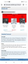
 
What's kind of funny is reading about the NWS tracking the changes in each model run(like we do). I can imagine them yelling out at hour 24 the 12k NAM is west. Or heck, they're probably logged into this site yelling Hey Fro just said the RAP is west at hour 15.
 
Well, after a great 0z suite of models, the 6z runs seemed to have backed off on precip totals a bit. 10z runs of the RAP and hrrr are both drier than their previous runs as well. I was hoping things would trend wetter all the way until game time. Let’s see which way the 12z suite goes.
 
Last edited:
Well, after a great 0z suite of models, the 6z runs seemed to have backed off on precip totals a bit. 10z runs of the RAP and hrrr are both drier than their previous runs as well. I was hoping things would trend wetter all the way until game time. Let’s see which way the 12z suite goes.
The run to run inconsistencies in precip amounts have to be frustrating the forecasters. One run is a solid 3-5 event then the next 1-3. Crazy
 
Well, after a great 0z suite of models, the 6z runs seemed to have backed off on precip totals a bit. 10z runs of the RAP and hrrr are both drier than their previous runs as well. I was hoping things would trend wetter all the way until game time. Let’s see which way the 12z suite goes.
Oddly enough the HRRR 10z run was much better at H5 so that surface depiction didn’t make sense.
 
Oddly enough the HRRR 10z run was much better at H5 so that surface depiction didn’t make sense.
That’s encouraging. I haven’t looked at the 500mb maps this morning. I was assuming that the system was coming in less vigorous or with a worse orientation. We know that many times the NW expansion is larger than modeled. All we can do is look for trends and see what falls from the sky.
 
The metro Atlanta area freezing surface temps are yet another fly in the ointment. The areas with the greatest chances of any precip to the east of Atlanta are going to struggle to get below freezing until tonight when the best moisture has passed. Some may recall seeing that warm bubble on the models dissecting Atlanta and the current maps below clearly show the battle line between the cold air in NW Georgia, and the wedge, with its less cold air struggling to make progress west into the opposing NW flow.

I've seen this play out many times before for MBY, and it's aggravating as hell.

airT.pngwind_dir.png
 
Last nights Ukmet lined up with GFS: Ops looked good Canadian, Euro for 1-3 here: Time for short range:

Also two shots next week: Tuesday is a thermals fight: Next Fri/Sat is the same fight now, difference all globals have a wound up Miller A off the coast. We would all be saying its right where we want it at this juncture and it really is right where we want it. But fighting todays battle trying to get a NW trend, Im cautiously optomistic now with that statement.

sn10_acc.us_ma.png
 
The 6z RDPS did back down some on snow totals (0z had 6+ showing in wake County). But it does align closer now with the 0z/6z GFS.

6z RDPS Kuchera:
View attachment 109056
MHX has held to their guns calling for a general 4-6 with higher amounts up NE towards Virginia and the Albermarle sound. Not too many times we see a forecast of heavy snow with a temp dropping to 23 degrees. Ratios should be good.
 
Oddly enough the HRRR 10z run was much better at H5 so that surface depiction didn’t make sense.
The precip shield has consistently been north of what the HRRR depicted at the same time. What’s weird is that it doesn’t seem to be ingesting that reality in subsequent runs.

B0901B14-337A-4289-8602-76A79FE24DEB.jpeg
 
11z RAP is bleak. Much drier and further east with precip shield compared to 10z. It totally lost the precip streamer banked up against the Lee side of the mountains it had been showing.
 
Well, after a great 0z suite of models, the 6z runs seemed to have backed off on precip totals a bit. 10z runs of the RAP and hrrr are both drier than their previous runs as well. I was hoping things would trend wetter all the way until game time. Let’s see which way the 12z suite goes.
We gotta ride the GFS (cough) and RDPS to the starting line as of right now.
 
Back
Top