• Hello, please take a minute to check out our awesome content, contributed by the wonderful members of our community. We hope you'll add your own thoughts and opinions by making a free account!

Pattern Jarring January

Well Euro's cold would be colder for most areas than the last cold snap if it were to verify. At least in many locations.

It looks like as of now the Op may be too far west with the trough and a bit too far south. The EPS doesn’t support the cold temps for the gulf states but more or less puts it over NC/SC. Likely fake news for a lot of those areas (as of now)


Sent from my iPhone using Tapatalk
 
Seeing the EPS/Euro city charts, it has the coldest temps predicted of the next cold snap, plus the EPS continues slowly backing away from the moderation after that.

Edit: And the EPS did pretty well I thought with the last one.
 
Seeing the EPS/Euro city charts, it has the coldest temps predicted of the next cold snap, plus the EPS continues slowly backing away from the moderation after that.

Edit: And the EPS did pretty well I thought with the last one.
EPS mean for the lowest low here is 11, well lower than the last cold snap. This is one chaotic roller coaster.
 
When you say that this cold snap will be stronger than the last one you have to take into consideration the area you're speaking of. For my area the last cold snap was 7 1/2 days without getting above freezing and two morning lows that were Sub-Zero with one being -8 there is no way this cold snap will be that strong or stronger for my area. Keep that in mind when making those statements that's all I'm asking.

Sent from my SM-G920V using Tapatalk
Yeah, TN and maybe AL will have the snow / ice cover this time, they could go pretty low
 
Maybe my terminology wasn't right but that sw looks like it enters OR/WA and rides the Canadian border grabbing our moisture out of the gulf causing it to cut. Or maybe the two are phasing and it's not necessarily cutting. Idk i'm no met

No, what's happening is the massive ULL over the NE is effectively a blender shredding anything that would come down that badly positioned ridge. No possible way to get a southern snow storm out of that unless you have some super clipper with enough moisture with it for flurries. We all know how well clippers work for us. The Euro is much better with its placement but still needs a lot of work.
 
No, what's happening is the massive ULL over the NE is effectively a blender shredding anything that would come down that badly positioned ridge. No possible way to get a southern snow storm out of that unless you have some super clipper with enough moisture with it for flurries. We all know how well clippers work for us. The Euro is much better with its placement but still needs a lot of work.
It's unbelievable that we have so much cold air to work with, but it's essentially too cold in a sense to produce a storm. Then when the pattern does relax, the cold is just about gone. Smh. Then it's nothing but rain.
 
Maybe slowly getting there:

View attachment 2709
You know GFS yesterday morning was similar to this although placement was different...
9d1fd07bb93df3d9ef0c01eb615c21ea.jpg


Sent from my SM-G920V using Tapatalk
 
It's unbelievable that we have so much cold air to work with, but it's essentially too cold in a sense to produce a storm. Then when the pattern does relax, the cold is just about gone. Smh. Then it's nothing but rain.

It's not really because it's too cold, but why it's too cold. In this situation we are cold because of a huge PV like ULL in the wrong location. To score here we need a trend to something like 1/28/14 or like Coldrain and 1300m is talking about.
 
You know, ol' Rain Cold may be sniffing something out here along with the Euro. On second look, this really isn' t that bad IF that energy can shift west a little more. Somehow we still are going to need to see it get to central or preferably western Montana, or have it really, really dig hard, which maybe it can if the western ridge keeps trending stronger.

View attachment 2710

View attachment 2711

Edit: Part of the problem is that kicker coming in hot on the heels of this and shoving everything east so quickly. If that could slow down that would really help also.

Edit 2: A few of the EPS members are sniffing something too. In fact, no joke, there are more members with light snow at RDU on the 00Z run than at any point with the last system haha.
Are we talking about a system along the EC or further west?
 
You're not joking, it is trying. I really don't like this setup too much but if the Euro trends stronger and further west again today at 12z I may become more interested.
If it trends further west, would we not be at risk of getting too warm at least aloft, for any snow?
 
You know, ol' Rain Cold may be sniffing something out here along with the Euro. On second look, this really isn' t that bad IF that energy can shift west a little more. Somehow we still are going to need to see it get to central or preferably western Montana, or have it really, really dig hard, which maybe it can if the western ridge keeps trending stronger.

View attachment 2710

View attachment 2711

Edit: Part of the problem is that kicker coming in hot on the heels of this and shoving everything east so quickly. If that could slow down that would really help also.

Edit 2: A few of the EPS members are sniffing something too. In fact, no joke, there are more members with light snow at RDU on the 00Z run than at any point with the last system haha.

Yeah we still got a ways to go. Need the things you mentioned to trend in the direction you mentioned. Still going to be tying to pull an inside straight, but there’s not much else to watch right now, so eyes on. If we sneak up on a period of light snow, that’s a win in my book, in this pattern! :)
 
The eps and gefs are actually both picking up on a system but there is a huge spread and not necessarily keying on the above mentioned energy . The gefs likes the idea of a system forming in Texas. Haven't really looked too closely at the eps . Will look after the 12z run
 
Maybe better to see a storm materialize slowly on the models over the next week instead of showing a big storm 7 to 10 days out. Those seem to hardly actually happen.
That would be nice. However, I think there are now too many different models, and their ensembles, that run multiple times a day. In a cold pattern, something will let us know there's potential.
 
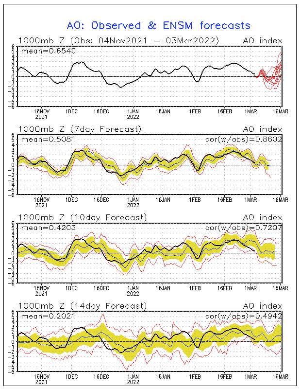
Seems like the AO wants to take another dip around that time frame as well.

ao.sprd2.gif
 
12z cmc tried to move moisture in next Thursday Friday like the Euro. But the cmc shoots the high offshore pretty quickly while the Euro keeps the cold around for longer

Sent from my SM-J320VPP using Tapatalk
 
Looks like the GFS is breaking image.png a little piece of energy off of the NS down into the southeast. CMC also has it but it drops it over Virginia

Edit: GFS also has a 1030 HP parked in South Georgia which is killing us
 
Last edited:
Hmmm the GFS is showing something very weird over the Greenland area in the 180hr+ range. I don't know what that is, but it's interesting.
 
Hmmm the GFS is showing something very weird over the Greenland area in the 180hr+ range. I don't know what that is, but it's interesting.
Euro has the same idea which really slows down the flow keeping the colder air in place longer . That's how the euro kept the southeast cold long enough on the 00z run for that winter storm

12z gfs
00z Euro
78cf4868d67e838feafcd55cd3fb52f0.jpg
c443a42b16aef4381c158154140b44cc.jpg


Sent from my SM-J320VPP using Tapatalk
 
CMC was actually really close to something on the 19th. Send me a little clipper action into the Apps and I'll be happy. I will be at the Indian Casino that weekend
 
Euro has the same idea which really slows down the flow keeping the colder air in place longer . That's how the euro kept the southeast cold long enough on the 00z run for that winter storm

12z gfs
00z Euro
78cf4868d67e838feafcd55cd3fb52f0.jpg
c443a42b16aef4381c158154140b44cc.jpg


Sent from my SM-J320VPP using Tapatalk

Makes it even more interesting. When the GFS was posted above, I said to myself there is only one way that look would lead to a snow storm and that one way is what it's showing. Been a long time.
 
Thing is, will that even verify even with the Euro? I'm worried it won't. Something just tells me we might get screwed again.
 
Thing is, will that even verify even with the Euro? I'm worried it won't. Something just tells me we might get screwed again.
I’ll never in my life trust a model again, even 3 days out. I use to think If you were within 3/4 days you just had to worry about it shifting around some or getting a little weaker/stronger but no even 3 days out it’s bad.
 
I’ll never in my life trust a model again, even 3 days out. I use to think If you were within 3/4 days you just had to worry about it shifting around some or getting a little weaker/stronger but no even 3 days out it’s bad.
Can the models be bad ? Yes, but they are just one tool used to make a forecast . I think In the southeast it's the unrealistic expectations that make it seem like the models are busting all the time when in reality it's people forgetting we live in the southeast . Let's be real winter weather is rare in the southeast and SOOOO many thing have to come together for systems to work out. I think people see systems on the models and just assume it's logical without really understanding how the model got to thst conclusion in the first . Many times you can look at 500mb and then the surface output and realize the two don't match up. But i think it all starts with the unrealistic expectations
 
I have been saying I wouldn't be surprised to see something happening wintry here the end of next week since we're going to be so warm tomorrow. It seems for whatever reason we get a good shot at winter weather here about 7 to 10 days after hitting near 70 in winter. Maybe the rubber band snapping back.
 
Can the models be bad ? Yes, but they are just one tool used to make a forecast . I think In the southeast it's the unrealistic expectations that make it seem like the models are busting all the time when in reality it's people forgetting we live in the southeast . Let's be real winter weather is rare in the southeast and SOOOO many thing have to come together for systems to work out. I think people see systems on the models and just assume it's logical without really understanding how the model got to thst conclusion in the first . Many times you can look at 500mb and then the surface output and realize the two don't match up. But i think it all starts with the unrealistic expectations
to add to that I think people attach themselves to all the solutions the models show bringing snow while not giving just as much weight to those that don't. If I see 25/51 ensemble members on the Euro showing me getting measurable snow at HR 120 that is a huge signal for a storm, yet still statistically only 50% chance taken verbatim.
 
Can the models be bad ? Yes, but they are just one tool used to make a forecast . I think In the southeast it's the unrealistic expectations that make it seem like the models are busting all the time when in reality it's people forgetting we live in the southeast . Let's be real winter weather is rare in the southeast and SOOOO many thing have to come together for systems to work out. I think people see systems on the models and just assume it's logical without really understanding how the model got to thst conclusion in the first . Many times you can look at 500mb and then the surface output and realize the two don't match up. But i think it all starts with the unrealistic expectations
It happens everywhere. Cantore was in Minneapolis this morning and he said they were origianally forecast to get 8-12, lowered to 5-7, then 2-4, now will end up with less than an inch.
 
It happens everywhere. Cantore was in Minneapolis this morning and he said they were origianally forecast to get 8-12, lowered to 5-7, then 2-4, now will end up with less than an inch.
Sure it happens everywhere but again , winter weather isn't that common in the southeast so expectations are crazy unrealistic down here . Up there they are happy when systems bust . I lived in Michigan for 4 years . People love it when systems bust

Sent from my SM-J320VPP using Tapatalk
 
Back
Top