• Hello, please take a minute to check out our awesome content, contributed by the wonderful members of our community. We hope you'll add your own thoughts and opinions by making a free account!

Pattern Outside of the SE thread

My forecast for Christmas Day keeps going down. A few days ago we were going to be in the 60's.

View attachment 179663

I guess it's come down slightly for highs(still records though) here only because apparently we have humidity moving in haha. There was moisture all over the place this morning

The morning lows are gonna be more ridiculous yeah and how long it lasts Screenshot_20251223-100505.The Weather Channel.png
 
For the upcoming anticipated heavy NYC snow starting later today: The NAMs at 12Z came back S and we’re back to all models showing a heavy hit there. The Euro suite has been on top of this for a number of days.

The NWS is now going 6-10” in Manhattan/Bronx and 4-8” for Queens, Brooklyn, and Staten Island. It’s not too often that Manhattan is forecasted to both have that much and also the most. The last time Central Park got 6”+ in a single storm was nearly 4 years ago, 1/28-9/2022, when they got 8.5”. So, it’s been awhile.

Dec NYC snowfall of 4”+ in La Niña is a positive indicator for snowfall during the rest of winter there.

NEW YORK (MANHATTAN)-
149 AM EST FRI DEC 26 2025

...WINTER STORM WARNING REMAINS IN EFFECT FROM 4 PM THIS
AFTERNOON TO 1 PM EST SATURDAY...

TODAY
PARTLY SUNNY THIS MORNING, THEN CLOUDY WITH SNOW LIKELY
THIS AFTERNOON. SNOW ACCUMULATION AROUND AN INCH. COOLER WITH
HIGHS IN THE LOWER 30S. NORTH WINDS 5 TO 10 MPH, BECOMING
NORTHEAST THIS AFTERNOON. CHANCE OF SNOW 60 PERCENT.

TONIGHT
SNOW. SNOW MAY BE HEAVY AT TIMES IN THE EVENING. TOTAL
SNOW ACCUMULATION OF 6 TO 10 INCHES. LOWS IN THE MID 20S. EAST
WINDS 5 TO 10 MPH. GUSTS UP TO 20 MPH AFTER MIDNIGHT. CHANCE OF
SNOW NEAR 100 PERCENT.

SATURDAY
MOSTLY CLOUDY. A CHANCE OF SNOW IN THE MORNING. HIGHS
IN THE LOWER 30S. NORTHEAST WINDS 10 TO 15 MPH. CHANCE OF SNOW
40 PERCENT.
 
Storm could bring New York City its biggest snow since 2022 according to this article

The forecast isnt even over 6 inches haha
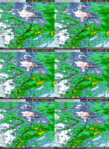
That NYC storm is busting big time for them, between much more dry slotting and the warm nose penetrating further NE than expected (poor ratios & sleet). There are meltdowns galore right now over at AmWx.
 
It’s busting vs the high expectations but it’s just snow we’re talking about, not the end of the world. What’s the big deal? And they got some, which is their second snow of a month that typically doesn’t get much.
Also, other areas covered by that forum got a lot like what Brent posted.

Some ocean effect is falling!

In addition, radar has filled in nicely with showery echos as I earlier said. So, not done by any means:
IMG_6541.gif
 
Local Mets calling for a dusting to 1/2” for most of Iowa!!?? I smell a bust! IMG_4106.pngIMG_4107.pngIMG_4108.png
 
Snow should be picking up about now in NYC per radar and last for at least 2 hours. There’s some pretty impressive echos.

Rough estimate for Central Park so far is 2”+. A total of 3-4” is possible.
 
And they got some, which is their second snow of a month that typically doesn’t get much.

NYC average 5" in December, which is nothing to sneeze at. It's certainly more than all of us in the South will ever see most years.
 
Snow should be picking up about now in NYC per radar and last for at least 2 hours. There’s some pretty impressive echos.

Rough estimate for Central Park so far is 2”+. A total of 3-4” is possible.

C Pk has 4.3” as of 7AM on 0.49” liquid
La Guardia/JFK 4.1”
Islip 6.6”
Newark 4.2”

So, all NYC area official reports >4”. So, this was not a bad bust at all. Overall totals were on the low end of the range and the highest C Pk fcast was 6” min. though others had a 4” min.

C Pk is now up to 7.2” month to date, making it the snowiest month since Jan ‘22. In addition, this month is headed to ~5 BN, the first any month will end up that far BN since Mar of 2015!
 
Back
Top