Ryan87NC
Member
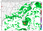
What do the ensembles look like?AI joins the GFS showing nothing
View attachment 173729
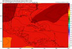
Euro alot less active. Just 1 weak low.
View attachment 173732
To be honest i never look at themWhat do the ensembles look like?
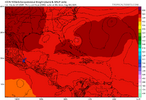
High, not ideal
360hr tropical tidbits outputs, the occasional 600hr CFS, and the occasional X post from Big Joe are all you look at.To be honest i never look at them
That one is 336 hours. Getting close to when it matters.
I cant see anything on the latest GFS or EURO.0Z UKMET fwiw has TCG/a TD at 168 in the far NW Bahamas:
NEW TROPICAL CYCLONE FORECAST TO DEVELOP AFTER 168 HOURS
FORECAST POSITION AT T+168 : 26.9N 78.3W
LEAD CENTRAL MAXIMUM WIND
VERIFYING TIME TIME POSITION PRESSURE (MB) SPEED (KNOTS)
-------------- ---- -------- ------------- -------------
0000UTC 06.08.2025 168 26.9N 78.3W 1014 27
I’m getting slightly concerned with this as it’s coming from a currently active AEW that’s now in the E ATL based on what I’m seeing on the 0Z and earlier runs of the UKMET. The 0Z has this AEW move WNW to the N Leewards at 96. It becomes a TD at 168 in the far NW Bahamas recurving NNW around a strengthening Bermuda high and threatening the SE US mid to late next week with no sharp upper trough to allow a sharp enough recurve to protect the coast:
I looked back and found a WNW moving distinct disturbance from this same E ATL AEW as far back as the 0Z 7/27 UKMET run.
I cant see anything on the latest GFS or EURO.


It would not take a major system to break the drought we are going into though. A storm like Hanna in 2002 or Beryl in 1994 would do it and neither of them hit hurricane strength. Beryl was a serious tornado maker though, but I don't think Hanna was. You are right about Helene and Michael though. We do NOT need storms like those 2.I'll definitely be surprised if there isn't a homegrown threat or two in the coming months, but if you're curious if I'm interested, the answer is absolutely not.
I'll pass on a Helene and even a Michael, the latter of which was just a bad, but not disastrous storm here (but would be a disaster for south GA, which has had to deal with 2 major hurricane problems in the past 7 years, apparently they had just finished up cleaning up in Albany/Valdosta from Michael when Helene struck).
Would a cream pie to the face be ok?Though 8/4-10 dropped due to no support likely partially related to little support for the current MDR AEW, today’s Euro Weeklies are slightly more ominous than yesterday’s for August’s ACE as a whole:
% of 2005-24 averages:
8/4-10: 80% (slightly lower than yest.)
8/11-17: 190% (slightly higher than yest.)
8/18-24: 210% (much higher than yest.)
8/25-31: 110% (same as yest.)
Taken as a whole, these probably imply a prog of ~38 ACE for next month fwiw. Please don’t shoot the innocent messenger! Of course lexx won’t shoot me lol.
