• Hello, please take a minute to check out our awesome content, contributed by the wonderful members of our community. We hope you'll add your own thoughts and opinions by making a free account!

Tropical 2025 Tropical Thread

August ACE forecast: Today’s Euro Weeklies vs yesterday’s (using 2005-24 base)

8/4-10: 0.9 vs 0.8
8/11-17: 1.5 vs 1.9
8/18-24: 1.6 vs 2.1
8/25-31: 1.2 vs 1.1

Overall, I’d call this slightly less active than yesterday’s run but still a good bit more active than 2005-24 average ACE for August as a whole.
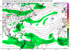
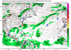
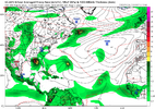
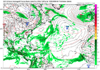
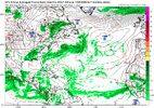
GFS and EURO have basically nothing thru mid-AUG. Is the MJO still coming?
 
Update

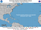
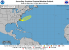
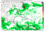
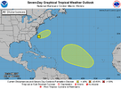
I would expect things will pick up after August 15th like they usually do....don't know why anyone is surprised it's dead right now. Heck in 2022 we had zero storms mid July to September lol and Ian was almost in October so just take a break til thentwo_atl_7d0 (23).png
 
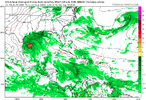
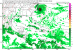
Im not sure if this is the same TD the ukmet was showing

View attachment 173785

It’s from the same front. GFS also has it.

0Z UKMET

NEW TROPICAL CYCLONE FORECAST TO DEVELOP AFTER 36 HOURS
FORECAST POSITION AT T+ 36 : 33.2N 77.1W

LEAD CENTRAL MAXIMUM WIND
VERIFYING TIME TIME POSITION PRESSURE (MB) SPEED (KNOTS)
-------------- ---- -------- ------------- -------------
1200UTC 02.08.2025 36 33.2N 77.1W 1015 31
0000UTC 03.08.2025 48 32.9N 75.5W 1010 33
1200UTC 03.08.2025 60 33.1N 73.4W 1009 35
0000UTC 04.08.2025 72 33.9N 72.2W 1009 26
1200UTC 04.08.2025 84 34.9N 71.4W 1010 27
0000UTC 05.08.2025 96 35.5N 69.9W 1012 24
1200UTC 05.08.2025 108 35.7N 68.2W 1015 25
0000UTC 06.08.2025 120 35.8N 66.8W 1016 23
1200UTC 06.08.2025 132 36.6N 65.4W 1017 28
0000UTC 07.08.2025 144 CEASED TRACKING

NEW TROPICAL CYCLONE FORECAST TO DEVELOP AFTER 168 HOURS
FORECAST POSITION AT T+168 : 36.0N 63.8W
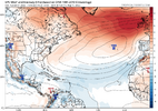
Models off and on show something

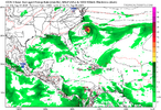
1754065938312.png
 
For the first time this season, the latest UKMET (12Z) has a TC in the MDR (moving WNW):

NEW TROPICAL CYCLONE FORECAST TO DEVELOP AFTER 120 HOURS
FORECAST POSITION AT T+120 : 10.3N 40.8W

LEAD CENTRAL MAXIMUM WIND
VERIFYING TIME TIME POSITION PRESSURE (MB) SPEED (KNOTS)
-------------- ---- -------- ------------- -------------
1200UTC 06.08.2025 120 10.3N 40.8W 1013 25
0000UTC 07.08.2025 132 11.4N 42.4W 1012 25
1200UTC 07.08.2025 144 13.0N 44.1W 1012 26
0000UTC 08.08.2025 156 14.8N 46.7W 1012 28
1200UTC 08.08.2025 168 16.1N 50.7W 1011 27
 
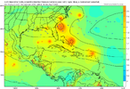
Based loosely on the 12Z Euro/UKMET/GEFS, the 6Z/0Z GEFS, the 0Z EPS, yesterday’s Euro Weeklies, and the forecasted MJO, it appears to me that there’s a somewhat enhanced chance of a TS/H threat around the NE Caribbean ~8/9-10, around the Bahamas/FL ~8/12-13, and either the US Gulf coast or the US E coast ~8/14-16. This isn’t an explicit forecast but rather just notable hints of what may be to come for those areas.
 
Based loosely on the 12Z Euro/UKMET/GEFS, the 6Z/0Z GEFS, the 0Z EPS, yesterday’s Euro Weeklies, and the forecasted MJO, it appears to me that there’s a somewhat enhanced chance of a TS/H threat around the NE Caribbean ~8/9-10, around the Bahamas/FL ~8/12-13, and either the US Gulf coast or the US E coast ~8/14-16. This isn’t an explicit forecast but rather just notable hints of what may be to come for those areas.

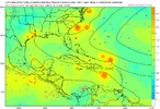
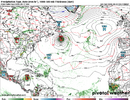
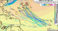
Followup for same AEW: 12Z EPS is somewhat ominous/more active for the Bahamas/CONUS during Aug 12-16. *Potential* mid August threat from NE Caribbean to CONUS as it appears now:

IMG_4219.png

*Edit: I’m counting a whopping 50% of 12Z EPS members with a TC from this one AEW. That’s quite high for this far out for the often rather conservative EPS. In addition, there are 5 TC members from the followup AEW threatening the NE Caribbean to Bahamas.

Edit: The new Euro Weeklies are notably active again for mid to late August.
 
Last edited:
Back
Top