• Hello, please take a minute to check out our awesome content, contributed by the wonderful members of our community. We hope you'll add your own thoughts and opinions by making a free account!

Pattern FEB 3-6 2024 System

Status
Not open for further replies.
Enjoyed tracking this one with everyone. Great insights provided by many, including you.
Thanks ! Yep, with each fail (and rarely win) we all get better and improve observations going in depth on what can provide a setup and what can kill a setup, and how the smallest things at H5 can have big implications, each time it’s a learning experience ! And it’s been better doing it with others. Not really upset about this one honestly, it’s nothing like the sting felt by the January fail
 
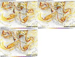
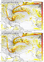
we probably have a model suite or two left in the clip to see if anything changes. the trough in question began landfalling in Cali last night and was sampled in 00z (bad) but it's a huge system and there's still a lot that has to come ashore (verdict still out) if you want to play the sampling card

a weaker, more strung out system will be faster, full stop. meteorological fact. i don't think it's getting squashed by the northern vort because previous model iterations like that electric 00z icon a few nights ago showed a constructive interference was possible. by the end, ok, there's an argument that it gets squashed because the ull goes into cuba and that is rare and needs a lot to line up for it to happen. but it leaking south and being weaker in the first place is allowing that to happen. take the northern depiction of yesterday's 00z gfs coupled with the ull strength/location of yesterday's 12z gfs and this thread could be 12 pages longer.

no reason to expect the weaker trend to stop this round though. i'd be pleasantly surprised if it did. thems the breaks.

edit: 12z nam might be strengthening and slowing the ull if you want a shred of hope, if you're into that kind of thing ?‍?
If it has been in a poorly sampled area, it's not too far fetched to think it could be stronger. That said, we need more than sampling to help us here.

Also, on a related note, referencing the Jan 2000 system as the benchmark example of how models miss wide right isn't really the ray of hope it seems like it is, 25 years later. It wasn't as simple as the models missing the timing on phasing a well modeled northern stream wave with a southern stream wave. It was a miss on smaller scale processes that led to rapid cyclogenesis closer to the coast. Also, models are much better now, so a miss of that magnitude in that short time scale may not even be possible now...a point that has been made.

Anyway, there is still hope here, although it hangs by a thread.
I am almost convinced surprises like that cant happen anymore. I can remember one off the top of my head(February 2014) where something turned up out of nothing.
 
we probably have a model suite or two left in the clip to see if anything changes. the trough in question began landfalling in Cali last night and was sampled in 00z (bad) but it's a huge system and there's still a lot that has to come ashore (verdict still out) if you want to play the sampling card

a weaker, more strung out system will be faster, full stop. meteorological fact. i don't think it's getting squashed by the northern vort because previous model iterations like that electric 00z icon a few nights ago showed a constructive interference was possible. by the end, ok, there's an argument that it gets squashed because the ull goes into cuba and that is rare and needs a lot to line up for it to happen. but it leaking south and being weaker in the first place is allowing that to happen. take the northern depiction of yesterday's 00z gfs coupled with the ull strength/location of yesterday's 12z gfs and this thread could be 12 pages longer.

no reason to expect the weaker trend to stop this round though. i'd be pleasantly surprised if it did. thems the breaks.

edit: 12z nam might be strengthening and slowing the ull if you want a shred of hope, if you're into that kind of thing ?‍?
Great post
 
I am almost convinced surprises like that cant happen anymore. I can remember one off the top of my head(February 2014) where something turned up out of nothing.
Feb 14th Popped up on the 84hr NAM as a Murphy - Manteo right? then was just consistent on and on until that weds i believe. Sorry didnt know how to respond to this in another thread?
 
Feb 14th Popped up on the 84hr NAM as a Murphy - Manteo right? then was just consistent on and on until that weds i believe. Sorry didnt know how to respond to this in another thread?
Oh I mean the snow before the big one in 2014. It was mostly Charlotte and south - we ended up with about an inch to inch and a half in midtown charlotte
 
I am almost convinced surprises like that cant happen anymore. I can remember one off the top of my head(February 2014) where something turned up out of nothing.
I had to check but I think you’re referring to 2/24/2015. There was a small system that gave pretty much all of NC 1-4” of snow and it was completely missed in the forecast up to the night before. I remember going onto AmericanWX for discussion about the storm that was coming for the 25-26th and seeing everyone talk about what the NAM and SREF were starting to put out over the next 24 hours and I was confused until I pulled the models up. Local TV mets here, nor GSP bit on it by 11pm news. Then I got woke up by a phone call at 5am saying Union County Schools were on a 2-hour delay due to light snow and looked outside to see the ground and the street already white… so that was a miss on a small scale. I can’t imagine though there ever being another miss on the scale of January 2000 when many areas saw the biggest storm they’ve seen over the last 70 years and were not even forecasted a flake 24 hours earlier
 
Oh I mean the snow before the big one in 2014. It was mostly Charlotte and south - we ended up with about an inch to inch and a half in midtown charlotte
Oh I saw this after my post about 2/24/2015.. you’re correct 2/11/2014 did end up being a bigger deal for areas across southern and eastern NC and northern SC than was expected. I was forecast to get around 1” from that but instead got 3.5”… the first of three straight days with 3” or more of daytime snowfall.
 
I had to check but I think you’re referring to 2/24/2015. There was a small system that gave pretty much all of NC 1-4” of snow and it was completely missed in the forecast up to the night before. I remember going onto AmericanWX for discussion about the storm that was coming for the 25-26th and seeing everyone talk about what the NAM and SREF were starting to put out over the next 24 hours and I was confused until I pulled the models up. Local TV mets here, nor GSP bit on it by 11pm news. Then I got woke up by a phone call at 5am saying Union County Schools were on a 2-hour delay due to light snow and looked outside to see the ground and the street already white… so that was a miss on a small scale. I can’t imagine though there ever being another miss on the scale of January 2000 when many areas saw the biggest storm they’ve seen over the last 70 years and were not even forecasted a flake 24 hours earlier
I do remember that one too - the one time I told myself I'd never drive to work in the snow again
 
I do remember that one too - the one time I told myself I'd never drive to work in the snow again
I had a meeting for work scheduled in Sanford that day and had to rush to get ready so that I could leave early and give myself extra time. Then of course once I got halfway there, I got a phone call saying the meeting was cancelled
 
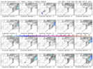
I said it a few days ago.....someone is going to get a surprise out of the ULL cold with all the moisture that is going to be hanging around. I really like the area from Huntsville to Chattanooga to Atlanta if this occurs. Ive seen a few members of the globals showing this here and there....It would be like betting on the Lions to win the Super Bowl next week......slim chance, but WTH, Im in!!
 
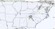
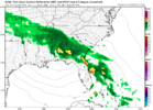
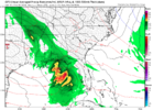
Way offshore now.

gfs_mslp_pcpn_frzn_us_20.png
 
Status
Not open for further replies.
Back
Top