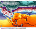
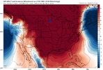
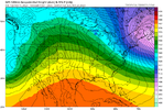
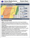
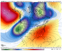
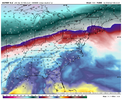
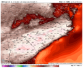
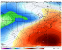
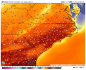
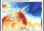
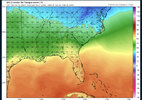
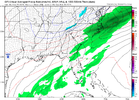
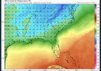
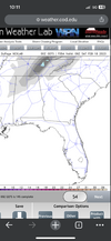
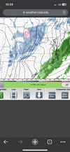
Looks like there is plenty of cold air. Just need a mechanism (-NAO) to get it intrenched in our area. But we really need this to happen soon. I would think this 10-16 day period (fantasy or not) is our last real chance for a board wide storm.Sure the 06z GFS spits out a fantasy storm that won’t verify but at least you can see the power of a -NAO and how rare it is.
Sent from my iPhone using Tapatalk
-
Hello, please take a minute to check out our awesome content, contributed by the wonderful members of our community. We hope you'll add your own thoughts and opinions by making a free account!
You are using an out of date browser. It may not display this or other websites correctly.
You should upgrade or use an alternative browser.
You should upgrade or use an alternative browser.
Pattern Fail or Fab February 2023 Pattern Thread
- Thread starter RBR71
- Start date
The fact that there is plenty of cold air available is a good sign in that you don’t necessarily need a +PNA and tall western ridge to tap into it. If we can get some help from the NAO it would be nice or just get some good TPV. As for a board wide storm, I think that ship has sailed and south of I-20 and probably south of I-40 is out of the gameLooks like there is plenty of cold air. Just need a mechanism (-NAO) to get it intrenched in our area. But we really need this to happen soon. I would think this 10-16 day period (fantasy or not) is our last real chance for a board wide storm.
We’ve got a 40+ degree swing between Thursday’s highs and Friday’s lows
- Joined
- Jan 23, 2021
- Messages
- 4,602
- Reaction score
- 15,197
- Location
- Lebanon Township, Durham County NC
We are going to be on a very fine line between very warm and stuck in CAD. CMC shows this well but also the gfs has high pressures parading through as well.
- Joined
- Jan 23, 2021
- Messages
- 4,602
- Reaction score
- 15,197
- Location
- Lebanon Township, Durham County NC
Canadian gives us a sleet storm from what appears to be a clipper on D9. Cant say I've seen that before.
That’s a new one. A clipper that strong enough to bring precip east of the mountains should have plenty of cold air aloftCanadian gives us a sleet storm from what appears to be a clipper on D9. Cant say I've seen that before.
You get a 50/50 low like currently modeled you're going to see a good CAD pattern. Whether it produces winter precip or not is another thing.
iGRXY
Member
SSWE take 3-4 weeks to truly have an impact on the pattern so we likely have about 7-10 days to score some type of winter weather. But if you think you're about to get that warm Spring boy do I have some bad news for you. MJO favorability will help the Pacific go from a disaster to likely more neutral or at least stay above -1 sigma. SSWE helps the Atlantic with high latitude blocking so right now that's favorable, but we are likely going to be stuck in a -PNA/-NAO pattern which means get ready for the CAD and more rain come March and April like usual.
We always talk about potentially wasting a good winter pattern during early periods when we aren't in the heart of winter, well the same can be said for spring time patterns. We have continued to waste H5 patterns that support spring warm ups and severe weather in February before switching back to below average temps and more of a winter time pattern with a -NAO constantly showing up in March-May. This year looks no different TBH. I have a pretty high confidence that everyone in the Carolinas and Georgia outside of the Mountains probably are getting blanked when it comes to snow.
The only perk is that we have legit cold air on our side so getting a nice TPV trapped under the Greenland block is very possible, but that just seems to mean an even colder rain than we are accustomed to in March and April. If we do get something frozen, it is really going to favor ZR/Sleet as the winter airmasses are going to begin to moderate more and more so even if we get a nice piece of TPV trapped under the block it will likely only be cold enough to support a mix bag of stuff vs straight snow.
olhausen
Member
Drizzle Snizzle
Member
It's almost impossible to get Freezing Rain in March or April. Almost every time there's winter precip in March or April it's snow.SSWE take 3-4 weeks to truly have an impact on the pattern so we likely have about 7-10 days to score some type of winter weather. But if you think you're about to get that warm Spring boy do I have some bad news for you. MJO favorability will help the Pacific go from a disaster to likely more neutral or at least stay above -1 sigma. SSWE helps the Atlantic with high latitude blocking so right now that's favorable, but we are likely going to be stuck in a -PNA/-NAO pattern which means get ready for the CAD and more rain come March and April like usual.
We always talk about potentially wasting a good winter pattern during early periods when we aren't in the heart of winter, well the same can be said for spring time patterns. We have continued to waste H5 patterns that support spring warm ups and severe weather in February before switching back to below average temps and more of a winter time pattern with a -NAO constantly showing up in March-May. This year looks no different TBH. I have a pretty high confidence that everyone in the Carolinas and Georgia outside of the Mountains probably are getting blanked when it comes to snow.
The only perk is that we have legit cold air on our side so getting a nice TPV trapped under the Greenland block is very possible, but that just seems to mean an even colder rain than we are accustomed to in March and April. If we do get something frozen, it is really going to favor ZR/Sleet as the winter airmasses are going to begin to moderate more and more so even if we get a nice piece of TPV trapped under the block it will likely only be cold enough to support a mix bag of stuff vs straight snow.
If the strat pv totally breaks over the next 2 weeks spring will be spring early April. Any high lat blocking should start to dissolve by then and the mjo should be moving into the warmer phases. The last few years have seen a later pv breakdown which led to us being cold later but we should hopefully move that timeline up this year.SSWE take 3-4 weeks to truly have an impact on the pattern so we likely have about 7-10 days to score some type of winter weather. But if you think you're about to get that warm Spring boy do I have some bad news for you. MJO favorability will help the Pacific go from a disaster to likely more neutral or at least stay above -1 sigma. SSWE helps the Atlantic with high latitude blocking so right now that's favorable, but we are likely going to be stuck in a -PNA/-NAO pattern which means get ready for the CAD and more rain come March and April like usual.
We always talk about potentially wasting a good winter pattern during early periods when we aren't in the heart of winter, well the same can be said for spring time patterns. We have continued to waste H5 patterns that support spring warm ups and severe weather in February before switching back to below average temps and more of a winter time pattern with a -NAO constantly showing up in March-May. This year looks no different TBH. I have a pretty high confidence that everyone in the Carolinas and Georgia outside of the Mountains probably are getting blanked when it comes to snow.
The only perk is that we have legit cold air on our side so getting a nice TPV trapped under the Greenland block is very possible, but that just seems to mean an even colder rain than we are accustomed to in March and April. If we do get something frozen, it is really going to favor ZR/Sleet as the winter airmasses are going to begin to moderate more and more so even if we get a nice piece of TPV trapped under the block it will likely only be cold enough to support a mix bag of stuff vs straight snow.
As for snow I wouldn't write it off but the cards are just about on the table that we will see any supportive Atlantic muted by a bad pacific. The are occasional blips from run to run where the models want to rex the pacific. That's great if you want to make a run at a cold potential snow pattern but historically they typically trend progressive. I'm personally not off the snow chance rain for mby I think any nao action gets the I40 corridor in the game but the 20 to 40 corridor needs more help. Ultimately we may just end up extending the pattern out with dual troughs in the west and in the 50/50 region with a sharp gradient pattern across the conus with a wedge in the Carolinas. Pretty mediocre
NBAcentel
Member
ATLwxfan
Member
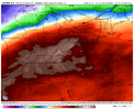
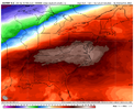
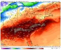
That was a really really warm euro run, about as classic as a look for record warmth your gonna get, 850s approaching 15+C which is favorable for upper 70s/low 80s, that’s some great weather can’t be any more happier with this View attachment 133246View attachment 133247View attachment 133248View attachment 133249View attachment 133250
I’m all in. Negative PNA delivering. Should have some beautiful sunny late spring weather for many and accelerating the early blooms and leafing. Judah Cohen joked in his blog about the permanent feature the SER plays in our weather.
Sent from my iPhone using Tapatalk
ATLwxfan
Member
GEFS also showing quite a bit of warming over Canada as we get into the beginning of March which should put a damper on any hope for wintery weather. Could change of course.
Sent from my iPhone using Tapatalk
Sent from my iPhone using Tapatalk
NBAcentel
Member
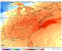
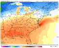
Subseasonal forecasting has truly made long range forecasting much easier, the jig was up it looked like forcing was returning to the MC/lowering AAM (-)/big -EAMT event back in mid jan that helped start the retraction of the pacific jet in the last few weeks of January. The maritime MJO pulse was the nail in the coffin and is still present, which is gonna be a big driver to this warmer pattern. as said in mid jan by me and some others, the signs of a really really warm Feb was there, with a lack of snow overall, other than an outside chance. 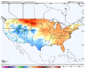


ATLwxfan
Member
Subseasonal forecasting has truly made long range forecasting much easier, the jig was up it looked like forcing was returning to the MC/lowering AAM (-)/big -EAMT event back in mid jan that helped start the retraction of the pacific jet in the last few weeks of January. The maritime MJO pulse was the nail in the coffin and is still present, which is gonna be a big driver to this warmer pattern. as said in mid jan by me and some others, the signs of a really really warm Feb was there, with a lack of snow overall, other than an outside chance. View attachment 133255View attachment 133256View attachment 133257
And that lack of snow has been the case for a very long time…

Sent from my iPhone using Tapatalk
NBAcentel
Member
NBAcentel
Member
Dang, still not below freezing on a Feb morning at 6am ??Man you can’t get better than this! ???View attachment 133264View attachment 133263
ATLwxfan
Member
The cold is transient though. The ridge still the dominant feature.
Sent from my iPhone using Tapatalk
Iceagewhereartthou
Member
That's a total poop show, I can find many looks better than that. That would be good for June or July. Here you go:Man you can’t get better then this ???View attachment 133260View attachment 133261View attachment 133262


These are at least seasonal. Keep it cool!
JHS
Member
Looks like the rain is shutting off too for some of us. Hopefully not the start of a 2-3 month period of little to no rain.
Was in Enochville today and I wish I'd taken pics of 2 of the most beautiful Bradford Pears..(though I hate these trees due to not being native etc etc..) was just shocked that they were in full bloom. Anyone else seeing Bradford's blooming in CLT area?
Makes sense that we've been in a la Nina so long that would skew those numbers making Texas have a surplus and further east is not so much Typical jet stream patterns during la Nina's.And that lack of snow has been the case for a very long time…

Sent from my iPhone using Tapatalk
ATLwxfan
Member
Take your SSWE and shove it…
Sent from my iPhone using Tapatalk
Sent from my iPhone using Tapatalk
Itryatgolf
Member
That's to be expected when a la niña happens is warmer than normal in south. Typically they are cooler in December, but it really wasn't other than the quick cold blast around Christmas. If we do get an El niño next winter, we don't want it east based because that promotes stronger stj but cold air again will be lacking. Interesting to see with a -qbo and El niño
Wow I’m 40 miles south of Enochville and mine haven’t bloomed yet. I fully expect the middle of next week for everything to start getting in full bloom as I’m convinced we could make a run at 80 on Wednesday. Looking at ensembles at the next couple weeks, I think we’re gonna see some pretty wild swings… especially in the CAD areas. There will be more warm days that’s cool, but I think the closer we get to March, CAD might become more prevalent…. Definitely would follow how we’ve seen things go the last several yearsWas in Enochville today and I wish I'd taken pics of 2 of the most beautiful Bradford Pears..(though I hate these trees due to not being native etc etc..) was just shocked that they were in full bloom. Anyone else seeing Bradford's blooming in CLT area?
Yeah… really the only good thing about an east based El Niño is that you don’t really torch as the stronger STJ keeps the SER muted. The strength of the El Niño is also important as a stronger one definitely favors warmer than average.That's to be expected when a la niña happens is warmer than normal in south. Typically they are cooler in December, but it really wasn't other than the quick cold blast around Christmas. If we do get an El niño next winter, we don't want it east based because that promotes stronger stj but cold air again will be lacking. Interesting to see with a -qbo and El niño
accu35
Member
It does seems like some leftover snow showers/moisture on the back side of this storm Friday morning for north Al and TN. Models been showing this consistently.
ATLwxfan
Member
Yeah… really the only good thing about an east based El Niño is that you don’t really torch as the stronger STJ keeps the SER muted. The strength of the El Niño is also important as a stronger one definitely favors warmer than average.
Lol so basically we will have this winter again.
Sent from my iPhone using Tapatalk
accu35
Member
Bingo!Lol so basically we will have this winter again.
Sent from my iPhone using Tapatalk
accu35
Member
LickWx
Member
First shot at 80 here today. NWS had 79 last night , 78 this morning. Do we do it? I hope so. Hit 81 on this day in 2018 for the record high and 27 for the record low max in 2015

