I honestly think I've got a better chance of seeing anything wintry mix wise tomorrow morning than Friday. HRRR is very close in the morning
-
Hello, please take a minute to check out our awesome content, contributed by the wonderful members of our community. We hope you'll add your own thoughts and opinions by making a free account!
You are using an out of date browser. It may not display this or other websites correctly.
You should upgrade or use an alternative browser.
You should upgrade or use an alternative browser.
Pattern Fail or Fab February 2023 Pattern Thread
- Thread starter RBR71
- Start date
Teach Lesley
Member
I think maybe the Euro looks interesting at h216.

It certainly has a strong system in this timeframe, probably a good severe setup followed by some backside wintry as it stands right now. Long way to go on this one but it's something at least in the LRI think maybe the Euro looks interesting at h216.
iGRXY
Member

If only this look was sub 150 hours
Not surprising as you get deeper into Feb and closer to March, these systems are gonna be juiced....

I think maybe the Euro looks interesting at h216.

Meh, why not..... Lol

Why is the euro the one giving us our fantasy storms nowadays ?
- Joined
- Jan 23, 2021
- Messages
- 4,604
- Reaction score
- 15,203
- Location
- Lebanon Township, Durham County NC
The Canadian version of the HRRR had that yesterday. It’s backed off though.I honestly think I've got a better chance of seeing anything wintry mix wise tomorrow morning than Friday. HRRR is very close in the morning
Mby begs to differ.Alabama the mud capital of the country.
My poor dogs r so tried of this rain.
- Joined
- Jan 23, 2021
- Messages
- 4,604
- Reaction score
- 15,203
- Location
- Lebanon Township, Durham County NC
So there’s five SREF members seeing something.
The thing is those members are all 3” or more.
The thing is those members are all 3” or more.
They all hinted at 2/11-2/14 storm on an off. cfs,gfs,canWhy is the euro the one giving us our fantasy storms nowadays ?
GEFS excited 2/11-2/14 period as well

EPS likes Mtns

EPS likes Mtns
coldfront22
Member
NCSNOW Wonder how we get a cold air source if the storm is there 2/11-2/14.


- Joined
- Jan 23, 2021
- Messages
- 4,604
- Reaction score
- 15,203
- Location
- Lebanon Township, Durham County NC
I have seen some noise in the valentines day period on the ensmbles periodically as well.

Been asking that question all winter and keep getting same answer lol.NCSNOW Wonder how we get a cold air source if the storm is there 2/11-2/14.
Only hope for this, assuming it did pop up is to Miller A, Deeping/bombogenesis, make its own and be on the NW side. Completely different than what we been chasing for the end of this week.
coldfront22
Member
No doubt NCSNOW. It will take one heck of a Miller A. Most long-range forecast are mid 50's to 60's at that time frame. Man, I hope the EURO is on to something.
NCHighCountryWX
Member
- Joined
- Dec 28, 2016
- Messages
- 700
- Reaction score
- 1,921
GSP comments
There is a precip-type wrinkle at the
highest elevations that develops by Thursday afternoon, perhaps
the result of dynamic cooling, whereby a nearly isothermal layer
is seen on fcst soundings above 5000 feet or so. It wouldn`t take
much to bring the snow level down to where we could see a changeover
to a heavy wet snow above 5k feet. Suspect it will be snow at the
summit of Mt Mitchell by the end of the daytime period. Elsewhere,
the extensive clouds, precip, and cool air mass will keep high
temps in the mid/upper 40s
- Joined
- Jan 23, 2021
- Messages
- 4,604
- Reaction score
- 15,203
- Location
- Lebanon Township, Durham County NC
Biggest thing I’ve noticed today is everything seems to be about six hours quicker on the NAM. If we could slow it down or get a NW trend(at this range very possible), I could see a more positive solution.
SWVAwxfan
Member

iGRXY
Member
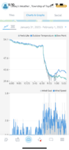
That wedge is serious. Went from 59 at lunch to 46 now
Snownut
Member
Still 64 over here on my side of the upstateThat wedge is serious. Went from 59 at lunch to 46 now
Sent from my SM-A526U using Tapatalk
NoSnowATL
Member
Looks like ATL on a avg afternoon drive home.Bad day to be driving around the metroplex.
Teach Lesley
Member
It'll be fun to watch Clemson crash here in a bit
- Joined
- Jan 23, 2021
- Messages
- 4,604
- Reaction score
- 15,203
- Location
- Lebanon Township, Durham County NC

When we tell y’all about how awful the 90s were in general, we mean it.
rburrel2
Member
I don't hate it.
No one? Alright here yah go .. 
rburrel2
Member
Gust front just blew through my yard 10 minutes ago.It'll be fun to watch Clemson crash here in a bitView attachment 131988
NBAcentel
Member


Rdu is BN on rain for the last 60 days hopefully we can get into a decent rain pattern
Last edited:
The 12z euro had this too around the same timeNo one? Alright here yah go .. View attachment 131991
43 here. No ice but at least I’m close enough to be fairly cold.
W
WSW
Guest
Damn those are some long stretches.View attachment 131989
When we tell y’all about how awful the 90s were in general, we mean it.
Listen there’s no stopping a bad “snow pattern” from being a bad snow pattern .. that’s what we’re in ?? but to see how we’ve come from long range into medium range the trend is for progressing troughs through the US .. this still gives us a fighting chance to get a needle in the haystack type of set up for winter precip on occasion. Basically a slop pattern of 60-70 degree days, 40-50 degree cad rain .. and the occasional cold plunge capable of producing winter precip given perfect timing of different pieces. It’s better than a pure wall to wall warm 70s in the heart of winter
Here’s the trends from long range to medium range for 500mb anomalies and 850 temp anomalies


but to see how we’ve come from long range into medium range the trend is for progressing troughs through the US .. this still gives us a fighting chance to get a needle in the haystack type of set up for winter precip on occasion. Basically a slop pattern of 60-70 degree days, 40-50 degree cad rain .. and the occasional cold plunge capable of producing winter precip given perfect timing of different pieces. It’s better than a pure wall to wall warm 70s in the heart of winter Here’s the trends from long range to medium range for 500mb anomalies and 850 temp anomalies
I count exactly 60 hours below average for Atlanta from today through 02/17.

Nobody told me about the 18z @metwannabe special? This one is the real deal. Take it to Wells Fargo and lock it in the bank security box because it’s yours. Easy 6-12”
Get Storm 5 to buy me a giant fan and I’ll blow all mine your way for the next three weeks…..Rdu is BN on rain for the last 60 days hopefully we can get into a decent rain pattern