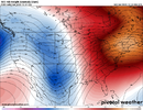
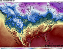
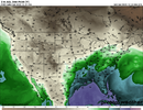
The most interesting thing to me about the first week of Jan on the eps is how nothing is extremely warm.
You must not have heard, Danny Dewpoint ordered xtra hot salsa
Sent from my iPhone using Tapatalk
The most interesting thing to me about the first week of Jan on the eps is how nothing is extremely warm.
Euro goes into the COD before it gets there. GFS takes a month to finally get back into P7.These look nice .. January thaw and then phase 8-1-2 MJO? Let’s ride View attachment 128334View attachment 128335
COD is good. Patience is key and trends are good. Thaw early January .. mid to late January we could be back in businessEuro goes into the COD before it gets there. GFS takes a month to finally get back into P7.
I have always understood the COD to mean that when the MJO registers that value, its impacts are negligible. I've always preferred it entering the COD after being in one of the better phases. In any case, someone said it before (I think it might have been you), and I agree, that the pattern has been variable. I'm not worried about a sustained torch pattern.COD is good. Patience is key and trends are good. Thaw early January .. mid to late January we could be back in business
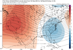
I agree we're looking at around the 10th before we see a shot another good pattern showing up. Then give it a week more for "delayed not denied" garb. Man thats pushing into the 3rd week of january. That's a little depressingLooks like that 2 week pattern change is holding true. I expect by the 10th we will be heading back to below normal. We will still be in peak climo for about another 10 days so still opportunities out there.
A reflection of the retraction/backing up of the pacific jet that’ll eventually happen ?Western ridge was going up at the end of the GEFS if it’s any consolation
Yep, should have a cold April.A reflection of the retraction that’ll eventually happen ?
It looks more like we’re shifting from a solid jet extension to an extension/poleward regime. Poleward regimes have the tendency to be very warm and flood the mid latitudes, hence the warmup. I don’t think we’ll see a retraction anytime soon to the point that we get a traditional La Niña Aleutian Ridge.It’s all about backing the pacific jet enough. When that happens we probably initially have slowed flow over the US, could maybe score in that, then western ridge and EC trough (could score in that) then enough retraction and -PNA/North Pacific ridge

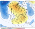
That’s kinda what I was saying and been saying for a while when I say that… i know we’re overextending the next week. I was saying we need to back up the jet eventually, like what the gefs shows, in order to improve the pattern.It looks more like we’re shifting from a solid jet extension to an extension/poleward regime. Poleward regimes have the tendency to be very warm and flood the mid latitudes, hence the warmup. I don’t think we’ll see a retraction anytime soon to the point that we get a traditional La Niña Aleutian Ridge.
Our favorability will come when the jet shifts back to where it is now. The GEFS looks warm at the moment, but you can see heights building over the Pacific Northwest to indicate where things are going around the 10th as the jet shifts more equatorial.
I’m currently working on some composites for the North Pacific Jet phases. I will post them when I’m done.
View attachment 128404
View attachment 128405
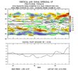
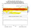
For ex, you can see on the gefs the pacific jet letting off the pressure hose, and backing off, which starts to turn the pattern around. It would help we moved a mjo wave into the west pacificThat’s kinda what I was saying and been saying for a while when I say that… i know we’re overextending the next week. I was saying we need to back up the jet eventually, like what the gefs shows, in order to improve the pattern.
Interesting in those NPAC jet phase composites.
At the end of the day we still have a La Niña background, we’re eventually gonna retract, likely in late jan/early Feb, it’s just bound to happen, maritime forcing is heavily favored in Nina’s mid-later on in winter. Reason for the overextension is to much deposition of +AAM into the pacific jet, +AAM finally resulting in consistent and heavy positive east Asia mountain torque View attachment 128408View attachment 128409
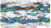
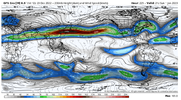
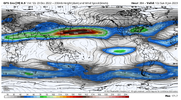
Let’s get this arctic blast again in late January.. maybe it’ll be colder so everyone in SC can enjoy it too!Nice +NAM showing up in the lower stratosphere early January.. looks like we’re not done wrt -AO in the longer range esp if any coupling occurs View attachment 128414
Nice +NAM showing up in the lower stratosphere early January.. looks like we’re not done wrt -AO in the longer range esp if any coupling occurs View attachment 128414
Let’s get this arctic blast again in late January.. maybe it’ll be colder so everyone in SC can enjoy it too!
We got a bad break with the position of the pna with this past -nao. Any shift west would have been golden for us especially teamed up with a pronounced -ao. Hopefully we can get a better setup for cold and snow sometime in JanuaryNice +NAM showing up in the lower stratosphere early January.. looks like we’re not done wrt -AO in the longer range esp if any coupling occurs View attachment 128414
That's how we roll in the Carolina's and Gerogia.What pisses me off is the last time we had an arctic outbreak this strong it never made it to the southeast, but Texas/Arkansas/Louisiana got wave after wave of overrunning precip. We finally get an equally strong arctic plunge and there isn’t crap for anything coming through on the southern edge.
Just read a local met FB post & he was saying it's not a matter of if we get this cold again but when in mid January


And just like that, the GEFS/EPS are showing the strat PV take a beating in early January thanks the the persistent NPAC low resulting from persistent +EAMT. I wouldn’t go as far as saying a SSWE, but the strat PV is getting stretched and taking one-twos hereYep, EPS drops another bout of high pressure into east Asia by day 10-11 (+EAMT) which extends the pac jet even more and pushes lower heights into the Bering sea-Alaska. This draws a Bering Sea/Alaskan vortex, which ultimately attacks the stratospheric polar vortex. EPS hinting at return of urals high end of the run. There’s a reason why 2021 had the SSWE, because this exact setup (Bering sea vortex) put constant strain on it weeks prior. Not really any signs of jet retraction in the future either as the weakening MJO wave traverses east and we continue to speed up the pac jet. Basically we’re gonna go for a strat attack the next couple of weeks ?View attachment 126743View attachment 126744
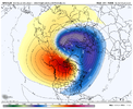
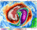
Yep I’m certainly not worried about not having at least one more period of good winter weather chances with what we’re seeing on the models. With it coming at our peak climo .. you can’t ask for much better than this.And just like that, the GEFS/EPS are showing the strat PV take a beating in early January thanks the the persistent NPAC low resulting from persistent +EAMT. I wouldn’t go as far as saying a SSWE, but the strat PV is getting stretched and taking one-twos here View attachment 128439View attachment 128440View attachment 128441
This is just about all we need. SSWs are great but annoying the pv and keeping the atmosphere from syncing up is good enoughAnd just like that, the GEFS/EPS are showing the strat PV take a beating in early January thanks the the persistent NPAC low resulting from persistent +EAMT. I wouldn’t go as far as saying a SSWE, but the strat PV is getting stretched and taking one-twos here View attachment 128439View attachment 128440View attachment 128441
Yep, I love reflection/stretching events, they do plenty of work themselvesThis is just about all we need. SSWs are great but annoying the pv and keeping the atmosphere from syncing up is good enough
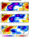
Starting to get more bullish on a solid cold period east of the Rockies to the Deep South from just before Christmas into the 1st week of January. I think we'll see modeling improve with that as we go thru next week. Excellent sequence shown on the EPS for +EAsiaMtnTorq with strong high moving into SE Asia (1st loop). This should combine with the tropical convective signal emerging into the WPac next week (2nd loop) to move us into a --EPO / +PNA look. In addition, this sequence during La Nina favors a continuation of the current generally negative AO / NAO regime (3rd image).
Yeah this period needs to be watched closely for a severe threat.Weenie thunderstorm pattern View attachment 128451
