HSVweather
Member
All clouds up here but seeing a few breaks on visible, notably back in MississippiStarting to get a few breaks in the cloud cover in Hoover.
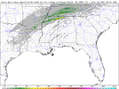
It still keeps the updraft swaths though, it's been consistent in a general idea of a boundary running supercell. Wouldn't be surprised if it shows back up like It was again. But idk interesting to watch. Oh wait it doesn't have the updraft swath on the 15z lol I thought it did.FWIW the 15z HRRR just took the storm away


That is pretty impressive there.Check out the updraft swath in north Alabama tho,
I still think there will be a long track decent supercell in the same vicinity as it's been showing especially if it's on a boundary with paramters that aren't half bad.@LukeBarrette View attachment 114179
It's a very good possibility too. That could produce a violent tornado in that atmosphere. Continue to watch trends.That is pretty impressive there.
It isn't good as it may allow for greater instability to build in. At the same time though there are countless other variables in play here it may have no impact as a whole. Generally speaking you would prefer it stay cloudy though.The sun just popped out here in Madison County. Is that bad?
Is that sounding from the northwest corner fo Alabama?Very impressive 0-3km Cape with values between 200-240. Regardless of tornado threat, any trigger will get Fro drooling over the pictures he could have taken.
View attachment 114183
Yes.Is that sounding from the northwest corner fo Alabama?
2 hours later it's still outThe sun just popped out here in Madison County. Is that bad?
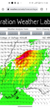
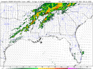
2 back to back strong rotations in north Alabama. Also still a decent signal at a stronger supercell in central Alabama.Hey @Arcc the 19z is back with the monster updraft swath in north Alabama same location same parameters. May see a big one later. View attachment 114202

It may be showing the possibility of cells forming on the rain cooled boundary across extreme NE Mississippi into NW Alabama.2 back to back strong rotations in north Alabama. Also still a decent signal at a stronger supercell in central Alabama. View attachment 114203

Probably what it's picking up on. Either way it's not good, with the parameters in play you could possibly have a violent tornado in that corridor. Nonetheless all eyes will be glued on coverage later. That boundary setting up isn't good. A similar type of boundary set up on April 27th with a cooled rain air mass and the warm moist air to the south. Hackleburg/ Phil Campbell tornado spawned from that. Not saying this will be like that. But boundaries are pretty bigIt may be showing the possibility of cells forming on the rain cooled boundary across extreme NE Mississippi into NW Alabama.
View attachment 114208
May have a rare occasion where the spc issues a mesoscale discussion for one cell lolProbably what it's picking up on. Either way it's not good, with the parameters in play you could possibly have a violent tornado in that corridor. Nonetheless all eyes will be glued on coverage later. That boundary setting up isn't good. A similar type of boundary set up on April 27th with a cooled rain air mass and the warm moist air to the south. Hackleburg/ Phil Campbell tornado spawned from that. Not saying this will be like that. But boundaries are pretty big
