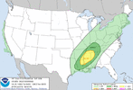
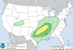
-
Hello, please take a minute to check out our awesome content, contributed by the wonderful members of our community. We hope you'll add your own thoughts and opinions by making a free account!
You are using an out of date browser. It may not display this or other websites correctly.
You should upgrade or use an alternative browser.
You should upgrade or use an alternative browser.
Severe Severe Threat 2/21-2/23
- Thread starter SD
- Start date
HSVweather
Member
For areas farther west (MS and west) this setup has better mid level lapse rates and a has a better signal for higher instability, low level lapse rates already look better on the globals
Z
Zander98al
Guest
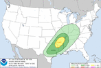
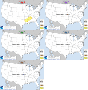
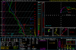
checking the NAM. that day 4 threat looks pretty good from what I can tell, less of a dry layer/warm layer. than the other threat more potential for higher instability. EHI is already pretty good, expect it to be bumped up a bit the closer we get, shear is not as high so not as good of chance for updrafts to be shredded. Lapse rates from the surface to 3km are pretty good along with the mid lapse rates. Only question I have is there any lift to push these storms into forming. Probably will have some confluence bands to initiate some convection but any higher threat your probably going to have to look for a boundary which will probably be somewhere in the northern extent of the threat area I'f I had to guess.sounding is actually pretty good in MS comparatively speaking. Loaded gun if anything can initiate convection.
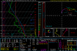

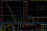
Now that is legit sounding.checking the NAM. that day 4 threat looks pretty good from what I can tell, less of a dry layer/warm layer. than the other threat more potential for higher instability. EHI is already pretty good, expect it to be bumped up a bit the closer we get, shear is not as high so not as good of chance for updrafts to be shredded. Lapse rates from the surface to 3km are pretty good along with the mid lapse rates. Only question I have is there any lift to push these storms into forming. Probably will have some confluence bands to initiate some convection but any higher threat your probably going to have to look for a boundary which will probably be somewhere in the northern extent of the threat area I'f I had to guess.sounding is actually pretty good in MS comparatively speaking. Loaded gun if anything can initiate convection.
View attachment 113944
Z
Zander98al
Guest
Typically we see a eastward shift with parameters too. Wouldn't be surprised if the best parameters end up near the Alabama Mississippi state line again. The SRH Helcity isn't screaming this go round, but I imagine it to will go up with CAMS, and with higher instability that'll offset some of the lacking shear.Now that is legit sounding.
May be a event where you see cells popping from peak heating in that southern MS area and track that typical Northeastward path.
Last edited by a moderator:
Z
Zander98al
Guest
Everything is pointing to a pretty decent setup over Mississippi into western portions of Alabama for Tuesday. High lapse rates, moderate shear and moderate instability question I got is the lift, might be a front pushing through there but all I got is a sounding from north Georgia in this dialup 4g LTE data in Georgia hard to really look at anything with this such slow internet. If anything peak heating and confluence bands will be enough to initiate some cells. Cips analogs guidance is really conservative on the setup. Really curious to see what the CAMS initiate in the warm sector if anything. Also wonder if your going to have a boundary just south of the MCS/rain mass feature that looks to preside over Tennessee that I had saw on the 12z run. If you had a strong cold front you'd probably be looking at some nasty supercells and accompanying tornadoes possibly.
Can't even upload the sounding I have ?
Can't even upload the sounding I have ?
Z
Zander98al
Guest
I'll take this setup over the last one honestly, if you get enough lift in a environment with both moderate shear and moderate instability with some good lapse rates youll get some spinning tops. In all likelihood the shear and instability will probably be underdone. If you get a good meshpoint and lift at the right time you'll have a pretty good environment.It’s a trade off to last system, lower confidence as well, better thermodynamics but kinematics are much lower then last setup, could go either way, this setup imo has a higher ceiling then the last but still doesn’t look like a big event View attachment 113961
Z
Zander98al
Guest
Scott81
Member
Where is this sounding from?View attachment 113962finnaly let me upload
Z
Zander98al
Guest
Northeast Mississippi. Took a closer look, storm mode is actually elevated or very close too it on that sounding.Where is this sounding from?
Z
Zander98al
Guest
Another thing I've noticed before, with these open low systems that have instability pushing up all the way to the north right on the front. benefit from backed winds with the deeper pressure falls sometimes when the system is deeping. Lines up well with the northern extent of the warm sector having a higher chance for severe weather.
Two issues I see there, one is you will have some lower dew points mixing down and definitely gonna need a trigger with that warm layer aloft.View attachment 113962finnaly let me upload
HSVweather
Member
HSVweather
Member
HSVweather
Member
Z
Zander98al
Guest
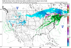
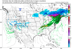
I'd almost say his target area is abit too far south, but then again that southern Mississippi area is usually your usual producer. Running a fine line between anything even forming, still stand by the best chances being in north MS but if you have a bit more lift best area would be that south MS area. NAM 3km and the FV3 simulated radar for around the 5 o'clock. The only two CAMS currently in range. FV3 shows scattered development in the northern MS range while the The 3km NAM shows very little returns. But again you almost always see a increase with time. Possibility of a pseduo front breaking from the MCS that's to the north is a definite potential to watch. your best potential is where you can get surface features on this day. (Confluence bands, peak heating, any boundary.) Won't know some of this till day of.
Z
Zander98al
Guest
I'll go out on a ledge hear and say models are probably a good bit under done on the moisture and heating like our previous last two events. Expect a hike when you get into that 1 or 1 & half day away range.
HSVweather
Member

