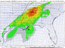
Wowzers this is coming from the nws bham discussion Tuesday afternoon through Sunday. Wouldn't be surprised for a enchanced in that northern Alabama region may see a very favorable area for tornadoes there.
Tuesday will be very warm across the region with a strong 500 mb
ridge covering the Gulf of Mexico and Bahamas. Meanwhile, a
low-amplitude shortwave trough will support a mid-latitude
cyclone moving from the Mid-Mississippi Valley to the Great Lakes.
A moderately strong low-level jet axis will extend southwestward
from the Ohio Valley to Mississippi and Alabama Tuesday afternoon.
Initially, a plume of steep mid-level lapse rates will be
associated with a warm nose and capping around 600 mb. Despite
neutral height tendencies and very little synoptic support,
scattered thunderstorm development will be supported by
significant moisture advection within a warm advection regime
across Northeast Mississippi and Northwest Alabama. CAPE profiles
appear quite support of robust updrafts with LI values reaching -6
in West Alabama. MLCAPE values of 1000-1400 J/kg and increasingly
large curved hodographs will be sufficient for supercell storms
beginning around 5 PM. A couple of tornadoes and isolated damaging
winds appear possible with these storms in our northwestern
counties through midnight before storms congeal into a slow-moving
line. As the approaching cold front becomes parallel with the
deep-layer flow, training thunderstorms could result in isolated
flash flooding with rainfall amounts of 2 to 3 inches.