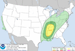
-
Hello, please take a minute to check out our awesome content, contributed by the wonderful members of our community. We hope you'll add your own thoughts and opinions by making a free account!
You are using an out of date browser. It may not display this or other websites correctly.
You should upgrade or use an alternative browser.
You should upgrade or use an alternative browser.
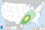
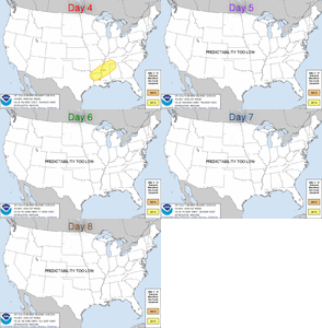
Severe Severe Threat 2/21-2/23
- Thread starter SD
- Start date
HSVweather
Member
NBAcentel
Member
For areas farther west (MS and west) this setup has better mid level lapse rates and a has a better signal for higher instability, low level lapse rates already look better on the globals
Z
Zander98al
Guest
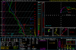
checking the NAM. that day 4 threat looks pretty good from what I can tell, less of a dry layer/warm layer. than the other threat more potential for higher instability. EHI is already pretty good, expect it to be bumped up a bit the closer we get, shear is not as high so not as good of chance for updrafts to be shredded. Lapse rates from the surface to 3km are pretty good along with the mid lapse rates. Only question I have is there any lift to push these storms into forming. Probably will have some confluence bands to initiate some convection but any higher threat your probably going to have to look for a boundary which will probably be somewhere in the northern extent of the threat area I'f I had to guess.sounding is actually pretty good in MS comparatively speaking. Loaded gun if anything can initiate convection.
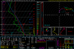

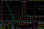
Now that is legit sounding.checking the NAM. that day 4 threat looks pretty good from what I can tell, less of a dry layer/warm layer. than the other threat more potential for higher instability. EHI is already pretty good, expect it to be bumped up a bit the closer we get, shear is not as high so not as good of chance for updrafts to be shredded. Lapse rates from the surface to 3km are pretty good along with the mid lapse rates. Only question I have is there any lift to push these storms into forming. Probably will have some confluence bands to initiate some convection but any higher threat your probably going to have to look for a boundary which will probably be somewhere in the northern extent of the threat area I'f I had to guess.sounding is actually pretty good in MS comparatively speaking. Loaded gun if anything can initiate convection.
View attachment 113944
Z
Zander98al
Guest
Typically we see a eastward shift with parameters too. Wouldn't be surprised if the best parameters end up near the Alabama Mississippi state line again. The SRH Helcity isn't screaming this go round, but I imagine it to will go up with CAMS, and with higher instability that'll offset some of the lacking shear.Now that is legit sounding.
May be a event where you see cells popping from peak heating in that southern MS area and track that typical Northeastward path.
Last edited by a moderator:
Z
Zander98al
Guest
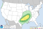
Everything is pointing to a pretty decent setup over Mississippi into western portions of Alabama for Tuesday. High lapse rates, moderate shear and moderate instability question I got is the lift, might be a front pushing through there but all I got is a sounding from north Georgia in this dialup 4g LTE data in Georgia hard to really look at anything with this such slow internet. If anything peak heating and confluence bands will be enough to initiate some cells. Cips analogs guidance is really conservative on the setup. Really curious to see what the CAMS initiate in the warm sector if anything. Also wonder if your going to have a boundary just south of the MCS/rain mass feature that looks to preside over Tennessee that I had saw on the 12z run. If you had a strong cold front you'd probably be looking at some nasty supercells and accompanying tornadoes possibly.
Can't even upload the sounding I have ?
Can't even upload the sounding I have ?
NBAcentel
Member
Z
Zander98al
Guest
I'll take this setup over the last one honestly, if you get enough lift in a environment with both moderate shear and moderate instability with some good lapse rates youll get some spinning tops. In all likelihood the shear and instability will probably be underdone. If you get a good meshpoint and lift at the right time you'll have a pretty good environment.It’s a trade off to last system, lower confidence as well, better thermodynamics but kinematics are much lower then last setup, could go either way, this setup imo has a higher ceiling then the last but still doesn’t look like a big event View attachment 113961
Z
Zander98al
Guest
Scott81
Member
Where is this sounding from?View attachment 113962finnaly let me upload
Z
Zander98al
Guest
Northeast Mississippi. Took a closer look, storm mode is actually elevated or very close too it on that sounding.Where is this sounding from?
Z
Zander98al
Guest
Another thing I've noticed before, with these open low systems that have instability pushing up all the way to the north right on the front. benefit from backed winds with the deeper pressure falls sometimes when the system is deeping. Lines up well with the northern extent of the warm sector having a higher chance for severe weather.
Two issues I see there, one is you will have some lower dew points mixing down and definitely gonna need a trigger with that warm layer aloft.View attachment 113962finnaly let me upload
HSVweather
Member
HSVweather
Member
HSVweather
Member
Z
Zander98al
Guest
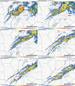
I'd almost say his target area is abit too far south, but then again that southern Mississippi area is usually your usual producer. Running a fine line between anything even forming, still stand by the best chances being in north MS but if you have a bit more lift best area would be that south MS area. NAM 3km and the FV3 simulated radar for around the 5 o'clock. The only two CAMS currently in range. FV3 shows scattered development in the northern MS range while the The 3km NAM shows very little returns. But again you almost always see a increase with time. Possibility of a pseduo front breaking from the MCS that's to the north is a definite potential to watch. your best potential is where you can get surface features on this day. (Confluence bands, peak heating, any boundary.) Won't know some of this till day of.
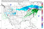
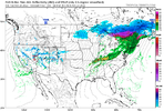
Z
Zander98al
Guest
I'll go out on a ledge hear and say models are probably a good bit under done on the moisture and heating like our previous last two events. Expect a hike when you get into that 1 or 1 & half day away range.
HSVweather
Member
Z
Zander98al
Guest
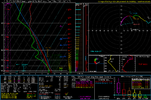
Looks like that eastward shift of parameters I mentioned is starting to occur. The RAP is picking up on it, just now barely getting into range sounding on the MS/AL border nice EHI plume. Instability is still likely under modeled. Still need a lifting mechanism not going to try to interpret simulated radar on the model though lol.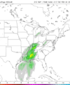


HSVweather
Member
Z
Zander98al
Guest
Darklordsuperstorm
Member
One thing I'm noticing lately that is a bit of a pet peeve with me. These new PDS tornado warnings that are issued when a TDS is seen on radar. I have seen that whenever that happens a warning is upgraded using the wording "Large and extremely dangerous tornado." Of course that phrase is then said by the on air meteorologists. The issue I have is very few tornados actually ever reach that description. I feel like it needs to be worded differently. Maybe something like "a tornado has been confirmed and is doing damage, this is a particularly dangerous situation." The last thing we need to do is give the perception that a tornado is EF3 or greater every time we have a TDS on radar
tennessee storm
Member
Agree but guess hard tell at times rating of a tornado till after damage is done … but the ef4 to ef5 s they just have that classic hook echo to them on radar images … me being a big chaser I learned that .One thing I'm noticing lately that is a bit of a pet peeve with me. These new PDS tornado warnings that are issued when a TDS is seen on radar. I have seen that whenever that happens a warning is upgraded using the wording "Large and extremely dangerous tornado." Of course that phrase is then said by the on air meteorologists. The issue I have is very few tornados actually ever reach that description. I feel like it needs to be worded differently. Maybe something like "a tornado has been confirmed and is doing damage, this is a particularly dangerous situation." The last thing we need to do is give the perception that a tornado is EF3 or greater every time we have a TDS on radar
Darklordsuperstorm
Member
Exactly. I mean I know why they do it. Trying to be more urgent with the warning process. However sometimes they issue these PDS warnings. Get the warning out say that it's a a large violent tornado and the next scan the debris is spinning down and you can tell it was a quick spin up. Typically those large, violent, extremely dangerous tornados will have all those other signs on radar, and continue to show them for multiple scans without losing entensity. I just feel like that sort of wording should actually mean something. It definitely used to. If it's gonna be worded that way every time their is a TDS that wording is going to get watered down quicklyAgree but guess hard tell at times rating of a tornado till after damage is done … but the ef4 to ef5 s they just have that classic hook echo to them on radar images … me being a big chaser I learned that .
Z
Zander98al
Guest
I think they're okay with PDS. You kind've have three tornado warnings. The original tornado warning, a PDS, then a tornado emergency. PDS is used when it's certain a tornado is on the ground doing damage and then tornado emergency is for a very destructive life threating rare tornado.One thing I'm noticing lately that is a bit of a pet peeve with me. These new PDS tornado warnings that are issued when a TDS is seen on radar. I have seen that whenever that happens a warning is upgraded using the wording "Large and extremely dangerous tornado." Of course that phrase is then said by the on air meteorologists. The issue I have is very few tornados actually ever reach that description. I feel like it needs to be worded differently. Maybe something like "a tornado has been confirmed and is doing damage, this is a particularly dangerous situation." The last thing we need to do is give the perception that a tornado is EF3 or greater every time we have a TDS on radar
Darklordsuperstorm
Member
I'm fine with PDS also we definitely need that type of warning. I just think they need to change the wording a little. Especially about it being a large violent tornado save that wording for a tornado emergency and for a PDS warning simply say a tornado is confirmed amd currently doing damage
Z
Zander98al
Guest
Z
Zander98al
Guest
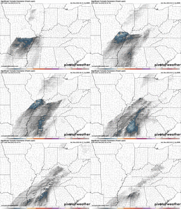
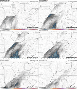
I think the tornado threat is starting to rise for the MS/AL area. That shear is increasing in the northern Alabama area. Might be backed winds from pressure falls. But models are starting to show some nasty supercells with accompanied updraft swaths. Definitely needs to be watched until go time
EMTime
Member
The reason they do it ( I assume ) is for knuckleheads like me that go outside and look for it when a warning is issued.
If they say "a large and violent tornado", most people ( not all ) will seek shelter.
If they say "a large and violent tornado", most people ( not all ) will seek shelter.
Z
Zander98al
Guest
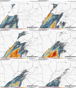
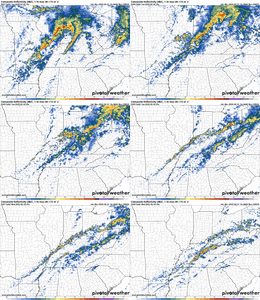
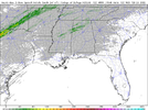
Pretty consistent idea with the HRRR on a swath of updrafts in the northern portion of Alabama. Ill tell you one thing I'f these training updrafts that the HRRR is showing is true. Your going to have a dang serious floodingnt threat in north Alabama. Currently at a moderate for flooding. Probably see a high risk flooding outlooked in north Alabama. 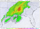


Z
Zander98al
Guest
Your biggest threat tommorow may be life threatening flooding somewhere in north Alabama were the train of convection sets up and follows one another.
Z
Zander98al
Guest
Z
Zander98al
Guest
Wowzers this is coming from the nws bham discussion Tuesday afternoon through Sunday. Wouldn't be surprised for a enchanced in that northern Alabama region may see a very favorable area for tornadoes there.
Tuesday will be very warm across the region with a strong 500 mb
ridge covering the Gulf of Mexico and Bahamas. Meanwhile, a
low-amplitude shortwave trough will support a mid-latitude
cyclone moving from the Mid-Mississippi Valley to the Great Lakes.
A moderately strong low-level jet axis will extend southwestward
from the Ohio Valley to Mississippi and Alabama Tuesday afternoon.
Initially, a plume of steep mid-level lapse rates will be
associated with a warm nose and capping around 600 mb. Despite
neutral height tendencies and very little synoptic support,
scattered thunderstorm development will be supported by
significant moisture advection within a warm advection regime
across Northeast Mississippi and Northwest Alabama. CAPE profiles
appear quite support of robust updrafts with LI values reaching -6
in West Alabama. MLCAPE values of 1000-1400 J/kg and increasingly
large curved hodographs will be sufficient for supercell storms
beginning around 5 PM. A couple of tornadoes and isolated damaging
winds appear possible with these storms in our northwestern
counties through midnight before storms congeal into a slow-moving
line. As the approaching cold front becomes parallel with the
deep-layer flow, training thunderstorms could result in isolated
flash flooding with rainfall amounts of 2 to 3 inches.
NBAcentel
Member
HSVweather
Member
12Z HRRR seems to be maximizing parameters around the 5-6PM time around east MS, and west AL. Golden triangle up to Marion and Winston counties.Wowzers this is coming from the nws bham discussion Tuesday afternoon through Sunday. Wouldn't be surprised for a enchanced in that northern Alabama region may see a very favorable area for tornadoes there.
Tuesday will be very warm across the region with a strong 500 mb
ridge covering the Gulf of Mexico and Bahamas. Meanwhile, a
low-amplitude shortwave trough will support a mid-latitude
cyclone moving from the Mid-Mississippi Valley to the Great Lakes.
A moderately strong low-level jet axis will extend southwestward
from the Ohio Valley to Mississippi and Alabama Tuesday afternoon.
Initially, a plume of steep mid-level lapse rates will be
associated with a warm nose and capping around 600 mb. Despite
neutral height tendencies and very little synoptic support,
scattered thunderstorm development will be supported by
significant moisture advection within a warm advection regime
across Northeast Mississippi and Northwest Alabama. CAPE profiles
appear quite support of robust updrafts with LI values reaching -6
in West Alabama. MLCAPE values of 1000-1400 J/kg and increasingly
large curved hodographs will be sufficient for supercell storms
beginning around 5 PM. A couple of tornadoes and isolated damaging
winds appear possible with these storms in our northwestern
counties through midnight before storms congeal into a slow-moving
line. As the approaching cold front becomes parallel with the
deep-layer flow, training thunderstorms could result in isolated
flash flooding with rainfall amounts of 2 to 3 inches.
HSVweather
Member
HSVweather
Member
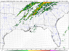
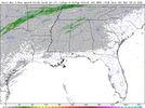
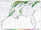
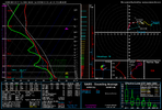
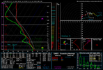
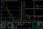
Could be, but I’d definitely be concerned with that being breached is much higher than the low level warm layer with the last threat. Not a bad look though to see that 700mb level wetbulbing below 0C.Pretty nasty warm layer around 700mb associated with minor subsidence from the ridge flexing, even more then the last setup showing up, could be a big limiting factor View attachment 114057View attachment 114058View attachment 114059
Edit: Seeing that 0-3km Cape closing in on 200 is very impressive for February.

