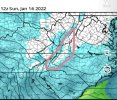
UKMET has come north, but not nearly as amped or north as the rest of this evening's model suites. EMCF to follow its lead?


If we could hold onto that look right right there, a lot of folks board wide would take it! Let's hope it doesn't keep trending more NW, in future runs (not likely) lol.UK!! hah. Although its north from its 12z run
View attachment 104238
UK was the southern most model up to this point. Odds that it was going to come north to aN extent should’ve been expectedUK keeps trending north. It will be gone on it by this time tomorrow so enjoy your color maps for now

But we’re building a stronger 50/50 with more confluence which is pulling it further south and slowing it down some and building in stronger HP. It’s a trade off reallySlowing down of the ull has been a killer and this will probably continue for a couple more days.
View attachment 104231

Not driving the Euro. And the GFS is nothing to put your faith in as leading the others.Folks the UKMET was the trailer here. The lead is the GFS ops albeit probably not fully correct on that last run. It's driving the change and movement for all the others it seems so far. Has it stopped yet? I'm not so sure.
Euro starts in less than an hourWhen is the next model running? About to call it a night.
Sent from my iPhone using Tapatalk
0z Euro @ 1 AMWhen is the next model running? About to call it a night.
Sent from my iPhone using Tapatalk
So that Mexico high jumped out to me as well. I think that last frame, 0z run, could be showing the low before the transfer, whereas the previous frames are showing it after. If that's the case it has slowed a bit. It also appears the high over Mexico, which has formed and expanded, is helping push our low a bit North, along with a slightly weaker pressing high over NE. I don't know if that high is showing up on other models or not. You'll notice it's also pushed the low over N Mexico North as well.Where did that high come from off of Mexico coast?
Sent from my iPhone using Tapatalk
Euro 1am estWhen is the next model running? About to call it a night.
Sent from my iPhone using Tapatalk

Based in current guidance I'd say with the CAD as strong as it is we're getting hit regardless. But I'd say just south of 85 would be more Sleet than anything. Once you get down close to lower upstate/northern midlands more zr for sure. North of 85 still may do quite well.
Still very bad ice storm for midlands of SC. I
