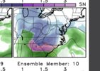
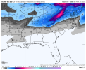
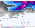
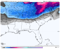
Definitely has potential, but i am not going to be excited until a good look shows up on operationals. Right now they show way too much Midwest ridging to feel good about the midrange. I know the ensembles show better, but yeah, the ensembles. I really hope we start seeing something to truly get excited about other than another mid Atlantic storm.Im still perked up about 1/16ish: Thats getting in to Euro hr 240 now: If you look at the 0z Euro you can see energy from Texas deep south heading east and cold in place upper south.This is the time-frame the GFS was on to for a few days: Its been quit past few cycles: But its rock solid on the Cold: Just be looking for some energy to show from 1/16-1/23.

-
Hello, please take a minute to check out our awesome content, contributed by the wonderful members of our community. We hope you'll add your own thoughts and opinions by making a free account!
You are using an out of date browser. It may not display this or other websites correctly.
You should upgrade or use an alternative browser.
You should upgrade or use an alternative browser.
Pattern Januworry
- Thread starter SD
- Start date
Snownut
Member
Yep it's just a matter of time and the GFS will be popping a Big SE Winter Storm. The Euro I believe will do the Same once it starts getting in Range. The Pattern is Ripe with lots of Energy Starting to show up.Im still perked up about 1/16ish: Thats getting in to Euro hr 240 now: If you look at the 0z Euro you can see energy from Texas deep south heading east and cold in place upper south.This is the time-frame the GFS was on to for a few days: Its been quit past few cycles: But its rock solid on the Cold: Just be looking for some energy to show from 1/16-1/23.

Sent from my SM-A526U using Tapatalk
ATLwxfan
Member
We are going to be threading the needle as always. We will have to see how the PV plays out. Even with all the players on the field, the more likely scenario puts us either in the shredder or too warm. And then it could seemingly look perfect and we get the coldest rain of our lives
Sent from my iPhone using Tapatalk
Sent from my iPhone using Tapatalk
iGRXY
Member
From these past 2 small systems we really didn't even start getting any good model runs showing a storm until well under 200 hours if I am not mistaken. Likely going to be that way for any potential system we may see down the road in a week or 2. We may get a fantasy run here or there as we have seen but nothing consistently showing until we get well into the medium range. Cold looks to be in place, and we have energy all of the map that can easily get something going. Key is to be patient and not think the wheels are falling off if the models still aren't showing fantasy storms.
NBAcentel
Member
Just looked at the models from last night and was expecting to see a disaster based on what I read here. Nothing looks all that bad to me. We still have plenty of cold air nearby that periodically intrudes, along with some attempts at blocking around Greenland. We also have a fairly favorable pattern out west.
No series of panels look as good as what we were talking about yesterday, but the same general background is in place. There look to be a couple of systems that run by just south or blossom late, off the coast. Those are worth watching for sure.
No series of panels look as good as what we were talking about yesterday, but the same general background is in place. There look to be a couple of systems that run by just south or blossom late, off the coast. Those are worth watching for sure.
NBAcentel
Member
Man the 00z models looked frustrating, there not bad but all I’m seeing on OPs is potential ways to avoid anything during a good pattern, at least it’s far out and we have plenty of time, still overall like the look at H5
Batman
Member
This is one of the best posts I have seen in weeks and one everyone should take it to heart! I post very little here because there are those on here that are better at model analysis than me. I also bite my tongue when folks display the emotions of a middle school kid when they think the weather trends are not going their way. This post however, is something we all need to understand and appreciate. The rest of January will likely be the best pattern for potential snow in the SE that we have experienced in a few years! No it won't stay below freezing everyday this month and no, every model run will not be great. However, the potential for winter weather and the availability of cold air should be present most of the time for the rest of the month. 10 days ago, we had folks canceling winter and saying how much "we suck" as usually happens this time of year. Who would have thought 10 days ago that Nashville and surroundings areas were going to get 2 accumulating snows this week. A major pattern change has taken place in the last week. The 2 storms this week are a perfect example of that and what can happen down the road. Rather than splitting hairs over each model run, we should from time to time step back and appreciate where are, what has played out in the last week or so, and the potential that exists for the rest of the month.From these past 2 small systems we really didn't even start getting any good model runs showing a storm until well under 200 hours if I am not mistaken. Likely going to be that way for any potential system we may see down the road in a week or 2. We may get a fantasy run here or there as we have seen but nothing consistently showing until we get well into the medium range. Cold looks to be in place, and we have energy all of the map that can easily get something going. Key is to be patient and not think the wheels are falling off if the models still aren't showing fantasy storms.
SnowNiner
Member
Yeah, long range doesn't look all that fantastic overnight. Western ridge is retrograding faster than I'd like. 6Z GEFS wasn't ever really cold at all in the SE. Hope that turns around today. 


D
Deleted member 609
Guest
He's still in!Just looked at the models from last night and was expecting to see a disaster based on what I read here. Nothing looks all that bad to me. We still have plenty of cold air nearby that periodically intrudes, along with some attempts at blocking around Greenland. We also have a fairly favorable pattern out west.
No series of panels look as good as what we were talking about yesterday, but the same general background is in place. There look to be a couple of systems that run by just south or blossom late, off the coast. Those are worth watching for sure.
Hard to find many examples of lows that ended up off the coast but were modeled to our NW but plenty of examples of lows that started well offshore but backed west, I take that as a good sign.Just looked at the models from last night and was expecting to see a disaster based on what I read here. Nothing looks all that bad to me. We still have plenty of cold air nearby that periodically intrudes, along with some attempts at blocking around Greenland. We also have a fairly favorable pattern out west.
No series of panels look as good as what we were talking about yesterday, but the same general background is in place. There look to be a couple of systems that run by just south or blossom late, off the coast. Those are worth watching for sure.
SnowNiner
Member
Eps looks about the same at the same time
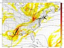
View attachment 102145
But it reestablished troughing afterView attachment 102146
Ya'll got anymore of dem jet extensions?
NoSnowATL
Member
Had some freezing fog this morning with temps at 33.
Can we just take a breath. I came in to catch up and I thought the world was ending. Stop looking a P-type maps and look at the upper dynamics. They are still great for us in the southeast. Let’s not put all our chips on OP runs, but look at them ensembles guys. All of them still look fantastic. Especially since this is the SE and a La Niña year.
A lot of the times we never had both the thread and the needle at the same time. Now we do.
Sent from my iPhone using Tapatalk
A lot of the times we never had both the thread and the needle at the same time. Now we do.
Sent from my iPhone using Tapatalk
ATLwxfan
Member
Man the 00z models looked frustrating, there not bad but all I’m seeing on OPs is potential ways to avoid anything during a good pattern, at least it’s far out and we have plenty of time, still overall like the look at H5
Exactly…the models seem to be illustrating the myriad ways in which we can fail despite having the right ingredients. To be fair it is the most likely scenario so the models are doing as they should.
Sent from my iPhone using Tapatalk
Wouldn't that be nice. It's going to retract in the mid range which should help retrograde the ridge/trough axis in time across the conus. The good thing is no models overnight retracted out far enough for us to go into western trough/ser yet. We will eventually get there you can see the means playing around with the okhotsk Aleutian pattern by d13-16 but we still probably have 21 ish days to score hereYa'll got anymore of dem jet extensions?
Anyone who knows how winter works around here knows there’s absolutely nothing to “panic” about. Nothing has changed other than you don’t get to see pretty colors yet. I’ve seen storms pop up in the 120 hour range and some of those are the most notorious. Deep breaths and if you think everything’s coming to an end just don’t come back on here for a few model cycle runs so you can clear your head. I’ve seen this many times before
It’s better the models show nothing right now because if they did show something big and then once we got closer it went poof y’all would literally melt down and explode .. we’re seeing a good pattern but no storm yet (which could entirely happen) but I just find it hard to believe we escape without nothing to track eventually. Remember where we live the SE. We aren’t going to see a mega snow storm at hour 300 and see the same mega snow storm at hour 70 .. it almost never works like that
The only big negative I see right now is a tendency to flatten the pattern across Noam after the big cold shot early to mid next week which might lead to a warm up but that should hopefully be erased by a renewed western ridging and eastern and Central US troughing
We’re not even in a cold pattern now! Like you said we wouldn’t be inYeah, long range doesn't look all that fantastic overnight. Western ridge is retrograding faster than I'd like. 6Z GEFS wasn't ever really cold at all in the SE. Hope that turns around today.

Well then , I’m golden! No snow for me in 15 days on the GFS?It’s better the models show nothing right now because if they did show something big and then once we got closer it went poof y’all would literally melt down and explode .. we’re seeing a good pattern but no storm yet (which could entirely happen) but I just find it hard to believe we escape without nothing to track eventually. Remember where we live the SE. We aren’t going to see a mega snow storm at hour 300 and see the same mega snow storm at hour 70 .. it almost never works like that
Does anyone know what’s going on the the soundings on TT?
Sent from my iPhone using Tapatalk
Sent from my iPhone using Tapatalk
I kind of like the models showing medium to longer range winter storms. As silly as it sounds, it tells me that the model thinks the pattern is conducive. Plus, it's fun to see.It’s better the models show nothing right now because if they did show something big and then once we got closer it went poof y’all would literally melt down and explode .. we’re seeing a good pattern but no storm yet (which could entirely happen) but I just find it hard to believe we escape without nothing to track eventually. Remember where we live the SE. We aren’t going to see a mega snow storm at hour 300 and see the same mega snow storm at hour 70 .. it almost never works like that
When we go days on end seeing what we think looks like an OK pattern without the model ever showing anything, that's a little bit of a red flag.
A model showing a storm is no guarantee of a storm and a model not showing a storm is no guarantee of no storm. But for whatever reason, when the model sees a good pattern, it usually has no trouble spitting out winter storms occasionally.
Just file that away in the Rabbit's Foot and Horseshoe drawer, I guess.
Stephenb888
Member
Ah another winter is cancelled kind of day... I’ll be back tomorrow then.
Please stop posting stuff like this in this thread. First of all, we have a Whamby/Banter thread. And second, it doesn't make any sense whatsoever.Ah another winter is cancelled kind of day... I’ll be back tomorrow then.
Avalanche
Member
Post of the day right here!!I kind of like the models showing medium to longer range winter storms. As silly as it sounds, it tells me that the model thinks the pattern is conducive. Plus, it's fun to see.
When we go days on end seeing what we think looks like an OK pattern without the model ever showing anything, that's a little bit of a red flag.
A model showing a storm is no guarantee of a storm and a model not showing a storm is no guarantee of no storm. But for whatever reason, when the model sees a good pattern, it usually has no trouble spitting out winter storms occasionally.
Just file that away in the Rabbit's Foot and Horseshoe drawer, I guess.
D
Deleted member 609
Guest
Logan, is that you?Ah another winter is cancelled kind of day... I’ll be back tomorrow then.
D
Deleted member 1449
Guest
You keep posting pics from up there, it’s going to piss people off!The forecast for my location today is another 6-12" of snow with ratios of 20:1 expected, per NWS Grand Rapids. So high ratios is actually a thing, then?
Our rental is one lot off of the lake front here. I could totally live here lol
View attachment 102156
Avalanche
Member
Oh Lord. I love your posts, but you were posting an extreme amount of times on a forum that's been snowstarved for nearly 3 years. I support you, however. I get it.You keep posting pics from up there, it’s going to piss people off!
SnowNiner
Member
I kind of like the models showing medium to longer range winter storms. As silly as it sounds, it tells me that the model thinks the pattern is conducive. Plus, it's fun to see.
When we go days on end seeing what we think looks like an OK pattern without the model ever showing anything, that's a little bit of a red flag.
A model showing a storm is no guarantee of a storm and a model not showing a storm is no guarantee of no storm. But for whatever reason, when the model sees a good pattern, it usually has no trouble spitting out winter storms occasionally.
Just file that away in the Rabbit's Foot and Horseshoe drawer, I guess.
Agreed, if the models aren't putting out fantasy snow, the patterns usually not conducive for it IMO. The models can be wrong and still snow come shorter leads but I feel so much better about a pattern when you get at least some pings here and there; the better the pattern, the more pings. And the ensemble snow mean should be decent. No guarantee of course, just helps identify a better pattern.
Right now the pattern seems to favor Tennessee and the mid-atlantic IMO. That doesn't mean we can't sneak one in at some point. But I'm currently looking for more pings IMBY.
NBAcentel
Member
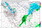
That's actually not a bad image there. I have no idea what the surface response is or what temp profiles look like, though.meh-decent look on the icon, SS wave placement is decent-good, but the northern stream needs to be faster so it can reinforce cold air before the SS wave moves in View attachment 102163
Cary_Snow95
Member
- Joined
- Jan 5, 2017
- Messages
- 3,779
- Reaction score
- 5,990
Even with a faster northern stream short wave, the 850 temps need a lot of help. Maybe if that low bombs in the eastern central Gulf of Mexico? But the low is over New Orleans...IDK, I think this one is going to the backstop, way outside...meh-decent look on the icon, SS wave placement is decent-good, but the northern stream needs to be faster so it can reinforce cold air before the SS wave moves in View attachment 102163

