-
Hello, please take a minute to check out our awesome content, contributed by the wonderful members of our community. We hope you'll add your own thoughts and opinions by making a free account!
You are using an out of date browser. It may not display this or other websites correctly.
You should upgrade or use an alternative browser.
You should upgrade or use an alternative browser.
Pattern Januworry
- Thread starter SD
- Start date
Fountainguy97
Member
accu35
Member
couple more good trends and Alabama would get a nice surprise
Brent
Member
Man this thing is close for us foothill peeps to bad downsloping will kill our temps....
NBAcentel
Member
Ron Burgundy
Member
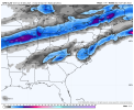
I’m moving to Villa Rica myself.This is painful watching from Charlotte, this has been the way we have gotten screwed the last 3 years, same areas everytime View attachment 99950
Don't feel bad ill be at work so close I can smell it lolThis is painful watching from Charlotte, this has been the way we have gotten screwed the last 3 years, same areas everytime View attachment 99950
iGRXY
Member
It’s tough living 10 minutes from the NC/SC border. We get cold rain and all I have to do is drive 15 minutes up the road and it’ll be either icy or snowing.This is painful watching from Charlotte, this has been the way we have gotten screwed the last 3 years, same areas everytime View attachment 99950
BufordWX
Member
Webberweather53
Meteorologist
This is painful watching from Charlotte, this has been the way we have gotten screwed the last 3 years, same areas everytime View attachment 99950
The classic SW piedmont screw job w/ a Miller A cyclone.
So mega 2nd half of March?I'm under the impression that w/ this AAM distribution and evolution (summarized as the GWO) that the deeper we go into February, the more likely we'll see +NAO/+AO/+NAM, which would favor warmth and a strong SE ridge around here. La Nina climo (February is usually warm-torchy) & the current episode of high-latitude North Pacific blocking coupled w/ +NAO & already strong +NAM in the mid-upper stratosphere lends even more credence to this idea.
Certainly will be interesting though prior to then, as the subtropical jet will be more amped than usual for much of January and the negative momentum that's entering the mid-latitudes is a favorable look for high-latitude blocking. (may be more-so in the Pacific instead of the Atlantic tho)
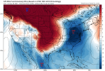
View attachment 99930
Avalanche
Member
Bring it on home fellas.So mega 2nd half of March?
Realistically I think central and eastern NC is on deform band watch .. there’s some heavy precip over even Raleigh and I’m assuming it would be snow since our temps are similar to those in eastern NC where the snow was shown .. looking at individual GEFS runs they are all roughly the same but still slightly different .. most have 1 thing in common and that is a heavy deform band .. this really will have to be looked at by the NAM to really see the inner workings of what happens .. but being in Raleigh I’m slightly excited for the chance but I’d be more excited if I was metawannabeTouchdown. Still a lot of outcomes possible but I wouldn't mind this one. NE NC is on deform band watch.
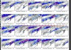
View attachment 99945
Typical late arriving cold scenarioThis is painful watching from Charlotte, this has been the way we have gotten screwed the last 3 years, same areas everytime View attachment 99950
Hey don’t count march out past few years have shown us we can’t count that month out anymore .. although there will be many more comments about Sun angles we have to deal withSo mega 2nd half of March?
Having to cool from the top down means lower your expectations to 0 and hope from thereRealistically I think central and eastern NC is on deform band watch .. there’s some heavy precip over even Raleigh and I’m assuming it would be snow since our temps are similar to those in eastern NC where the snow was shown .. looking at individual GEFS runs they are all roughly the same but still slightly different .. most have 1 thing in common and that is a heavy deform band .. this really will have to be looked at by the NAM to really see the inner workings of what happens .. but being in Raleigh I’m slightly excited for the chance but I’d be more excited if I was metawannabe
cd2play
Member
If I get an inch out of this, I will be thrilled.
Exactly I’m not too excited .. but I’m getting more excited that maybe I see novelty flakes ??Having to cool from the top down means lower your expectations to 0 and hope from there
Sounds like we are on the same page. If we shifted the upper levels just a little further south and more negative I'd be way more excited but at around 100 hours I'm not sure we are going to see that big of a jumpExactly I’m not too excited .. but I’m getting more excited that maybe I see novelty flakes ??
I just need 1 exciting NAM runSounds like we are on the same page. If we shifted the upper levels just a little further south and more negative I'd be way more excited but at around 100 hours I'm not sure we are going to see that big of a jump
Also possible big time CAD event soon on the GFS fantasy land of course but boy oh boy look at that +PNA
- Joined
- Jan 23, 2021
- Messages
- 4,602
- Reaction score
- 15,196
- Location
- Lebanon Township, Durham County NC
Yeah, I think where you are, it's gonna be tough for that big of a shift to happen. I think for the border counties and maybe myself and @FallsLake, it's possible but still not yet probable.Sounds like we are on the same page. If we shifted the upper levels just a little further south and more negative I'd be way more excited but at around 100 hours I'm not sure we are going to see that big of a jump
NBAcentel
Member
I’m seriously just wanting this to show up under day 7, it’s getting exhausting chasing day 7000 mapsIs this a good look View attachment 99964
Avalanche
Member
That might kick up something in the Carribean.Is this a good look View attachment 99964
I’m just glad we chased the SER away for nowI’m seriously just wanting this to show up under day 7, it’s getting exhausting chasing day 7000 maps
Certainly would feel more excited up your way. Seems like the RDU airport to Durham up toward Henderson, Louisburg, and Roxboro always at least change over briefly in these looksYeah, I think where you are, it's gonna be tough for that big of a shift to happen. I think for the border counties and maybe myself and @FallsLake, it's possible but still not yet probable.
Avalanche
Member
Just hop on 85 and go to Butner and that area.Yeah, I think where you are, it's gonna be tough for that big of a shift to happen. I think for the border counties and maybe myself and @FallsLake, it's possible but still not yet probable.
D
Deleted member 609
Guest
Avalanche
Member
Go to the graphics icon and slide that HP NE.
That low position looks good. Cold funneling down the wrong side of the mountains. Block with a banana high centered in NY state and ?
D
Deleted member 609
Guest
Yea. At least it isn't impossible for something to happen, unlike what we have been seeing recently.That low position looks good. Cold funneling down the wrong side of the mountains. Block with a banana high centered in NY state and ?
Nice Miller A bomb look there.
Avalanche
Member
Potential for interior mid Atlantic to get their first?Nice Miller A bomb look there.
whatalife
Moderator
No shortage of energy flying around on the GFS (imo).
Sent from my iPhone using Tapatalk
Sent from my iPhone using Tapatalk
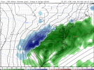
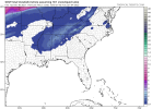
12z NAM (at hour 84) is different from the 12 GFS whereas the NAM doesn't have a strong low pushing up into NC. It looks like it has later weaker development south which lets more cold air to initially dive in. If it verifies it could be more interesting for central/eastern NC folks.
12z NAM at hour 84:
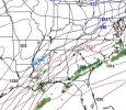
12z NAM at hour 84:

Stephenb888
Member
What is upstate Sc’s chances with this system. None?12z NAM (at hour 84) is different from the 12 GFS whereas the NAM doesn't have a strong low pushing up into NC. It looks like it has later weaker development south which lets more cold air to initially dive in. If it verifies it could be more interesting for central/eastern NC folks.
12z NAM at hour 84:
View attachment 99969

