Cary_Snow95
Member
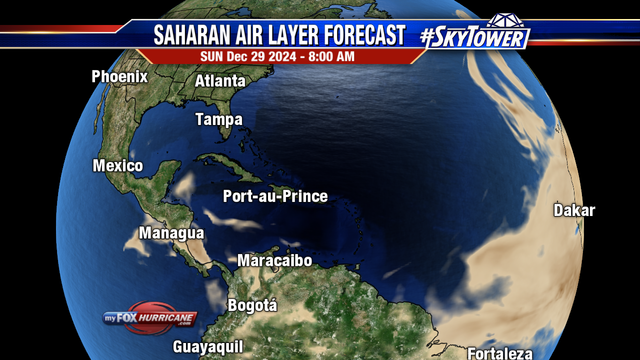
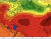
Ahh okay that’s a great explanation, thanks man. So for instance if 95L developed (would be on this blue dot) this look would favor a scraper? Or would this trough instill a more easterly flow and force a recurveTo get as far west as us you'd need something like this where the ridge center poking into the NE coast by its far enough north a system can gain latitude View attachment 85845
For the coastal scrapers you'd likely have the ridge farther SE and the trough closer over the main land and to get something that crosses the FL east coast into the gulf that ridge is typically centered near or over us
.png")