• Hello, please take a minute to check out our awesome content, contributed by the wonderful members of our community. We hope you'll add your own thoughts and opinions by making a free account!

Pattern Muddy March 2021

I suppose there’s an outside chance this morning’s freeze at RDU could be the last one of the season. I think our average last freeze is around the end of March/first of April, but the next week or so aren’t looking conducive to anymore freezes, at least.
Yeah think it has potential to be it .
 
I suppose there’s an outside chance this morning’s freeze at RDU could be the last one of the season. I think our average last freeze is around the end of March/first of April, but the next week or so aren’t looking conducive to anymore freezes, at least.
Wouldn't be entirely surprised. Once we get past that cold shot going into easter im going forward with planting
 
This look could easily trap a ULL, however it’s not a cold look, looks like trop forcing is gonna switch the the MC towards the end of the month, phase 6 is one of the warmest phases in spring D891362E-CC1F-4342-AC36-6ED0641A3181.gif57383878-00DB-4F97-AFC6-75249830E3F4.png316D0E9F-3AF8-4178-8BDF-482B23063633.pngCF081754-A3A2-483C-920E-3DBF6B175C1D.png
 
Yeah, wish I could bottle it and let out for the summer months; I dread that weather coming. I'll take this every day of the year!
Enjoy it for now because climo is gonna roar in real soon bro, and take a look at this, late next week, with dews in the 60s, fantastic, bet we see some 80 degree days DF97511E-7044-40F0-AE00-D9BD1D59B707.png61CE79A9-8E96-4987-8DB9-862450A471B1.png5D0B83B7-D67F-46A8-AE17-D56B1DD398F4.png
 
Just had a couple sleet pellets in Mooresville


Congrats on this total surprise as this is the forecast:

NCZ036-210800-
IREDELL-
INCLUDING THE CITIES OF STATESVILLE AND MOORESVILLE
505 PM EDT SAT MAR 20 2021

TONIGHT

MOSTLY CLEAR. LOWS IN THE LOWER 30S. NORTHEAST WINDS
10 TO 15 MPH.

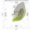
Radar is suggesting a big bust in parts of NC!

index.png
 
Thread I wrote on twitter
solid look for severe wx wrt the 18z GEFS, nice 200mb double barrel jet aloft with plenty of divergence = forcing for ascent and plenty of it (further East becomes more questionable), also a S/W trough rounding the base of a longwave trough, looking like Moisture return should be no problem given centered ridge around the Caribbean, so there should be enough instability/llvl moisture, should be plenty of shear in the low/mid/upper levels given the S/W that’s rounding the base of the trough, once again this type of setup hastons of forcing, so this setup could easily become full of convection in the warm sector, however the ingredients are there for severe weather and some formidable severe weather at that next week, something to watch as it’s getting under day 7, plenty of time for changes. For areas further east like the Carolinas, it becomes more questionable, the shortwave trough could eject to far west and we get the overall cape/shear but lack forcing, however severe is possible in these areas late next week, also need to watch for a cluster of storms near the Gulf coast that could slow and progression of a warm front given the first system leaving some energy at H5 around the gulf coast, this could cause some bust potential but to early to speculate on mesoscale details, the look synoptically is there right nowB312164C-9736-4255-9ADD-F3DB55817C86.jpeg3893FC31-D615-484C-8DA5-7A2953ED3950.jpegB267F4DE-D376-4C1E-AE25-A4638691AA86.png47E6B4A0-6EE2-4675-87ED-402BB8071FB1.png
 
Back
Top