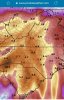
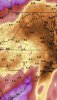
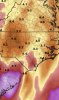
• Hello, please take a minute to check out our awesome content, contributed by the wonderful members of our community. We hope you'll add your own thoughts and opinions by making a free account!

Pattern Muddy March 2021

Lol this is the ugliest possible pattern for wintry wx, the EPS already has mean highs near the 70s with this pattern, if we get a coupled -NAO this could be pushed back however, far out tho but that’s warm for that range E35E52FB-2616-4403-8CC6-8E5A083B952B.png7F1E0275-4C30-4E44-963A-7440F89658BF.png
 
That basically means this year has been super anomalous when it comes to La Niña standards, crazy ! El Niño’s have been like ninas at H5 lately which is the strange part
 
What's the criteria

They use anomaly correlation coefficient (ACC) (as is also often used to determine "skill" for forecast models in synoptic settings)

The equation looks something like this, it's actually not bad. The numerator is basically the sum of the forecast anomalies (f'm) and observed anomalies (o'm) at each grid point divided by the square root of the forecast and observed anomalies squared. (Cm = climo)
Screen Shot 2021-02-26 at 3.38.53 PM.png
 
The good news is that spinning low pressure system next weekend appears to be manufacturing its own warm air.


Sent from my iPhone using Tapatalk
 
Lol I’m wondering if we should get scared yet seeing these sorts of look wrt to cutoffs and it’s relevance to hurricane season haha
 
Lol I’m wondering if we should get scared yet seeing these sorts of look wrt to cutoffs and it’s relevance to hurricane season haha
If this summer is an La Niña, I’m concerned about hurricane season being bad for the E coast and gulf again!
 
I know people don’t want to hear it but this period holds potential for a lot of cold rain and even some winter weather ... crazy upper level lows being spit out at medium range and we think we know the answer on what’s to come? Nope
 
Back
Top