Blue_Ridge_Escarpment
Member
Ummmmm. Only about 20 inches showing up around Little Switzerland.Gfs looking too warm for the second wave. Even in the NC mountains. Searching for cold air and not getting it
Sent from my Pixel 3 using Tapatalk

Ummmmm. Only about 20 inches showing up around Little Switzerland.Gfs looking too warm for the second wave. Even in the NC mountains. Searching for cold air and not getting it
Sent from my Pixel 3 using Tapatalk

Wow


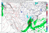
What the temps look like?KMA so far...fwiw
View attachment 53300

To hell with that jazz!I won’t be in Gville that weekend so it can be rainy and 65 trapped under a cloud deck and I would be ok with it
I wouldn't worry bout that right now..GEFS looks like garbage
Sent from my Pixel 3 using Tapatalk
14 inches in 8 hours best storm since 93 imby.Maybe the southern apps can cash in like dec 2018. Marginal temps but enough to get you a foot in higher elevations and a decent amount in the foothills [hickory, old fort, lenoir, adako]
That would be epic!!

That would be awesome but only a couple of the GEFS members showed that
But there's a clear idea by at least half the members. Sure only 2 nice ones for areas like TN and N Ga but still if there's snow in the Apps, there's a system.That would be awesome but only a couple of the GEFS members showed that

That would be awesome but only a couple of the GEFS members showed that
Yes the pattern looks great. Feels like we haven't had a pattern to track like this since 2018Pattern is 100% there (& has been for days) which is what matters at this stage not individual GEFS member snowfall output.

Also just looking at soundings, areas east of the mountains in the SC upstate and NC Piedmont that are showing rain, the soundings are supportive of wet snow.But there's a clear idea by at least half the members. Sure only 2 nice ones for areas like TN and N Ga but still if there's snow in the Apps, there's a system.
View attachment 53316
I know all the focus is on early December but I am intrigued by the evolution of this toward the 2nd week/mid December. Can we eventually get enough PNA that we can kidney bean/lobe the PV into the Hudson Bay region before the wheels fall off?
One thing about Nina's you can get much more impressive cold than Ninos.
Good to see you guys catching on to me saying I'll take my chances with a weak nina
I know all the focus is on early December but I am intrigued by the evolution of this toward the 2nd week/mid December. Can we eventually get enough PNA that we can kidney bean/lobe the PV into the Hudson Bay region before the wheels fall off?
That comment you made a while back about Nina's is looking pretty good!
Yeah we need an amplified pattern with a ridge up the west coast , Alaska and to the pole with big troughs coming down the plains . Instead we have a giant ridge covering the entirety of Canada .Yeah you can definitely get colder in Ninas than Ninos but this is not the way you're supposed to do that lmao.


Rare but certainly not unheard of.....As crazy as this sound, when you see sub -10C 850s passing over warm area lakes in early-mid winter w/ enough deep-layer moisture laying around (& large enough lakes to generate a strong moisture fetch), you actually start running into the risk for seeing lake effect snow downwind of places like Lake Kerr, Gaston, & possibly even Lanier in NE Georgia.
View attachment 53356
As crazy as this sound, when you see sub -10C 850s passing over warm area lakes in early-mid winter w/ enough deep-layer moisture laying around (& large enough lakes to generate a strong moisture fetch), you actually start running into the risk for seeing lake effect snow downwind of places like Lake Kerr, Gaston, & possibly even Lanier in NE Georgia.
View attachment 53356

Seems as if there's much less precip on this run