The GFS upgrade is now available on Tropical Tidbits!

GFS-Para Model
GFS-Para model forecast of MSLP & Precip (Rain/Frozen) for CONUSwww.tropicaltidbits.com
And still a crappy model.
The GFS upgrade is now available on Tropical Tidbits!
GFS-Para Model
GFS-Para model forecast of MSLP & Precip (Rain/Frozen) for CONUS
Yep, sky looks very dusty. I’m traveling home today and haven’t seen any blue sky so far.You can definitely notice the dust in the sky.
No dust here with blue skies. Complete disappointment. Yet another event the models busted!You can definitely notice the dust in the sky.
It’s coming...No dust here with blue skies. Complete disappointment. Yet another event the models busted!
Quite a bit dust in NashvilleNo dust here with blue skies. Complete disappointment. Yet another event the models busted!
Or..... you know....Board is getting unruly....yep must be Friday afternoon
Or..... you know....
.png")
So basically it will be during the coldest darkest part of the day and decaying. If you take an average


I sense disturbances in the Force.Board is getting unruly....yep must be Friday afternoon
Use polarized sunglassesFor you fishing dudes what is the best way to watch flounder that isn't gigging.
Ill be in SC by the way so it looks like there is no season
I’m behaving. Getting some good laughs no doubtBoard is getting unruly....yep must be Friday afternoon
Matt---you made a post in the Sports thread which somehow mentions Pearl Harbor and Franklin D. Roosevelt.I’m behaving. Getting some good laughs no doubt
Shhhhhh ???Matt---you made a post in the Sports thread which somehow mentions Pearl Harbor and Franklin D. Roosevelt.
You are NOT behaving. ?
 www.youtube.com

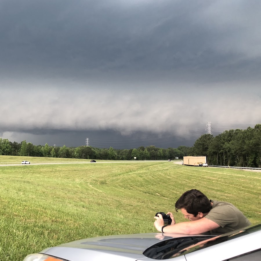
(*For educational entertainment only and may not be used anywhere else). The NWS in Wilkes has issued an early advanced severe thunderstorm watch for western NC including upstate SC. View attachment 43456 In addition, the NWS in Wilkes has issued a preliminary advanced tornado warning along I-40 in western NC with a 1 County margin of error. Further, the NWS in Wilkes has issued a rare Dense Fog Advisory for blowing dust with reduced visibilities from Mount Airy NC to Charlotte NC. Storms will cause the dust to surge and blow out ahead of stronger storms. More to come storm timing and exact locations are largely unknown at this time. Watauga County NC has the greatest chance of thunderstorm formation. View attachment 43457
.png")
? THIS IS A PANDEMIA ALERT ? for ?
 (1).png")
Guys should I make a new account
.gif")
.png")