Pattern January 2020 - Operation Thaw Alaska

  • Hello, please take a minute to check out our awesome content, contributed by the wonderful members of our community. We hope you'll add your own thoughts and opinions by making a free account!
I'm about to unleash the delete beast, ok it's not that dramatic BUT, there is a ton of off topic discussion in here. One word post, no thread specific post, wrong thread post..... ladies and gents, it's a tad annoying. Please please please follow the very loose few guidelines we have and keep this a flowing, fun reading experience for all. And as always thanks for flying with SouthernWx.

Carry on....

Sent from my SM-G950U using Tapatalk
 
I don't know who you're referring to, but I havent canceled winter. I simply stated that in my opinion this cold pattern is just a mirage and stated plenty of facts to back that up. If you don't agree then please tell me why you think its going to be a great pattern setting up?
There is a clear pattern change coming up... MJO forecasts have us going straight into 7.. Gfs has done better with its MJO forecasts than any model and has us circling through 7 and into 8 also take a look at the image below as the Monday evening euro weekly run was much colder than previously forecasted for the last week of January and beginning of February .. we need to establish the cold first (which is what is currently being modeled) and then look out for storm threats which are all THERE we live in the south we need to flip the switch and wait for the rest of the atmosphere to cooperate before we get some big time solidified threats
 

Attachments

  • 873EBEF1-83D4-4957-96BC-24DF3CD357FA.jpeg
    873EBEF1-83D4-4957-96BC-24DF3CD357FA.jpeg
    231.2 KB · Views: 37
I remember quoting wow yesterday or the day before we about to lose everything for a few days like the models always do. Well it’s happening. Glory may come back Friday imo or sooner who knows. Cooler weather should boost our odds esp climo areas of GA/SC/NC
 
There is a clear pattern change coming up... MJO forecasts have us going straight into 7.. Gfs has done better with its MJO forecasts than any model and has us circling through 7 and into 8 also take a look at the image below as the Monday evening euro weekly run was much colder than previously forecasted for the last week of January and beginning of February .. we need to establish the cold first (which is what is currently being modeled) and then look out for storm threats which are all THERE we live in the south we need to flip the switch and wait for the rest of the atmosphere to cooperate before we get some big time solidified threats
I agree fully about a pattern change coming. You make a good point there. My opinion is it isn't exactly what people want or think it is with a huge trough over the east locked in with multiple threats. Those cold models all have one thing in common, a -EPO which has been a unicorn all year and we have a strong consolidated tPV up near the pole with a +AO and +NAO. Not sure where all the love for phase 7 came from. And down below is the newest GEFS which doesn't get to 8.20200114_192639.jpg20200114_193634.jpg
 
  • Like
Reactions: Jimmy Hypocracy
At one point we had 5 days forecast above 60 but think we only made it once this past Sunday. Just as well, was off Sunday and don't mind working as much when the weather is crappy outside. The Sat CAD system looks like it is drying up where it counts so will just have to look forward to the colder temps next week.

18Z GFS has some silly looks with those storms but at least still has cold available. Wind issues could be a thing if we really get a wrapped up storm east and a big high west.
 
I agree fully about a pattern change coming. You make a good point there. My opinion is it isn't exactly what people want or think it is with a huge trough over the east locked in with multiple threats. Those cold models all have one thing in common, a -EPO which has been a unicorn all year and we have a strong consolidated tPV up near the pole with a +AO and +NAO. Not sure where all the love for phase 7 came from. And down below is the newest GEFS which doesn't get to 8.View attachment 30921View attachment 30922
I think Webb’s post here shows why there’s love for phase 7

Webb’s post below
Just as a refresher:

"When you look at Januarys where the MJO was in phase 7 for at least 3 successive days (1975, 1976, 1977, 1979, 1981, 1983, 1985, 1986, 1992, 2002, 2004, 2008, 2009, 2010, 2011, 2013, 2014, 2015, & 2016) east-central NC picked up a winter storm a whopping 60% of the time!

Since 1985, the frequency has increased and we've picked up a winter storm nearly 80% of the time (10 of the last 13 cases) when the MJO was in phase 7 in January!!"

View attachment 29957

https://southernwx.com/community/threads/the-great-december-dump.650/page-116#post-220651


Cmonnnn phase 7!
 
I think Webb’s post here shows why there’s love for phase 7

Webb’s post below
And it very well may this time too next week. But it probably won't do me or you any good. We're not east/central NC. But this isn't a mby post. My analysis is on a pattern and not 1 specific storm and the outlook doesn't support long lasting cold atm. Could it change? Yes and I hope it does.
 
Let me remind everyone that as we start getting busy the back and forth banter will be deleted so no need to message anyone on staff to complain this is the warning . We have a treasure trove of amazing posters with great knowledge and people come here to learn and to get information. We have a banter thread and the whamby thread for a reason . So use it


Sent from my iPhone using Tapatalk
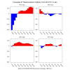
 
One thing that’s not believable is that big system diving south into Texas and LA producing wintry weather then magically 84 hours later a big system fires out of the gulf..yeah ok
 
  • Like
Reactions: Rain Cold
I agree fully about a pattern change coming. You make a good point there. My opinion is it isn't exactly what people want or think it is with a huge trough over the east locked in with multiple threats. Those cold models all have one thing in common, a -EPO which has been a unicorn all year and we have a strong consolidated tPV up near the pole with a +AO and +NAO. Not sure where all the love for phase 7 came from. And down below is the newest GEFS which doesn't get to 8.View attachment 30921View attachment 30922
Eric Webb said that phase 7 is "the phase" that produces winter storms for NC
 
One thing that’s not believable is that big system diving south into Texas and LA producing wintry weather then magically 84 hours later a big system fires out of the gulf..yeah ok
I don't want to get caught up in model flip flopping of a particular storm. The timeframe is favorable and I hope we can squeeze something out because I'm less optimistic than most we lock a good pattern so quick. However the pattern doesn't look real hostile and can easily trend better and Feb can still turn out good unlike the last few.