Looks like a win. Kinda like a few flurries in winter. ??
-
Hello, please take a minute to check out our awesome content, contributed by the wonderful members of our community. We hope you'll add your own thoughts and opinions by making a free account!
You are using an out of date browser. It may not display this or other websites correctly.
You should upgrade or use an alternative browser.
You should upgrade or use an alternative browser.
Pattern Scorchtember
- Thread starter SD
- Start date
My song the whole summer: Been through the desert on a horse with no name! CSN ?sounds like a rock n' roll show from the late '60's or early 70's
~~~~~~~~~~
Actin' funny, but I don't know why
'Scuse me while I kiss the sky
The high yesterday was 97*F.
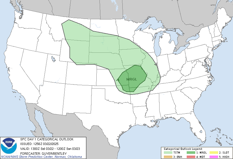
Marginal Risk issued for Wilkes Co today for severe
NBAcentel
Member
ForsythSnow
Moderator
Well there's some hints about a large low (the one near Chicago in the pic) already on several model runs. A hurricane would amplify the situation as shown if timed right. That could even bring frost to the upper SE if it happened.Welp whoever said it took a hurricane to get a pattern change wasn’t lying, lol View attachment 23384
ATLwxfan
Member
Seems like the pattern change has been at the end of the run for several days...not really a good sign.
Sent from my iPhone using Tapatalk
Sent from my iPhone using Tapatalk
NoSnowATL
Member
Where have we seen this before? UMMM all last winter. Different year. Same Weather.Seems like the pattern change has been at the end of the run for several days...not really a good sign.
Sent from my iPhone using Tapatalk
Seems like we always used to get our first big front sometime in the last half of September. It was in the upper 30s in Carrollton in late September 2001 ! Atl was officially 44 in Sept 01.
I know that feeling of Delayed and Denied during winter. But this cold front might actually have something to it. It's been consistently forecast with the GFS having it arriving in the last few days of September.Where have we seen this before? UMMM all last winter. Different year. Same Weather.
Sent from my SM-G950U using Tapatalk
tennessee storm
Member
It’s going to have come a strong frontal passage deep trough bringing a severe weather event to change pattern... that will do the trick
Round Oak Weather
Member
It seems like every model has a pattern change toward the end of the month or at least less of a torch. The GEFS has seemed to continue to strengthen the cooler temps over the past few runs. It’s long range yes but maybe possibly we have hope on the horizon
Storm5
Member
That’s a sexy front at the end of the gfs run . Can’t wait for verification in like mid October
Sent from my iPhone using Tapatalk
Sent from my iPhone using Tapatalk
ATLwxfan
Member
That’s a sexy front at the end of the gfs run . Can’t wait for verification in like mid October
Sent from my iPhone using Tapatalk
Exactly! It looks great but we first saw the pattern change pop up on the end of the runs last week and everyday it gets pushed back further and further. To the point where we are on the verge of the hottest September ever.
Sent from my iPhone using Tapatalk
ATLwxfan
Member
Sent from my iPhone using Tapatalk
NoSnowATL
Member
Sent from my iPhone using Tapatalk
Boy it’s helps soooo much.
Sent from my iPhone using Tapatalk
SWVAwxfan
Member
Hottest day of the year here in the highlands. 91. Absolutely ridiculous.
We are probably going to start seeing some end to the ridging in the d10 time frame and possibly a breakdown afterward. I'm personally still not sure we go west ridge/east trough but we may finally at least be able to break the ridge and trend back to normalThat’s a sexy front at the end of the gfs run . Can’t wait for verification in like mid October
Sent from my iPhone using Tapatalk
Sent from my SM-G975U using Tapatalk
LickWx
Member
Hit 92 in raleigh with a heat index of 72 . Raleigh has avoided much of this heat really . Past few years it seems to mostly focus charlotte south and west.
None the less nws has some storm chances next few days hope they materialize
None the less nws has some storm chances next few days hope they materialize
Hello wedge

Sent from my SM-G975U using Tapatalk

Sent from my SM-G975U using Tapatalk
It sometimes takes a little while. Just like back in April SC and NC got some snow, a month into SpringSeems like we always used to get our first big front sometime in the last half of September. It was in the upper 30s in Carrollton in late September 2001 ! Atl was officially 44 in Sept 01.
LickWx
Member
I find it funny when people use examples of colder than normal years and play it off as a normal and wonder why it’s not like that year. I get it the heat is a pain but be patient relief will come unless your phil in Gainesville Florida ( well they got a while to go down there) .
Yes this September is hot , for Atlanta it’s still a solid 3-5 degrees if I’m not mistaken COOLER than the record hottest up to this date . Yes it’s hotter than normal but for much of this forums area the average high has yet to drop below 80 with 2 weeks more to go for northern locales like raleigh drop below 80 for avg. Avg for this date is 84/64 at RDU.
Yes this September is hot , for Atlanta it’s still a solid 3-5 degrees if I’m not mistaken COOLER than the record hottest up to this date . Yes it’s hotter than normal but for much of this forums area the average high has yet to drop below 80 with 2 weeks more to go for northern locales like raleigh drop below 80 for avg. Avg for this date is 84/64 at RDU.
Anyone use radar omega? Thoughts? I use radarscope now. Looking for an alternative.
I find it funny when people use examples of colder than normal years and play it off as a normal and wonder why it’s not like that year. I get it the heat is a pain but be patient relief will come unless your phil in Gainesville Florida ( well they got a while to go down there) .
Yes this September is hot , for Atlanta it’s still a solid 3-5 degrees if I’m not mistaken COOLER than the record hottest up to this date . Yes it’s hotter than normal but for much of this forums area the average high has yet to drop below 80 with 2 weeks more to go for northern locales like raleigh drop below 80 for avg. Avg for this date is 84/64 at RDU.
Atlanta’s warmest December ever was in 1925, long before any of us were alive probably, and was 84F. So far this month the average is 84.2F. So yeah, this can be called extreme. Then add to the fact that last September became the second warmest on record.
Brent
Member
MichaelJ
Member
Well, the new EURO is U-G-L-Y. Much above normal temps though the end of October. Let's hope it is wrong.
ATLwxfan
Member
Still skeptical about the GFS cool push. Seems the SER is not easily giving up in GA at least. Also they just love the ATL heat island on their maps.
Sent from my iPhone using Tapatalk
Sent from my iPhone using Tapatalk
Well, the new EURO is U-G-L-Y. Much above normal temps though the end of October. Let's hope it is wrong.
The GGEM agrees.
B
Brick Tamland
Guest
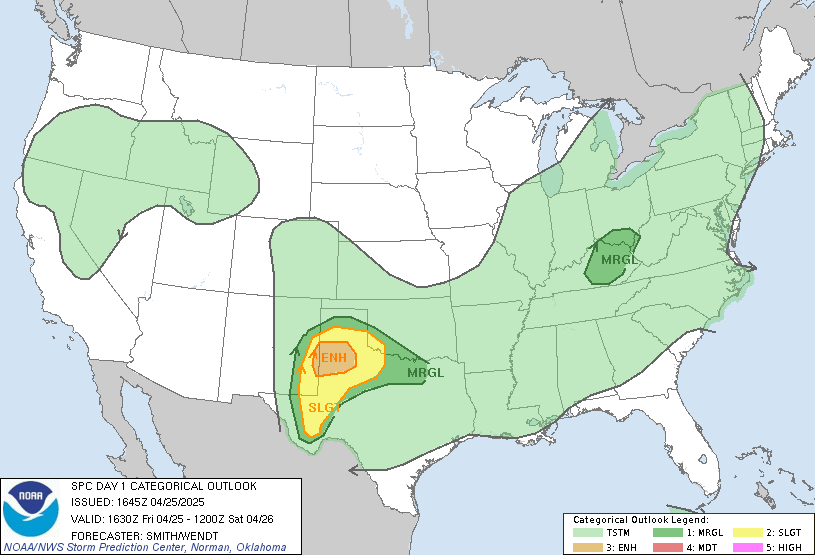
Level 1 severe threat for parts of VA and NC today.


tennessee storm
Member
euro is complete opposite... till euro shows this. No way I’m buying itRAH mentioned a possible cool down next week (wedge). The GFS agrees and shows dew points in the 50s and temps falling back to the 70s and low 80s by Wednesday. Then just for eye candy the 6z GFS has this way off in la la land (but this is what we're waiting for..):
View attachment 23455
Flurry
Member
If it were just a little bit hotter....
B
Brick Tamland
Guest
SPC decreased the size of the level 1 threat for NC.


SWVAwxfan
Member
Had a surprise thunderstorm last night.
Could make another run at triple digits today.
Currently 98*F.
Currently 98*F.
SWVAwxfan
Member
And looks like any rain we hoped to get from 95l is vanishing like a fart in the wind. ??
Our big wet day tomorrow, down to a big 30% chance of isolated t storms! Just keep winning! Drought begets drought, and apparently, can deflect hurricanes! 
GSP has tied the September 12 record for max high temp. 95F. If local Wunderground is to be believed, we've broken it at 96F. #winning
SWVAwxfan
Member
NWS has me only hitting 74 tomorrow with a chance of showers. I'll believe it when I see it.


