accu35
Member
From Accuweather

From Accuweather
From Accuweather

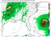
Shower activity associated with a surface trough interacting with
an upper-level low near the north coast of Hispaniola northeastward
over the southwestern Atlantic has increased a little since
yesterday. Little, if any, development of this disturbance is
expected during the next few days while it moves west-northwestward
across the Bahamas and the Florida peninsula. However, environmental
conditions could become a little more conducive for development
when the system moves into the Gulf of Mexico over the weekend.
Regardless of development, this disturbance will produce periods
of locally heavy rainfall across the Bahamas through Thursday, and
across Florida on Friday and continuing into the weekend.
* Formation chance through 48 hours...low...near 0 percent.
* Formation chance through 5 days...low...30 percent.
Sounds like the same conversation over a week ago.The 6Z Euro ensemble is tied for the most active of at least the last 4 EPS with 9 of the 51 members with an actual TC. If Weathernerds had the 6Z, they would likely be showing even more than the 15 or so surface lows that they show for the 0Z.
In terms of actual TCs, the 9 on the 6Z compares to 3 on the 0Z, 9 on the last 18Z, and 3 on the last 12Z. Also, there remain 2 pretty distinct camps of tracks with one moving more slowly NW/NNW/N into the E coast of FL and further north without necessarily ever going into the Gulf while the other camp moves more quickly WNW and then NW with hits in the AL/MS/LA corridor. This second camp would have more potential to eventually become a stronger storm as it would cross about the warmest SSTs in the entire Atlantic basin.
Is this going to steer into TX/MX, or curve up into gulf states, as currently modeled!?

1. It goes into AL/MS at hour 132 as possibly a TD.
2. 2Z UKMET:
NEW TROPICAL CYCLONE FORECAST TO DEVELOP AFTER 126 HOURS
FORECAST POSITION AT T+126 : 27.3N 91.7W
LEAD CENTRAL MAXIMUM WIND
VERIFYING TIME TIME POSITION PRESSURE (MB) SPEED (KNOTS)
-------------- ---- -------- ------------- -------------
0000UTC 16.09.2019 132 27.4N 92.5W 1007 30
1200UTC 16.09.2019 144 28.1N 93.3W 1005 28
Keep watching this one, folks!
Im with ya....just reporting what I see. Even a blind squirrel finds a nut occasionally. Never know. LolYeah, but this is a clear outlier among the major operationals (I don't count the very low skilled NAM for the tropics). It is splitting off the energy (note that there is a very weak low in the NW GOM even on this map you showed) and concentrating more of it offshore the SE coast, which never really makes landfall. The 6Z and some runs from yesterday were similar. As I recall, the ICON didn't do so well out 5 days or so with Dorian since it had him hit FL on a number of runs when he was in the Bahamas and it has no proven good record for the tropics unlike the Euro. That being said, some EPS members have been doing something similar. So, I'm not fully discounting that idea yet though I consider that ICON type of scenario only a low possiblity right now....perhaps 20%.
Shower and thunderstorm activity associated with a surface trough
near the southeastern Bahamas and adjacent Atlantic waters has
increased since yesterday. Limited development of this disturbance
is expected during the next couple of days while it moves
west-northwestward across the Bahamas. However, environmental
conditions could become a little more conducive for development when
the system moves over the Florida Straits and the Gulf of Mexico
late this week and this weekend. Regardless of development, this
disturbance will produce periods of locally heavy rainfall across
the Bahamas through Thursday, and across Florida on Friday and
continuing into the weekend.
* Formation chance through 48 hours...low...10 percent.
* Formation chance through 5 days...low...30 percent.
Im with ya....just reporting what I see. Even a blind squirrel finds a nut occasionally. Never know. Lol
Wouldn't that be something if it ended up in TX.....we've seen stranger things...12Z EPS: Still a bit of a split with where the surface low forms (just E of FL vs S of FL/GOM). Interestingly, the strongest member is way west in TX just E of Galveston!
Almost guaranteedWouldn't that be something if it ended up in TX.....we've seen stranger things...
For those of you with an unhealthy obsession with Hugo, LOL:
Gotta wait and see if they don't come....he might be right. Clearly nothing out there to stop it if it gets in the right place at the right time.... they have an uncanny way of doing that....JB worried about the ridge next week on his recent tweets. Says they will come “Hugo, Katrina, etc”). So when they don’t come let’s ask him where they at
Yeah, I lived through Fran and it has been permanently singed into my memory. I get that same uneasy feeling every time another hurricane is bearing down on us.For those who survived it, you don't have to post this. The memory of it lives on, just as those who survived Dorian. They remember it everyday and you can see the fear in their eyes when talk begins of another major hurricane in Charleston. They are the first ones to leave town. A good friend of mine says he remembers the strong smells of pine where the all the pine trees were laid down for miles.....smells of burning, where they burned the downed trees and brush because it was too much for garbage to haul off.....how hot it was with no electricity for months. Yea, they remember.....

Is this a first this season for candy stripes in the Atlantic?

Something eventually will come you would think with 3 x'sThis might be 97L soon, it looks healthy on the IR loop:
Another tropical wave is located about 600 miles southwest of the Cabo Verde Islands. Gradual development of this system is possible during the next several days, and a tropical depression could form early next week while it moves westward across the tropical Atlantic. * Formation chance through 48 hours...low...10 percent. * Formation chance through 5 days...medium...50 percent.
No wonder the models are having trouble of late. There's 3 x's close together here:
View attachment 23555
If I were a bettor, the one that's mandarin will probably take over and get strong, but also likely curve OTS thankfully. 96L has some pretty good spin but not much to the thunderstorms right now. But if it survives and gets to the gulf, there might be some problems...
How did you change your mind so fast? Lol, but with 3 areas out there something could shoot westAfter thinking about it for a minute, I've come to this conclusion:
The storm that I've been seeing on the GFS is not what 96L is. It's occasionally been the wave close to the wave that could get strong developing. Lol yeah...confusing but unless you have one that doesn't deepen and can get closer to the US, we might not have problems here.
ICON thinks so....How did you change your mind so fast? Lol, but with 3 areas out there something could shoot west
.png")

.png")