Darklordsuperstorm
Member
Looks like it did produce a tornado. Damage reports starting to come in from that area per ABC 3340


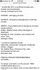
Overnight HRRR runs really lowered cape values for Alabama and Georgia today. Could this be a result of cloud cover as mentioned earlier?
4z
View attachment 18610
10z (current)
View attachment 18609
These soundings continue to increase helicity/shear a tad Around my area, me no likey those random spin up tornadoes, other than that damaging winds/hail dominates based off this sounding, this actually supports supercell structures but still looks like organized multicellular clusters are gonna dominate View attachment 18608


Overnight hrrr and nam are not quite as intense with the development of a large line of storms across NC this evening.
That being said there will still be plenty of TStorm activity across SC and NC and eastern portions of GA this afternoon!
It’s all about counting the minutes of sunlight now.
Biggest question will be how hot and how unstable we become this afternoon.
Overnight HRRR runs really lowered cape values for Alabama and Georgia today. Could this be a result of cloud cover as mentioned earlier?
4z
View attachment 18610
10z (current)
View attachment 18609
I'd believe it. The cloud cover isn't really all that dense and it'll be burned off easily unless the Gulf MCS blows up westward but it's moving E pretty fast.Now spc analysis shows near 3000j around 2 o'clock for central alabama. ? the damage northwest of birmingham seemed to cause a lot of damage they closed some schools in that county because of it.
That isn't good because the best shear is forecast in that time frame unfortunately were instability is the highest. The sun is also trying to peek through the clouds here were im at in birmingham. Nws bham belowI'd believe it. The cloud cover isn't really all that dense and it'll be burned off easily unless the Gulf MCS blows up westward but it's moving E pretty fast.

I'd believe it. The cloud cover isn't really all that dense and it'll be burned off easily unless the Gulf MCS blows up westward but it's moving E pretty fast.
Yep. Muggy outside right nowwe've got some sun poking out

Rapidly thinning just like my hairline.
Sun is progressively peaking out in Charlotte, we’re about 80/20 sun mixed with some clouds
Overall this setup definitely supports a slight risk and 2% tor threat. If we had about twice as much 0-1 SRH as what’s currently forecast by most of the CAMs, a little bit more low level shear, steeper mid-level lapse rates, & lower LCLs the tornado threat would be a big deal around here. I’ve seen worse produce a few isolated spin ups but damaging winds will be the primary threat with some semi-discrete modes possible in the Carolinas

Sun is progressively peaking out in Charlotte, we’re about 80/20 sun mixed with some clouds